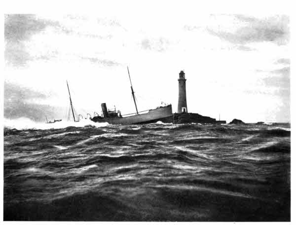
Gibson & Sons, Penzance.] WRECK OF THE BLUEJACKET, ON THE LONGSHIPS.
PRINTED AND BOUND BY
HAZELL, WATSON AND VINEY, LD.,
LONDON AND AYLESBURY.
| CHAPTER I | |
| PAGE | |
| NEW BRIDGE—THE TAMAR—MORWELL ROCKS—CALSTOCK—COTHELE—PENTILLIE—LANDULPH | 1 |
| CHAPTER II | |
| SALTASH—SALTASH BRIDGE—TREMATON CASTLE—ST. GERMANS—ANTONY—RAME—MOUNT EDGCUMBE—MILLBROOK | 18 |
| CHAPTER III | |
| DOWNDERRY—LOOE—TALLAND—POLPERRO—LANTEGLOS-JUXTA-FOWEY | 33 |
| CHAPTER IV[vi] | |
| FOWEY—THE FOWEY RIVER—ST. VEEP—GOLANT—LERRIN—ST. WINNOW—LOSTWITHIEL | 50 |
| CHAPTER V | |
| POLKERRIS—MENABILLY—PAR—THE BISCOVEY STONE—CHARLESTOWN, ST. AUSTELL, AND THE CHINA-CLAY INDUSTRY—THE MENGU STONE—PORTHPEAN—MEVAGISSEY—ST. MICHAEL CAERHAYES—VERYAN—GERRANS—ST.ANTHONY-IN-ROSELAND | 63 |
| CHAPTER VI | |
| ROSELAND—ST. MAWES—FALMOUTH | 83 |
| CHAPTER VII | |
| FLUSHING—PENRYN AND THE KILLIGREW LADIES—MYLOR—ST. JUST-IN-ROSELAND—RESTRONGUET CREEK, DEVORAN AND ST. FEOCK—KING HARRY PASSAGE—RUAN CREEK—MALPAS—TRESILIAN CREEK AND THE SURRENDER OF THE CORNISH ARMY | 99 |
| CHAPTER VIII | |
| TRURO | 115 |
| CHAPTER IX | |
| MAWNAN—HELFORD RIVER—MAWGAN-IN-MENEAGE—MANACCAN—ST. ANTHONY-IN-ROSELAND—THE MANACLES ROCKS—WRECK OF THE "MOHEGAN"—ST. KEVERNE | 123 |
| CHAPTER X[vii] | |
| COVERACK COVE—POLTESCO—RUAN MINOR—CADGWITH COVE—THE "DEVIL'S FRYING-PAN"—DOLOR HUGO—CHURCH COVE—LANDEWEDNACK—LIZARD TOWN—RUAN MAJOR—THE LIZARD LIGHTHOUSE | 142 |
| CHAPTER XI | |
| KYNANCE COVE—ASPARAGUS ISLAND—THE DEVIL'S POST-OFFICE—SIGNPOSTS—GUE GRAZE—MULLION COVE—WRECK OF THE "JONKHEER"—MARY MUNDY AND THE "OLD INN" | 159 |
| CHAPTER XII | |
| POLDHU AND THE MARCONI STATION—MODERN CORNWALL—GUNWALLOE—THE "DOLLAR WRECK"—WRECK OF THE "BRANKELOW"; WRECKS OF THE "SUSAN AND REBECCA" AND OF H.M.S. "ANSON"—LOE BAR AND POOL—HELSTON AND ITS "FURRY"—PORTHLEVEN—BREAGE—WRECK OF THE "NOISIEL"—PENGERSICK CASTLE | 176 |
| CHAPTER XIII[viii] | |
| PRUSSIA COVE AND ITS SMUGGLERS—PERRANUTHNOE—ST. HILARY—MARAZION—ST. MICHAEL'S MOUNT—LUDGVAN—GULVAL | 193 |
| CHAPTER XIV | |
| PENZANCE—NEWLYN AND THE "NEWLYN SCHOOL"—PAUL—DOLLY PENTREATH—MOUSEHOLE—LAMORNA—TREWOOFE AND THE LEVELIS FAMILY—BOLEIT—THE "MERRY MAIDENS"—PENBERTH COVE | 216 |
| CHAPTER XV | |
| THE LOGAN ROCK AND ITS STORY—PORTHCURNO AND THE TELEGRAPH STATION—ST. LEVAN—PORTH GWARRA—TOL-PEDN-PENWITH—CHAIR LADDER—LAND'S END | 232 |
| CHAPTER XVI | |
| THE LAND'S END DISTRICT—ST. BURYAN—SENNEN—LAND'S END—THE LONGSHIPS LIGHTHOUSE | 247 |
| CHAPTER XVII | |
| THE SCILLY ISLANDS—FLOWER-FARMING—THE INHABITED ISLANDS—ST. MARY'S—STAR CASTLE—SAMSON AND "ARMOREL OF LYONESSE"—SIR CLOUDESLEY SHOVEL—TRESCO—THE SEA-BIRDS | 256 |
| Wreck of Bluejacket | Frontispiece |
| PAGE | |
| The Cornish Coast | 1 |
| Newbridge | Facing 2 |
| Calstock | 5 |
| The Tower, Pentillie | 11 |
| Sir James Tillie | 13 |
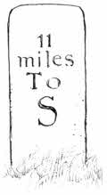
| "Two Miles to Saltash" | 17 |
| Plymouth Sound, The Hamoaze, and the Tamar | 19 |
| Saltash Bridge | Facing 20 |
| Trematon Castle | Facing 22 |
| St. Germans | 24 |
| Miserere, St. Germans | 26 |
| Plymouth and Drake's Island, from Mount Edgcumbe | Facing 32 |
| Looe | 37 |
| The "Jolly Sailor," Looe | 40 |
| Talland Church | 41 |
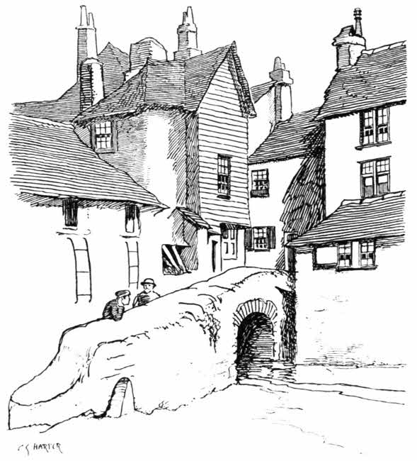
| Old Bridge, Polperro | 44 |
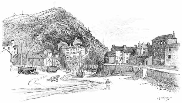
| Polperro | Facing 46 |
| Fowey | Facing 52 |
| St. Winnow | 57 |
| Lostwithiel Church | 59 |
| Font, Lostwithiel | 61 |
| The Biscovey Stone | 66[x] |
| Porthpean | 72 |
| St. Michael Caerhayes | 77 |
| "Parson Trust's Houses" | 79 |
| Falmouth Harbour | 81 |
| St. Anthony's Lighthouse | 84 |
| St. Mawes Castle | 86 |
| Charles Church, Falmouth | 94 |
| Little Falmouth | 100 |
| South Porch and Cross, Mylor Church | 104 |
| St. Just-in-Roseland | 107 |
| St. Feock | 109 |
| Malpas | 110 |
| St. Clements | 111 |
| Merther | 112 |
| View from Tresilian Bridge | 113 |
| Truro, from the Fal | 116 |
| Truro Cathedral | 120 |
| Tablet, Truro Market House | 122 |
| The Helford River | 125 |
| Mawgan-in-Meneage | 127 |
| Hagioscope, Mawgan-in-Meneage | 128 |
| St. Anthony-in-Meneage | 131 |
| Inscribed Font, St. Anthony-in-Meneage | 135 |
| Wreck of the Glenbervie on Lowlands Point | Facing 138 |
| St. Keverne | 140 |
| Cadgwith Cove | 145 |
| The "Devil's Frying Pan" | 147 |
| Landewednack | 149 |
| Kynance Cove | Facing 160 |
| Mullion Cove | Facing 166 |
| Gunwalloe | Facing 182 |
| Loe Pool[xi] | 185 |
| Breage | 188 |
| Wreck of Noisiel, Praa Sands | Facing 190 |
| Pengersick Castle | 191 |
| The Coast of Cornwall, North-west and South-west (Map) | 192 |
| The "Noti-Noti Stone," St. Hilary | 200 |
| St. Michael's Mount | Facing 210 |
| St. Michael's Chair | 212 |
| Arms of Penzance | 217 |
| Penzance Market House | 219 |
| Monument to Sir William Godolphin, with Armour | 226 |
| Cottages at Penberth Cove | 231 |
| Trereen Dinas | 233 |
| The Logan Rock | 235 |
| St. Levan | 239 |
| Chair Ladder | 243 |
| Early Home of Lord Exmouth | 248 |
| Land's End | Facing 252 |
| Star Castle, and the Island of Samson | 265 |
| Armorel's Home, Samson Island | Facing 266 |
| St. Agnes | 267 |
| Pulpit Rock | 268 |
| Holy Vale | 271 |
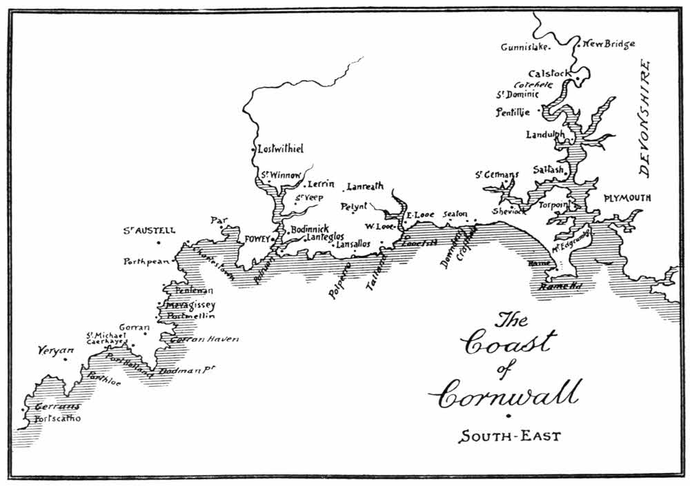
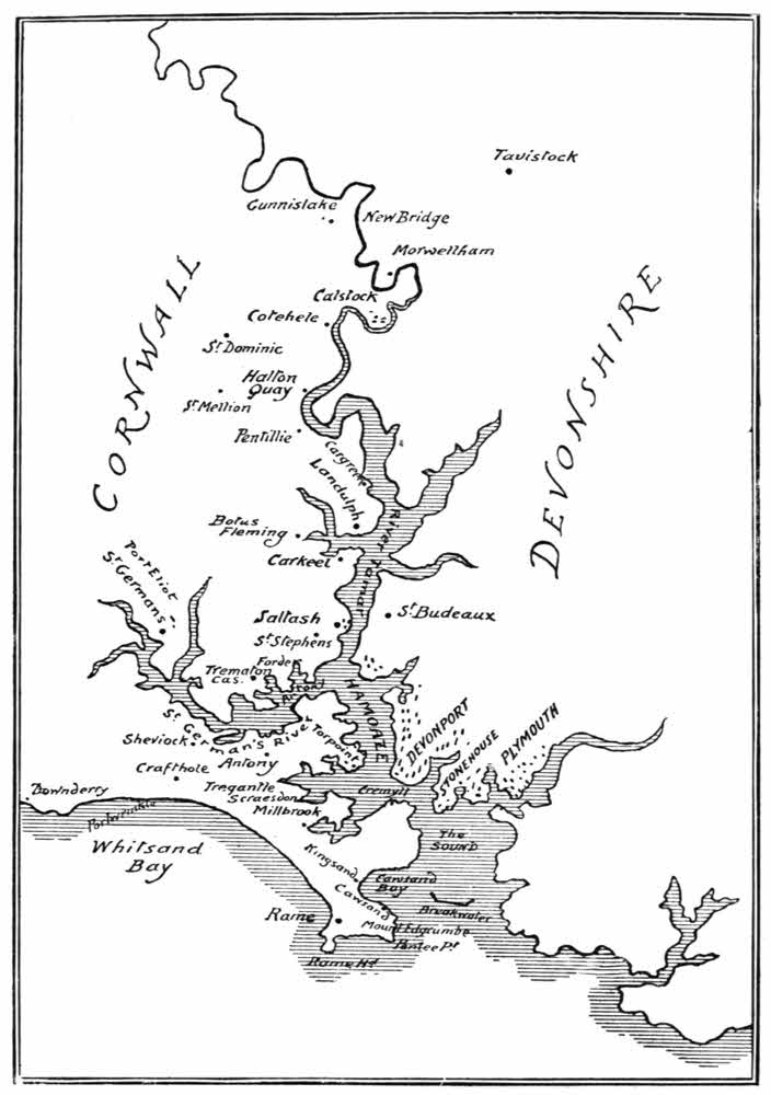
The southern portion of the Cornish Coast may be said to begin at the head of the navigation of the river Tamar, at Weir Head, to which the excursion steamers from Plymouth can come at favourable tides, or a little lower, at Morwellham Quay, where the depth of water permits of more frequent approach. But barges can penetrate somewhat higher than even Weir Head, proceeding through the canal locks at Netstakes, almost as far as that ancient work, New Bridge, which carries the high road from Dartmoor and Tavistock out of Devon into Cornwall.
From hence, then, at New Bridge, a hoary Gothic work of five pointed arches with picturesquely[2] projecting cutwaters, the south coast of Cornwall may most fitly be traced. It is a constant surprise to the explorer in England to discover that almost invariably the things that are called "new" are really of great age. They were once new and remarkable things. There is a "New Bridge" across the Thames, but it is the oldest now existing. The town of Newmarket, in Cambridgeshire, was a new thing in 1227, and there are other "Newmarkets" of even greater age. The subject might be pursued at great length; but sufficient has been said to prepare those who come this way not to expect some modern triumph of engineering in iron or steel.
New Bridge, three and a half miles west of Tavistock, is approached from that town by the old coach road and the new, descending with varying degrees of steepness to the river. As you come down the older and steeper and straighter road, you see the bridge far below, and the first glimpse of Cornwall beyond it, where the lofty hills of Gunnislake rise, scattered with the whitewashed cottages of the miners engaged in the tin mines of the district. They, and the large factory buildings below, near the river level, are not beautiful, and yet the scene is of great picturesqueness and singularity. A weird building beside the bridge on the Devonshire side, with two of its angles chamfered off, is an old toll-house. Mines in working on the Devonshire side belong to the Duke of Bedford, who has a fine park and residence near by, at Endsleigh, which[3] he would not (according to his own account), be able to maintain, together with various other residences, including the palatial Woburn Abbey, were it not for his vast income from the ground-rents of what he was pleased to style "a few London lodging-houses."
The surrounding country is dominated for many miles by the cone-shaped Kit Hill, the crest of the elevated district of Hingston Down, crowned by a monumental mine-chimney.
So runs the ancient rhyme. It has been "well wrought," not yet perhaps to the value indicated above, and now its scarred sides are deserted; but perhaps another instalment of London's ransom may yet be mined out of it.
The riverside walk along the Cornish bank of the Tamar is at first as smoothly beautiful as a Thames-side towing-path. Thus you come past the locks at Netstakes to the Morwell Rocks, masses of grey limestone cliffs rising from the Devonshire shore and hung with ivy and other growths. Soon the Tamar falls over the barrier of Weir Head, and then reaches the limit of the steamship navigation, at Morwellham Quay. Words and phrases seem colourless and inexpressive in face of the sweet beauties of limestone crag and winding river here; of the deep valley, wooded richly to the hill-tops, and the exquisitely tender light that touches the scene to glory. Nor is it[4] without its everyday interest, for the excursion steamers come up on favourable tides from Plymouth and wind with astonishing appearance of ease round the acute bends of the narrow channel; the branches of overhanging trees sweeping the funnels. The lovely valley is seen in a romantic perspective from the summit of the lofty hill that leads up to Calstock church, for from that point of view you look down upon the little peninsular meadows that now and again give place to cliffs, and through an atmosphere of silver and gold see the river winding past them, like some Pactolian stream. Down there lie the ruins of Harewood House, the old Duchy of Cornwall office; across, as far as eye can reach, spread the blue distances of Devon, and all along the course of the river the hamlets are transfigured to an unutterable beauty. Leave it at that, my friends. Do not explore those hamlets, for, in fact, they are neither better nor worse than others. Like many among the great characters in history, upon whom distance confers a greatness greater than properly belongs to them, they have their littlenesses and squalors.
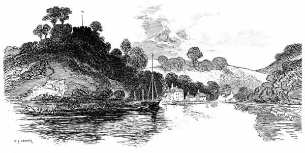
Calstock church must be, and must always have been, a prime test of piety, for it stands upon a tremendous hilltop nearly a mile from the village, and Calstock stands below by the water.
Calstock is the Richmond and Hampton Court of Plymouth. What those places are to London, this is to the Three Towns of Plymouth, Devonport, and Stonehouse; only the scenery is immeasurably[5] finer than that along the Thames, while, on the other hand, Cothele is not to be compared with Hampton Court, nor is it so public. Of all the many varied and delightful steamboat trips that await the pleasure of the Plymouth people, or of visitors, none is so fine as the leisurely passage from Plymouth to Calstock and back, first along the Hamoaze and then threading the acutely curving shores of the Tamar, rising romantically, covered exquisitely with rich woods. At the end of the voyage from Plymouth, Calstock is invaded by hungry crowds. One of the especial delights of the place is found in its strawberries, for the neighbourhood is famous for its strawberry-growing. But the tourist, who is not often able to set about his touring until the end of July, is rarely able to visit Calstock in strawberry-time,[6] and Plymouth people have the river in the tender beauty of early summer, with strawberries to follow, all to themselves. Here let a word of praise be deservedly given to the extraordinarily cheap, interesting and efficient excursions by steamboat that set out from Plymouth in the summer. Without their aid, and those of the ordinary steam ferries, I know not what the stranger in these parts would do, for the Plymouth district is one of magnificently long distances, and the creeks of the Hamoaze and the Tamar are many and far-reaching. And latterly the Calstock excursion has been advantaged by the acquisition of the Burns steamer, one of the London County Council's flotilla on the Thames that cost the ratepayers so dearly. There are shrewd people down at Plymouth—or as we say in the West, down tu Plymouth—and when the County Council's expensive hobby was abandoned, these same shrewd fellows secured the Burns in efficient condition for about one-twentieth part of its original cost, and are now understood to be doing extremely well out of it.
I could wish that Calstock were in better fettle than it now is. He who now comes to the village will see that it is completely dominated by a huge granite railway viaduct of twelve spans, crossing the river, and furnished with a remarkable spidery construction of steel, rising from the quay to the rail-level. This is a lift, by which loaded trucks, filled with the granite setts, kerbs, channelings, and road-metal chips, in which the[7] local "Cornwall Granite Company" deals, are hoisted on to the railway, and so despatched direct to all parts. The evidences of the Granite Company's special article of commerce are plentiful enough, littering the riverside and strewing the roads, just as though the Cornwall Granite Company were wishful by such means to advertise their goods; but since the opening of the new railway, in 1909, the unfortunate lightermen and bargemen of the place have been utterly ruined. The Plymouth, District, and South-Western Railway, whose viaduct crosses the river, has taken away their old trade, and has not the excuse, in doing so, of being able to earn a profit for itself.
Below Calstock, at the distance of a mile, is Cothele, an ancient mansion belonging to the Earl of Mount Edgcumbe. Steep paths through woodlands lead to it, and the house itself is not the easiest to find, being a low, grey granite building pretty well screened by shrubberies. The real approach, is, in fact, rather from Cothele Quay, on the other side of the hill, away from Calstock. Cothele is only occasionally used by Lord Mount Edgcumbe, but it is not, properly speaking, a "show house," although application will sometimes secure admission to view its ancient hall and domestic chapel.
Cothele, begun by Sir Richard Edgcumbe in the reign of Henry the Seventh, is still very much as he and his immediate successors left it, with the old armour and furniture remaining. Richard is a favourite name among the Edgcumbes. This[8] particular Sir Richard engaged in the dangerous politics of his time, and very nearly fell a victim to his political convictions. Suspected of favouring the pretensions of the Earl of Richmond, he was marked for destruction, and only escaped arrest by plunging into the woods that surround Cothele. From a crag overlooking the river he either flung his cap into the water, or it fell off, and the splash attracting attention, it was thought he had plunged into the river, and so was drowned. This supposition made his escape easy. He returned on the death of Richard the Third and the consequent accession of the Earl of Richmond, as Henry the Seventh, and marked his sense of gratitude for the providential escape, by building a chapel on the rock, overlooking Danescombe.
A Sir Richard, who flourished in the time of Queen Elizabeth, and was Ambassador to Ireland, brought home the curious ivory "oliphants" or horns, still seen in the fine hall, where the banners of the Edgcumbes hang, with spears and cross-bows and armour that is not the merely impersonal armour of an antiquary's collection, but the belongings of those who inhabited Cothele of old. The most curious object among these intimate things is a steel fore-arm and hand, with fingers of steel, made to move and counterfeit as far as possible the lost members of some unfortunate person who had lost his arm. To whom it belonged is unknown.
The tapestries that decorated the walls of Cothele at its building still hang in its rooms,[9] the furniture that innovating brides introduced, to bring the home up-to-date, has long since become the delight of antiquaries, and the extra plenishings provided for the visits of Charles the Second and George the Third and his Queen may be noted. So do inanimate things remain, while man is resolved into carrion and perishes in dust. I find no traces of the Early Victorian furnishings that probably smartened up Cothele for the visit of Queen Victoria and Prince Albert in 1846. They are well away.
Many are the royal personages who have visited Cothele. Sometimes they have been as desolating as the merely vulgar could be; as, for example, when one of them, disregarding the very necessary request not to handle the curious old polished steel mirrors that are numbered among the curiosities of the mansion, did so, with the result that a rusty finger-mark appeared. Here was a chance for the reverential! A Royal finger-mark, wrought in rust! It might have served the turn either of a snob or a cynic, equally well; but it was removed at last, not without much strenuous labour.
Cothele Quay stands deep down by the riverside, with a cottage or so near, but otherwise solitary amid the woods, where the little creek of Danescombe is spanned by an ancient Gothic bridge. The quay is the port, so to speak, of Cothele, and of the village of St. Dominic, high up on the hills; the readiest way for supplies of all kinds being from Plymouth, by water.
Up there, through St. Dominic, the lofty high road that runs between Callington and Saltash is reached. It runs through the village of St. Mellion, whose church contains monuments, some of them rather astonishing, to the Corytons of West Newton Ferrers, three miles to the west.
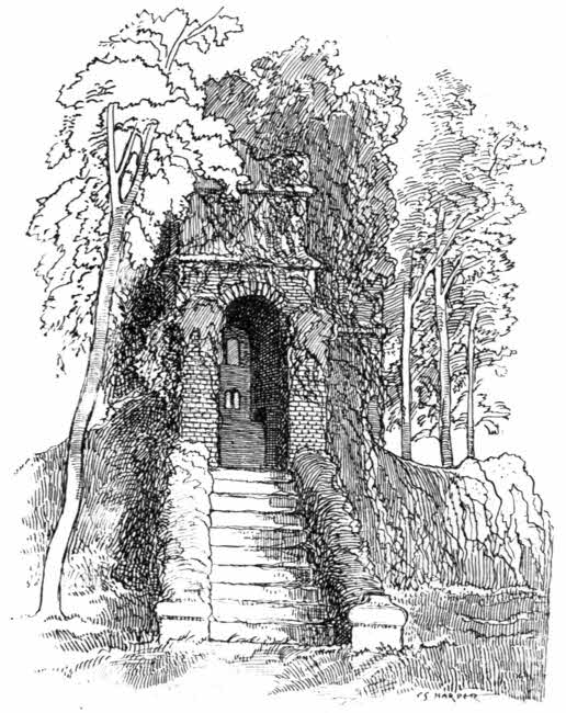
Passing through St. Mellion, the road comes presently to the lovely park of Pentillie, a wooded estate overlooking the Tamar in one of its loveliest and most circuitous loops, where the river may be seen through the woods winding and returning upon itself far below. Hidden away in luxuriant glades almost on a level with the river is the mansion of the Coryton family, itself of no great charm or interest; but there is on one of the heights above it, known as "Mount Ararat," a weird "folly," or monument, rather famous in its way, in which was buried, under peculiar conditions, the body of a former owner of Pentillie, who died in 1713. It is well worth seeing, but in those woody tangles is not so easily to be found. It stands, in fact, not so far from the road itself, down a lane on the left hand before coming to the lodge-gates of Pentillie, and then through a rustic gate or two; but the stranger might easily take the wrong one among the several rough footpaths, and the whole hillside is so overgrown with trees, that the tower is not seen until you are actually at the base of it. The better course is to proceed along the highway until you come to the lodge-gates and to the broad, smooth carriage-road leading lengthily[11] down to the mansion. If you are on a bicycle, so much the better; you are down there and in the courtyard of Pentillie "Castle," as it is called, in a flash. Proceeding then straight through to the kitchen-gardens, there is a gardener's cottage, where, to those gifted with a proper degree of courtesy, the gardener will point out the hillside footpath by which you presently[12] come to the tower, containing a forbidding statue of Sir James Tillie. "An' if ye look through a peephole in the wall," says the gardener, "ye can see th' owd twoad quite plainly."
Sir James Tillie was a person of very humble origin, born at St. Keverne in 1645. He was soon in the service of Sir John Coryton, Bart., of West Newton Ferrers, St. Mellion, who befriended him to a considerable extent, placing him with an attorney and afterwards making him his own steward. In 1680 the baronet died. Meanwhile Tillie, by industry and prudence, had grown pretty well-to-do, and had married the daughter of Sir Harry Vane, who brought him a fortune. She had died some years before the decease of Sir John Coryton, at whose death Tillie was a childless widower. His master had arranged that Tillie should continue steward to his eldest son, John, the next baronet, and guardian to his younger children. It was not long before the second Sir John died, and Tillie married his widow, and seems in the thirty years or so following to have been undisputed owner of Pentillie. How all these things came to pass does not exactly appear; but at any rate Tillie, who by false pretences of gentility and a considerable payment of money had secured the honour of knighthood in 1686, built Pentillie Castle, which he named after himself, and formed the park, and there he resided until his death in 1713. His wife survived him. He had no children, but was anxious to found a Tillie family, and left a will[13] by which his nephew, James Woolley, son of his sister, should inherit his estates on assuming the name of Tillie.
Wild and fantastic legends fill up the mysterious lack of facts here and there in Tillie's life. He is said to have poisoned Sir John Coryton the younger, and was, among other things, reputed to be a coiner, on a large scale, of base coin. But there is no evidence for those tales. More certain it is that the College of Heralds in 1687 revoked the grant of arms to him, and fined him £200 for the mis-statements that led to his obtaining them.
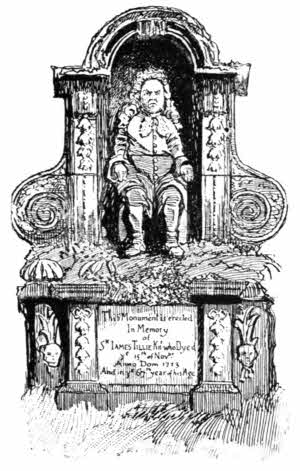
A vein of eccentricity certainly ran through[14] the composition of this remarkable man. His "castle" has been rebuilt, but contains a life-size leaden statue of himself that he had made, in voluminous periwig and costume of the period, holding a roll of documents. His will contained some remarkable provisions, including instructions for the building of the tower and for his body to be laid there, with a seated stone statue of himself. These instructions, repeated and noted down by a succession of writers, have lost nothing of their oddity. Thus Hals tells us that Tillie left directions that his body, habited in his hat, gloves, wig, and best apparel, with shoes and stockings, should be fastened securely in his chair and set in a room in the tower, with his books and pen and ink in front of him, and declared that Tillie had said he would in two years come to life and be at Pentillie again. The chamber in which his body was to be set was to have another over it containing portraits of himself, of his wife, and his nephew, to remain there "for ever." The upper chamber many years ago fell into decay, and the portraits were removed to the mansion; and no one knows what became of Tillie's remains. His scheme of founding a Tillie family failed, and the property eventually came into possession of descendants of the Coryton family, through the marriage of Mary Jemima Tillie, granddaughter of Sir James Tillie's nephew, with John Goodall, great-grandson of Sir John Coryton the younger's daughter, who assumed the name of Coryton.
The brick tower of "Mount Ararat," now open to the sky and plentifully overgrown with ivy, is approached by moss-grown stone steps. A lobby at the summit of them ends in a blank wall with a kind of peep-hole into the space within, not at all easy to get at. Any stranger peering through, and not knowing what to expect, would be considerably startled by what he saw; for directly facing the observer is the life-size effigy of a ferociously ugly, undersized man, with scowling countenance and great protruding paunch, seated in a chair and wearing the costume of the early eighteenth century. The statue is of a light sandstone, capable of high finish in sculpture; and every detail is rendered with great care and minuteness, so that, in spite of the damp, and of the ferns and moss that grow so plentifully about its feet, the statue has a certain, and eerie, close resemblance to life. It is so ugly and repellent that the sculptor was evidently more concerned about the likeness than to flatter the original of it.
The Tamar may be reached again in something over two miles, at Cargreen, a hamlet at whose quay the steamers generally halt. It is a large hamlet, but why it ever came into existence, and how it manages to exist and to flourish in a situation so remote, is difficult to understand, except on the supposition that the barge traffic has kept it alive. Landulph, a mile away, on a creek of its own, and not so directly upon the main stream, is a distinct parish with an ancient[16] church, but it has not the mildly prosperous air of Cargreen, and indeed consists of only two or three easily discernible houses. The fine church contains a mural brass to Theodore Palæologus, who died in 1636, at Clifton in Landulph, one of the last obscure descendants of the Palæologi, who were Emperors of Byzantium from the thirteenth century until 1453, when the Turks captured Constantinople and killed Constantine Palæologus, the eighth and last Emperor. He was brother of Thomas Palæologus, great-great-grandfather of the Theodore who lies here.
The reasons for this humble descendant of a line of mighty autocrats living and dying in England are obscure, but he appears to have attracted the compassionate notice abroad of some of the Lower family, who brought him home with them and lent him their house of Clifton. Here he married one Mary Balls in 1615. Although he is sometimes stated to be the last of his race, this is not the fact, for of his five children three certainly survived him. John and Ferdinand have left no traces. Theodore, the last of whom we have any knowledge, became a lieutenant in the army of the Parliament, and died and was buried, not unfittingly for the last representative of an Imperial line, in Westminster Abbey, in 1644. Mary died a spinster, in 1674, and was buried at Landulph. Dorothy, who in 1656 married a William Arundel, died in 1681, and it is not known if she left any descendants.
The brass bears a neat representation of the[17] double-headed imperial eagle of Byzantium, standing upon two towers, and has this inscription:
"Here lyeth the body of Theodore Paleologvs, of Pesaro in Italye, descended from ye Imperyall lyne of ye last Christian Emperors of Greece, being the sonne of Camilio, ye sonne of Prosper, the sonne of Theodoro, the sonne of Iohn, ye sonne of Thomas second brother to Constantine Paleologvs; the 8th of that name and last of ye lyne yt raygned in Constantinople vntil svbdewed by the Tvrkes. Who married wth Mary, ye davghter of William Balls of Hadlye in Sovffolke, gent.; & had issve 5 children, Theodoro, Iohn, Ferdinando, Maria, & Dorothy, & depted this life at Clyfton, ye 21st of Ianvary, 1636."
Winding roads of considerable intricacy and almost absolute loneliness lead away from the creeks about Landulph to Botus Fleming, with a church remarkable only for the extraordinary quantity of stucco placed on its tower. Thence the good broad high-road leads on to Saltash, with milestones marked rather speculatively to "S" and "C"; Saltash and Callington being understood.
The name "Saltash" simply means "salt water"—the "ash" having originally been the Celtic "esc." Salt water is found, as a matter of fact, as far up river as Calstock, but here it is, by all manner of authorities, that the river Tamar, the "taw mawr," or "great water," joins that broad and often extremely rough and choppy estuary, the Hamoaze: "Hem-uisc," the border water.
Saltash is a borough-town of an antiquity transcending that of Plymouth, and the rhyme
is equally proud and true. It was once also a Parliamentary borough, but that glory has faded away. Yet once more, it is in Cornwall, and that, according to any true Cornishman, is far better than being in Devonshire. So Saltash is amply blest. And if to these dignities we add the material advantage of possessing jurisdiction over Hamoaze, down even to Plymouth Sound,[20] and over all its creeks, we shall see that Saltash does right to be proud. It was by virtue of the borough authority over those waterways that Saltash was enabled to be so splendidly patriotic in the time of good Queen Bess. At that period the harbour dues were one shilling for an English ship, and two shillings for a foreigner. After the Armada Saltash levied an extra discriminatory five shillings upon Spanish vessels. Among the Corporation regalia is a silver oar, typifying this jurisdiction.
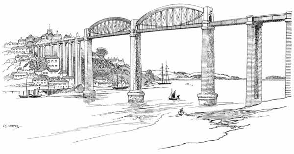
It is perhaps a little grievous, after all these noble and impressive things, to learn that Saltash church, which crests the hill on whose steep sides the town is built, is really, although very ancient, not a church, but a chapelry of St. Stephen's, a quite humble village inland, on the way to Trematon. And there is one other thing: Saltash cannot see its own picturesqueness, any more than one can see the crown of one's head, except for artificial aid. The mirror by which Saltash is enabled to see itself is the Devonshire shore, and across the quarter of a mile to it the steam-ferry, that plies every half-hour or less, will take you for one penny. From that point of view, not only Saltash, but also the best picture of Saltash Bridge is to be had: that giant viaduct which carries the Great Western Railway across from Devon to Cornwall in single track, at a height of 100 feet above the water. Saltash Bridge—no one calls it by its official name, the "Royal Albert Bridge"—has in all nineteen[21] spans, and is 2,240 feet long; but its great spectacular feature is provided by the two central spans of 455 feet each. Twelve years were occupied in building, and it was opened in 1859. The name of I. K. Brunel, the daring engineer, is boldly inscribed on it. There is a story told of some one asking Brunel how long it would last.
"A hundred years," said he.
"And then?"
"Then it will no longer be needed."
There is a good deal more work in Saltash Bridge than is visible to the eye, the stone base of the central pier going down through seventy feet of water and a further twenty feet of sand and gravel, to the solid rock. The cost of the bridge is said to have been £230,000.
Great ships may easily pass under the giant building, and old wooden men-o'-war lie near at hand, giving scale to it, including the Mount Edgcumbe training-ship, the Implacable, and an old French hulk.
This way came the Romans into Cornwall, their post, Statio Tamara, established on the Devonshire side at what is now King's Tamerton. And this way came the Normans, building a strong fortress nearly two miles west of Saltash, at Trematon, on a creek of the Lynher river. They are "proper rough roads" and steep that lead to Trematon Castle. You come to it by way of the hamlet of Burraton Combe and the village of St. Stephen's-by-Saltash. At Burraton some old cottages are seen with a half-defaced tablet[22] on them, once covered over with plaster. Most of the plaster has now fallen off, revealing this inscription, which some one, long ago, was evidently at some pains to conceal:
"This almshouse is the gift of James Buller of Shillingham, Esq., deceased, whose glorious memory as well as illustrious honours ought not to be forgotten but kept, as 'tis to be hoped they will, in euerlasting remembrance, decemr. ye 6 in ye yeare of our Lord 1726."
A shield, displaying four spread eagles, surmounts these praises to the illustrious Buller, whose honours and glorious memory are indeed clean forgot.
Trematon Castle stands on the summit of a mighty steep hill, rising from a creek branching out of a creek. At the head of this remote tongue of water, where the salt tide idly laps, stands the hamlet of Forder. Turner painted Trematon Castle, and in his day the crenellated walls of that amazing strong place could easily be seen from the creek. In these latter days the trees of the Castle hill have grown so tall and dense that little of the ancient stronghold can be glimpsed. A carriage-road winds up the hill, for a residence—not in the least pretending to be a castle, one is happy to say—stands in midst of the fortress precincts.
It is a peculiar castle, the "keep" crowning a lofty mound, difficult of access, heaped upon the highest point of the hill, resembling that of Totnes[23] and some two or three others in the West country, which exhibit vast circular battlemented walls, evidently never roofed nor intended to be roofed. Below this keep is a wide grassy space now occupied by the mansion and its beautiful rose and other gardens. Entrance to this court was formerly obtained by a strong gateway tower still remaining, but not now forming the approach; and around this court ran another massive battlemented wall, most of it existing to this day, and enclosed the castle. Such was the ancient hold of the Valletorts, afterwards the property of the Duchy of Cornwall. Carew finely describes the "ivy-tapissed walls"—it is a pretty expression, thus likening the ivy to tapestry—and tells us how the Cornish rebels of 1549, standing out for the old religion, treacherously invited the governor, Sir Richard Grenville, outside, on pretence of a parley, and then captured the castle and plundered at will. Then "the seely gentlewomen, without regard of sex or shame, were stripped from their apparel to their very smocks, and some of their fingers broken, to pluck away their rings."
Just below Trematon Castle, passing under a viaduct of the Great Western Railway, the creek opens out upon the broad and placid Lynher river, exactly resembling a lake, as its name implies. Here are the four or five cottages of Antony Passage, including a primitive inn. Antony is nearly half a mile across the ferry, but the Lynher, or "St. Germans River," as it is sometimes called, should certainly be explored[24] by boat for its length of four miles to St. Germans, the prettily situated village where the ancient bishopric of Cornwall was seated from its beginning in A.D. 909 until its transference to Exeter in 1046; and where Port Eliot, the park and mansion of the Earl of St. Germans, is placed. Ince Castle, a curious brick-built sixteenth-century building, peers from the wooded shores on the way. An Earl of Devon built it, and the Killigrews held it for a time. The house has a tower at each of its four corners, and according to legend, one of the Killigrews, a kind of double-barrelled bigamist, kept a wife in each tower, ignorant of the others' existence.
St. Germans, from being a borough, has declined to the condition of a village, and a very beautiful and aristocratic-looking village it is. The parish church stands on the site of the[25] cathedral of the ancient See of Cornwall, and, although practically nothing is left of the original building, the great size and the unusual design of the existing church in a great degree carry on the traditional importance of the place. You perceive, glancing even casually at the weird exterior, with its two strange western towers, square as to their lower stages and octagonal above, that this has a story more important than that of a mere parish church. The dedication is to St. Germanus of Auxerre, a missionary to Britain in the fifth century. The importance of the building is due to its having been collegiate. The noble, if strange, west front is largely Norman, the upper stages of the towers Early English and Perpendicular. The interior is Norman and Perpendicular. It will at once be noticed that there is no north aisle. It was demolished towards the close of the eighteenth century, in the usual wanton eighteenth-century way. The only remaining fragment of the ancient collegiate stalls is a mutilated miserere seat worked up into the form of a chair. It is carved with a hunting-scene; a sportsman carrying a hare over his shoulder, with animals resembling a singular compromise between pigs and dogs, in front, and huge hell-hounds with eyes like hard-boiled eggs, following.
St. Germans church is practically a mortuary chapel of the Eliot family, and it stands, too, in the grounds of their seat, Port Eliot, with the mansion adjoining.
It was in 1565 that the Eliots first settled here. The Augustinian Priory and its lands had been granted at the Dissolution to the Champernownes, who exchanged it with the Eliots, who came from Coteland, in Devon. The greatest of the Eliot race, Sir John, Vice-Admiral in the West, and patriot Member of Parliament in resistance to the arbitrary rule of Charles the First, paid the penalty of his patriotism by death in the Tower of London in 1632, after four-and-a-half years' captivity. His body does not lie here. "Let him be buried in the parish in which he died," wrote the implacable king; and he lies in the church of St. Peter-ad-Vincula, on Tower Green, instead of at St. Germans, where his own people would have laid him.
Many monuments to Eliots stud the walls, and hatchments gloom in black and heraldic colours, bearing their inspiring motto, Præcedentibus insta, i.e., "Urge your way among the leaders," suggested, no doubt, by the career of their great ancestor; but the inspiration has never been[27] keen enough to produce another great man from among them, and since the Earldom of St. Germans was conferred in 1815 the Eliots have been respectably obscured.
The Lynher river ends just beyond St. Germans at the village of Polbathick. Other creeks branch out on either hand, like fingers; beautifully wooded hillsides running down to them. At low water they are mostly mud flats, with the gulls busily feasting in the ooze, but when the tide flows they become still lakes, solitary except for a few "farm-places" along their course. On a knoll, high above the Lynher, the spire of Sheviock church peeps out. It is simply bathed in stucco. Carew gives an amusing legend relating to the building of the church, and tells how one of the Dawney family built it, while at the same time his wife was engaged in building a barn. The cost of the barn was supposed to have exceeded that of the church by three-halfpence; "and so it might well fall out, for it is a great barn and a very little church." It is a quaint legend, but there is no satisfaction to be got in visiting the church, for it is not a "very little church," and the barn with which it was compared is not now in existence.
Below Sheviock comes Antony, sometimes called "Antony-in-the-East," to distinguish it from the two other Antonys, or Anthonys, in Cornwall. Antony village stands high up on the hillside, and the park and mansion of the same name, seat of the Pole-Carew family, are[28] nearly two miles away, down by Antony Passage, where the Lynher makes ready to join Hamoaze. The park of Thanckes adjoins.
Antony church is approached by long flights of steps. It contains a monument to Richard Carew, of Antony, author of the "Survey of Cornwall," published in 1602, a work of mingled quaintness and grace. He died in 1620, as his epitaph shows. The part of it in Latin was written by his friend, Camden; the English verses are his own.
Antony lies directly upon the old coach road from Plymouth to Liskeard and Falmouth, three miles from Torpoint, to which a steam-ferry, plying every half-hour, brings the traveller from Devonport. Turner is said to have greatly admired the view from the churchyard, but it is greatly obscured in our own times by trees. The grandest of all views is the astonishingly noble panoramic view of Plymouth and the Hamoaze, from the summit of the road to Tregantle Fort. There the whole geography of the district is seen unfolded, mile upon mile, with the three towns of Plymouth, Devonport, and Stonehouse—to say nothing of Stoke Damerel, Ford, Morice Town, and St. Budeaux—looking like some city of the Blest, which we know not to be the case, and the great railway bridge of Saltash resembling an airy gossamer. It is a view of views. Incidentally, the panorama explains the existence here of Tregantle Fort, and of that of Scraesdon, down by Antony. This elevated neck of land[29] commands Plymouth, which, with the arsenals and dockyards of Devonport and Keyham, could be either taken in the rear or bombarded by an enemy who could effect a landing in Whitesand Bay. Tregantle Fort, mounting many heavy guns, therefore stands on the ridge, to prevent such a landing, and a fine military road runs between it and Rame, a distance of three miles, skirting the cliffs of Whitesand Bay. From the hillsides you see the soldiers firing at targets in the sea—and never hitting them. The way to Rame, along this military road, crosses lonely downs, with the tempting sands of Whitesand Bay down below. The dangers of this treacherous shore, often pointed out by guide-books, are made manifest by an obelisk beside the road, on the brink of the low cliffs, bearing an inscription to "Reginald Spender, aged 44, and his sons Reginald and Sidney, aged 13 and 11, who were drowned while bathing, Whit Sunday, June 9th, 1878."
At the end of the military road and its numerous five-barred gates, the village of Rame, consisting of a small cluster of a church and some farms screened by elms, stands in a sheltered fold of the hills. The church, with needle spire, is an almost exact replica of that of Sheviock, and, like it, has been covered with rough-cast plaster, as thoroughly as a twelfth-cake is faced with sugar. It contains a poor-box pillar, dated 1633. The lighting arrangements are in the primitive form of paraffin candles on wooden staves. Rame Head, almost islanded from the mainland, is the[30] western point of the bold promontory that encloses the Cornish side of Plymouth Sound. Penlee Point is the eastern. "When Rame and Dodman meet" is a West-country way of mentioning the impossible. The two headlands are twenty-seven miles apart, in a straight line. Fuller, who dearly loved a conceit of this kind, tells us that the meeting did actually come to pass when Sir Piers Edgcumbe, who owned Rame, married a lady who brought him the land including the Dodman. The small chapel of St. Michael on Rame Head, long in ruins, has been restored by Lord Mount Edgcumbe.
Penlee Point looks directly upon the Sound: an inspiring sight in the Imperial sort. It is indeed an epic of Empire, that broad waterway, three miles across, with the great Breakwater straddling in its midst, and shipping busily coming and going, and forts on land and battleships on sea. And I wish the walking were not so rough, and the near contact with the forts a little more martial and not so domestic. It resembles tricks upon travellers to find that the signals flying from Picklecombe Fort are not really, you know, signals when seen close at hand, but shirts hung out to dry.
And so presently round to Cawsand Bay. First you come to Cawsand and then Kingsand, villages not easily to be distinguished from one another. Notorious in the eighteenth century for being a nest of daring smugglers, these places nowadays form excursion resorts for afternoon[31] trippers from Plymouth, and almost every house supplies teas and refreshments. But in spite of the crowds that resort to Cawsand and Kingsand, they are sorry places, with a slipshod, poverty-stricken air. Only the splendid views make them at all endurable.
Mount Edgcumbe is one of the great attractions for the people of Plymouth. It is, of course, the private park of the Earl of Mount Edgcumbe, but the Plymouth people have by long use come to look upon the usual free access to it very much as a right, and the excursion steamers from Plymouth to Cremyll would receive a severe blow if the permission to wander here at large were withdrawn. The Duke of Medina-Sidonia, Admiral commanding the Spanish Armada, is said to have selected Mount Edgcumbe as his share of the spoil, when England should be conquered. Contrary from all reasonable expectations, there was no conquest, and consequently no spoils.
Maker church, on the heights above Mount Edgcumbe, commands panoramic views over Hamoaze, and its tower was used in the old semaphore signalling days, in connection with Mount Wise at Devonport and the fleets at sea.
The proper local pronunciation of "Hamoaze" is shown in the ode written by a parish clerk of Maker:
Equally fine, and more pictorially manageable views are those from the "ruined chapel" down below. The "ruin" is indeed a sham ruin, and was simply built for effect, but a fine effective foreground it makes, with all Plymouth massed over yonder, and the Hoe with Smeaton's old Eddystone tower prominent, and in the middle distance the fortified rock of Drake's Island.
A deep inlet runs inland past Cremyll to Southdown and Millbrook, whither frequent ferries also ply, at astonishing penny fares. At Millbrook, too, every other house supplies teas to hungry and thirsty crowds. You would not say the waters of Millbrook creek were altogether salubrious, and the steamers' paddles stir them up sometimes with desolating effect upon the nose, but the mackerel do not seem to be adversely affected. Indeed, they appear rather to affect these turbid and odorous waters, and may often be seen from the steamers leaping up into the air. There are few more beautiful sights than those on the return from Millbrook to Plymouth on a summer evening, when the moon peers over the wooded shores and the mackerel leap and glitter in her silver light.
The country of this Mount Edgcumbe peninsula is beautifully wooded. Inland from Millbrook towards Antony again, you come to St. John's, a pretty village, with an old church and plenteous elms. And then, having explored the peninsula, the way out to the coast line on to Looe is up again to Tregantle, whence a coastwise road leads past Crafthole and Portwrinkle to Downderry. Those places may easily be dismissed, together with the coast on which they stand. They are quite recent collections of houses, mostly of an extremely commonplace plastered type, devoted to letting lodgings for the summer months. Their situation has nothing to recommend it, for the coastline here is quite bald and uninteresting, and the country immediately in the rear is for the most part treeless downs. Downderry is the largest of these settlements. Those who merely follow the coast-road through Downderry will never appreciate the exquisite appropriateness of that name. The gradients that way are not steep. But let Downderry be approached from the direction of St. Germans, and[34] the steep two-miles' descent shall prove there to be something in a name. At the same time, it is but fair to add that the name did not derive from the hills, but from Dun-derru, i.e. "Oak Bank."
Beyond Downderry the road descends to a marshy valley crossed by a small stone bridge, at the point where a stream hesitates between percolating through the sands and running back upon itself to convert the marshy vale into a lake. This is marked on the maps "Seaton," but for town or village, or even hamlet, the stranger will look in vain. From this point it is a long four miles into Looe, and I can honestly say that, whichever way you go, by the road leading inland, and incidentally as steep as the roof of a house, or by the cliffs, in places considerably steeper, you will wish you had gone the other way. For indeed both ways are deadly dull. Coming on a first occasion by road the reverse way, from Looe, an old man, indicating the way, remarked that it would be a very good road "ef 'twadden for th' yills. Ye goo up th' yill, and ye tarn" (I forget where you turn), "an' then ye goo straight down th' yill to Satan."
As one had not at that time heard of Seaton, this final descent had a certain awful speculative interest.
Even the cliff route into Looe ends at last. There, almost hanging over the brink of Looe, as it were, you realise for the first time, in all the way from Rame, that you are really in Cornwall, for the coast has hitherto lacked the rugged[35] beauty that is found almost everywhere else. But Looe makes an honourable amende. It might not unfittingly typify Cornwall. Conceive two closely-packed little towns down there (for there are two Looes, East and West), fringing the banks of an extremely narrow and rocky estuary, widening as it goes inland; and imagine just offshore on the further side a craggy island, and there you have the seaward aspect of the place. Looe has been considerably altered during the last few years, but it can never be a typical seaside place; its physical peculiarities forbid that. It has no sea-front, and possesses only the most microscopic of beaches, just large enough to hold a few boats and to launch the lifeboat. The life of the Looes, East or West, is all along the streets and quay beside the estuary. The place is, as it were, a smaller Dartmouth, but with the added convenience of a bridge crossing the Looe River, half a mile from the sea.
The Looe River is partly an actual river, but very much more of a creek: a lakelike creek at high water, dividing above the bridge into two creeks, into which freshwater streams trickle from Liskeard and the Bodmin moors. Looe, in fact, takes its name from these lakelike estuaries. It signifies "lake," and has a common ancestry in the Welsh "llwch" and the Gaelic "loch." Thus in speaking of Looe River "we admit not only a redundancy but actually a contradiction. There are two Looes, or lakes, the East and the West, just as there are the two[36] towns so-called. Between these two waters, three miles inland, is the rustic village of Duloe, whose name is supposed to have originally been "Dew Looe," i.e., the Two Looes. "But there has always been great variety of opinion about this, and old writers on Cornwall have variously considered it to be "Du Looe," or "God's Lake," or "Du Looe" (spelled the same way), "Black Lake." A resourceful antiquary has, in addition, pointed out the difficulties of finding the true origin of place-names by advancing no fewer than six other possible origins:—
Dehou-lo = south pool.
Dour-looe = water lake.
Dewedh-looe = boundary lake.
Du-low = black barrow.
Dewolow = the devils.
Du (or tu) looe = Lake-side.
The "black-barrow" or "devils" derivations, it is said, might come from the remains of a prehistoric stone circle still existing at Duloe, where eight stones from four to ten feet high, are still standing. They may have once formed an awe-inspiring sight to the early peoples who gave names to places.
The foregoing is, however, only an exercise in possibilities, intended as a warning to those who make certain of meanings; the probabilities rest with "Dew Looe."
East Looe, formerly called Portuan, as its old borough seal shows, is the larger of the twin towns. It has a Town Hall, retaining the porch of an older[39] building with the old pillory; and a church whose only old part is a singularly sturdy and clumsy tower. It is equally puzzling to find the church and the tiny beach of Looe in the maze of narrow alleys. West Looe has also its church, very much of a curiosity, in a humble way. Its slender campanile tower, properly introduced into a view, makes a picture of the brother town across the water. Years ago, this church was desecrated in many ways. Among other uses it was made to do duty for a town hall and as a room for theatrical entertainments.
Along the West Looe water is the lovely inlet of Trelawne Mill, just above the bridge, with dense woods clothing the hillsides and mirrored in the still waters. Here is Trelawne, seat of the Trelawny family since the time of Sir Jonathan Trelawny, Bishop of Bristol, and afterwards successively of Exeter and Winchester, one of the Seven Bishops sent to imprisonment in the Tower of London by James the Second in 1688. The "Song of the Western Men," written by Hawker, using the old refrain, "And shall Trelawny die?" refers to that occasion:—
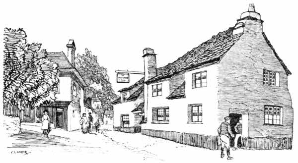
The "Jolly Sailor" Inn at West Looe is perhaps the most picturesque building in the little town, whose long steep street goes staggering up towards Talland, and its toppling chimney is a familiar object. It is not so much an accidental as an intentional slant, designed to counteract the down-draught of the winds.
Talland, situated on the hill overlooking the solitary bight of Talland Bay, is just a church, a vicarage, and the old manor-house of Killigarth. The church is one of the six in Cornwall which have detached towers. The others are St. Feock, Gunwalloe, Mylor, Lamorran, and Gwennap. Part of Talland church is Early English, the rest Perpendicular. It contains, among other memorials, a monument to "John Bevyll of Kyllygath," 1570, with an effigy of him carved in relief on slate, and a long metrical epitaph, full[41] of curious obsolete heraldic terms. If you seek to know anything of the marryings and intermarriages of the Bevill family, be sure that this monument sets them forth in full detail; and the fine bench-ends take up the story, and tell it abundantly in shields of many quarterings.
Talland was in the old smuggling days exceptionally notorious for the frequent landings of contraband on the lonely little beach below the church, and "Parson Dodge" was a famous devil-queller and layer of spirits, far and near. But he could not, or would not, lay the mischievous sprites who haunted his own churchyard, and were, in fact, not supernatural beings at all, but smugglers in disguise, whose interests lay in[42] making Talland a place to be shunned at nights. There is a great deal of smuggling history connected with Talland, and among the grotesque epitaphs in the churchyard there is even one to the memory of a smuggler, who was shot in an encounter with the Preventive Service.[A]
The cliffs between Talland and Polperro are in places fast crumbling away, and no one seems in the least concerned to do anything; perhaps because anything that might be done would presently be undone again by the sea. "Ye med so well throw money in the sea as spend et on mending they cliffs," is the local opinion. At Polperro itself the cliffs are of dark slate, and seem almost as hard as iron.
I suppose no one will deny Polperro the dignity of being the most picturesque village on the south coast of Cornwall. The place-name means "Peter's Pool," and the sea does indeed exactly form a pool in the little harbour at high water, retreating entirely from it at the ebb. The entrance from the open sea is a narrow passage between headlands of dark slate, whose characteristic stratification produces weird spiny outlines and needle-like points, inclined at an angle to the horizon. On the western of these two headlands formerly stood a chapel dedicated to St. Peter, the peculiar patron of fishermen. Instead of anything in that sort, the cliffs now exhibit a monster black and white lattice hoarding, as though a mad Napoleon of advertising had proposed[43] to celebrate some one's pills and soap, and had been hauled off to a lunatic asylum before he could complete his project. A similarly hideous affair infests the cliffs by Talland, a mile away. They are, however, not advertising freaks, but structures placed by the Admiralty to mark a measured mile for the steam-trials of new vessels. The artist-colony at Polperro, a large community, is rightly indignant at this uglification, but fortunately it is not seen all over Polperro.
The little town is in every way a surprise and a curiosity, and in most ways a delight. The stone piers that project from either side of the entrance to the harbour leave a space for entrance so narrow that it is commonly closed in stormy weather by dropping stout baulks of timber into grooves let into the pier-heads. The chief industries of Polperro are the pilchard-fishery and the painting of pictures, and it is because of the commercial, as well as the æsthetic, interest of the artistic community, in preserving the old-world picturesqueness of Polperro, that the wonderful old place remains so wonderful and retains its appearance of age. The rough cobble-stones that have mostly disappeared from other fisher villages are left in their wonted places, and when the local authority a little while ago removed some, in the innovating way that local authorities have, the loud cries of protest that were made speedily caused the replacement of them. I do not think there is any other place, even in Cornwall, which is situated in so sudden and cup-like[44] a hollow as Polperro, and with houses so closely packed together and staged so astonishingly above one another. Port Loe nearly approaches it, but that place is much smaller.
The time for sketching and seeing Polperro at its best is in the sweet of the morning, before the tender light of the sun's uprising has given place to the fierce sunshine of the advancing forenoon. A pearly opalescent haze then pervades the scene, in which the shadows are luminous. Then the[45] smoke from the clustered chimneys of Polperro ascends lazily from the sheltered hollow: breakfast is preparing. Polperro is unquestionably in many ways old England of the seventeenth and eighteenth centuries, surviving vigorously into the twentieth. The artist, sketching here, is startled at frequent intervals by glissades of slops, flung by housewives, adopting the "line of least resistance," over the rocks into the harbour. It is a custom that makes him nervous at first, but he gets used to it. At Polperro, it is always well, in seeking a picturesque corner, say half-way down, below any houses, to make quite sure (if in any way possible to make sure), that one is not in the line of discharge of any liquids or solids that in more conventional places are deposited in the ash-bin or thrown into the sink.
Many odd old cottages remain here, some of them with outside staircases, and most roughly built of granite and slate, and whitewashed. The chief industry of Polperro is evident, not only in the fishy smells, or in the fishing-boats and the appearance of the people; but its specialised character is hinted at by the sign of the humble "Three Pilchards" inn on the quay, near the old weigh-beam. Good catches of pilchards or bad make all the difference here, where these peculiarly Cornish fish are largely prepared and packed for export to Italy. An Italian packing-house has indeed an establishment on the quay. The salted pilchards, long since known among the Cornish[46] as "Fair maids" from the Italian "fumadoes"—the original method of preserving them having been by drying in smoke—are the chief source of the Polperro fishermen's livelihood. Thus the time-honoured toast of these otherwise sturdy Protestants:
Others beside the fisherfolk rejoice when the fishery is good. I refer to the gulls. Nowhere is the seagull happier than in Cornwall, if immunity from attack and the certainty of plenty to eat constitute happiness in the scheme of existence as it is unfolded to gulls. The Wild Birds' Protection Act is scarcely necessary for the protection of gulls in Cornwall, and the birds are so used to this affectionate tolerance that it might almost be denied that they are wild, except technically. I am afraid the gull presumes not a little upon all this. He seems to know that the fishermen dare not punish him, if sometimes they feel inclined, for to ill-treat a gull is notoriously the way in Cornwall to bring bad luck; and although they are incredibly ravenous eaters of fish, it is one of the fisher-folk's most deeply rooted convictions that the boats are lucky in proportion to the numbers of gulls that accompany them.[47] There is, of course, a good reason at bottom for this, because the gulls are the first to note the whereabouts of the fish, and scream and swoop down upon the shoals long before any human eye can detect their existence. The gulls go out with the boats and come back with them, and often they are the first to return; the winged couriers who awaken the little port with news of the home-coming of its men.
When the boats are in harbour, the gulls are at home, too. Every roof-ridge is alive with them, and they even take an intelligent interest in the domestic cooking. It is one of the most ridiculous sights to observe a gull perched on the edge of a chimney-pot smelling the odours that come up from cottage chimneys. When the tide is out, the gulls quest diligently in the ooze and scavenge all the offal that is plentifully flung into the harbour, for there is nothing nice in the feeding of a gull. Dead kittens and dogs come as handy and as tasty morsels as potatoes and cabbage-stalks. I have even seen a gull steal and bolt a pudding-cloth; but what happened to him afterwards I don't know. There are, indeed, few things a gull will not steal. The dogs and cats in Polperro have even developed a way of furtively glancing up at the roofs, for the gulls swoop down like lightning when the cats' dinners are put outside, and their food is gone on the instant. Thus you will notice the cats run to cover with their meal, while the dogs do the like, or are careful to place one paw on their bone, lest it be snatched[48] away in a twinkling. Nay, worse; the gull ashore will kill rabbits, rob nests, steal chickens, and poach young pheasants; and the "jowster" who hawks fish through the villages not infrequently finds his stock depleted through the same agency. And yet the gull is suffered gladly. He is the most privileged and the hungriest thief in existence.
A valley road leads inland from Polperro to the hamlet of Crumplehorn, a pretty spot whose name originated I know not how. The coastwise road goes through Lansallos to Fowey.
"A bit of a nip" they call the sharp road on the way to Lansallos, by which you see that the old word "knap," for a hill, is degenerating. Lansallos church tower, in rather a crazy condition, is a prominent landmark. The coast-line beyond Lansallos juts out at Pencarrow Head, a "cliff-castle" promontory, whose name comes from "Pen-caerau," the fortified headland. There are several shades of meaning in "caer," of which "caerau" is the plural form. It may indicate a town, a castle, a dwelling, or a camp, just as a dwelling in remote times was of necessity fortified against attack.
Lanteglos, inland from Pencarrow, is like Lansallos, lonely, but it is tenderly cared for, after long neglect. The full name of it, "Lanteglos-juxta-Fowey," sounds urban. The tall granite, fifteenth-century canopied cross, standing by the south porch, was discovered some eighty years ago, buried in the churchyard. Among the[49] brasses in the church is one for John Mohun and his wife, who died in 1508 of the "sweating sickness."
Polruan, the "Pool of St. Ruan," at the foot of the steep road leading down from Lanteglos, is a sort of poor relation of the prosperous town and port of Fowey over there, across the so-called "Fowey River," which here and for five miles up inland is a salt estuary, with smaller divergent creeks. The beauty of Fowey and its river unfolds with new delights at every stroke of the oars, as the ferry-boat, gliding through the translucent green sea-water, brings one across to the town quay.
The old town of Fowey, "Foy," as it is called, and was in old times often spelled, has a stirring history, resembling that of Dartmouth, even as its appearance and situation are reminiscent of that Devonshire port. Leland tells us that "The glorie of Fowey rose by the warres in King Edward I. and III. and Henry V.'s day, partly by feats of warre, partly by pyracie, and so waxing rich, fell all to marchaundize." The "Fowey Gallants," for such was the title by which the seamen of the port were known, or by which perhaps they styled themselves, were not good men to cross, and they had a high and haughty temper that brought them into conflict even with men of Rye and Winchelsea. It seems that ships were expected to salute on passing those Cinque Ports, but the men of Fowey refused, and being called to account for it, beat the Sussex men, and further added to their offences by adding the arms of Rye and Winchelsea to their own; an indignity felt acutely in those times, when one might perhaps pick a man's pocket with less[51] offence than to assume his armorial bearings. The men of Fowey were well known and dreaded by merchant vessels in the Channel; for, no matter the nationality, they practised piracy on all and sundry. They landed, time and again, on the French coast when we were at peace with France, and plundered, and burnt, and killed. The French stood this for some time, but were on several occasions obliged to fit out expeditions in revenge; and no one who reads of the ways of those shocking bounders can feel in the least sorry when he reads how the foreigners landed one night, in the reign of Henry the Sixth, and fired Fowey, and killed several of the townsmen. The lesson could not, however, be sufficiently enforced, for the tough Fowegians rallied and drove the French again aboard.
At length, after centuries of turbulence, the privileges of Fowey were taken away, about 1553, and given to Dartmouth, which itself was a nest of pirates and buccaneers. But a good deal of fight seems to have been left in Fowey, and its sailors in the time of Charles the Second rendered good service against the Dutch.
The houses of Fowey press closely against one another, and line the water very narrowly, and its "streets" are rather lanes. The greatest glory of the town is the fine church of St. Finbar, whose tall pinnacled tower, built of Pentewan granite, yellow with age, is elaborately panelled. Behind it rise the battlemented and still more elaborately panelled towers of Place (not Place[52] "House" as it is often redundantly styled), seat of the Treffry family. But most of the old-time houses have in these later years been ruthlessly destroyed, and the lanes of Fowey are becoming as commonplace as a London suburb. Nay, even more, a suburb of London would be ashamed of the tasteless, plasterful houses and vulgarian shop-fronts that have lately come into existence here. It is a sorrowful fact that the West Country is the last stronghold of plaster and bad taste and that things are now done here, of which the home counties grew ashamed a generation ago. Lately the old "Lugger" inn, almost the last picturesque bit of domestic architecture in Fowey, has been rebuilt. Readers of "Q's" stories of "Troy Town," by which, of course, Fowey is meant, will not, in short, now find their picturesque expectations realised.
The last warlike experiences of Fowey, apart from the amusing antics of the volunteers enrolled to withstand the expected French invasion under Napoleon, celebrated by "Q," were obtained in the operations that included the surrender of the Parliamentary army here in 1644. The visit of Queen Victoria and Prince Albert in 1846 is celebrated in a misguided way, by a granite obelisk of doleful aspect on the quay. It would add greatly to the gaiety of Fowey if it were disestablished.
St. Finbar, to whom the fine church is dedicated, was Bishop of Cork. He is said to have been buried in an earlier church on this site.[53] The existing church, built 1336—1466, is one of the few in Cornwall possessing a clerestory.
There are interesting monuments of the Rashleighs of Menabilly here; the old family that came from Rashleigh in mid-Devon, but even then bore a Cornish chough in their curious and mysterious arms. Their heraldic shield includes, among other charges, the letter T, but the meaning of it being there is unknown, even to the Rashleighs. The family formerly owned Fowey. It was their Parliamentary pocket-borough, and only their nominees could be elected. But this valuable privilege passed from them in 1813, I know not how. It suggests, however, that the Rashleigh punning motto, Nec temere, nec timide,—i.e. "Neither rashly nor timidly," had in some way ceased to regulate their doings.
The Treffrys, too, are well represented in monuments and epitaphs, as it is only right they should be, considering that their house, Place, adjoining the church, has been their home for many centuries. They were settled here long before the Rashleighs, but are now really extinct in the male line. The great J. T. Treffry, builder of the harbour at Par and constructor of the Cornwall Minerals Railway, and other works, was an Austen before he assumed the name by which he is better known.
A former vicar of Fowey, the Rev. Dr. Treffry, who flourished in the early part of the nineteenth century, before character had ceased in people, and every man had his own noticeable peculiarities,[54] was outspoken to a degree. It is recorded that few dared let the offertory-bag pass without a contribution, for if he noticed the omission his voice would be heard in a stage whisper saying, "Can't you spring a penny? I paid you an account last week."
No method of exploring the country on either side of the Fowey River is to be compared, for ease and beauty, with that of taking boat on the rising tide, and so being borne smoothly along those exquisite six miles to Lostwithiel. Here, and for a long way up the estuary, is deep water and safe anchorage for large vessels, as the pretty sight of weatherworn ships anchored over against Bodinnick shows; their tall masts and graceful spars contrasting with the wooded hills, and hinting of strange outlandish climes to the nestling hamlets.
Bodinnick is, like Polruan, a ferry village, opposite Fowey. It looks its best from the water. A mile up, on the same side, a creek opens to St. Veep, a sequestered church dedicated to a saint called by that name. Her real name was Wennapa, aunt of St. Winnow, and sister of Gildas the historian.
The Cornish way of dealing with saints' names may seem to some delightfully intimate, and to others a profane familiarity, almost as bad as it would be to style St. John "Jack," but the West Country saints are to the Evangelists and to the major saints what Irish and Scotch peers are to peers of the United Kingdom; or perhaps, better[55] still, what Knights Bachelors are to Dukes. I do not mean to say that they have not seats among the rest of the sanctified, but they are decidedly of a lower grade; a good deal more human and less austere than the great and shining ones. And when we find, as often we do find among the Irish, Welsh, native Cornish, or Breton saints, that entire families have attained to that state, we do right to look shyly upon their title.
Further up the Fowey River, on our left side, we come to Golant and the church of St. Samson, or Sampson, dedicated to a sixth-century Breton saint, who early fled his country and was educated in Wales, and then settled in Cornwall. Finally he returned to Brittany (when he thought it quite safe to do so), and died Bishop of Dôl.
Passing Penquite, which means "Pen coed"—i.e. "head of the woods"—a creek opens on the right, to Lerrin, a picturesque hamlet on the hillside, where the creek comes to an end, and the futile comings and goings of the sea die away in ooze. A prehistoric earthwork, running inland between Lerrin and Looe, is locally attributed to the Devil, in the rhyme:
"Hedge," to any one from the Home Counties, indicates a boundary formed by growing bushes. In Cornwall it is often either a rough stone or earthen bank.
Above Lerrin Creek is St. Winnow, a fine old[56] church standing by the waterside. St. Winnoe is an obscure saint. He was son of Gildas, the pessimist historian of the woes of Britain at the coming of the Saxons. There is some good old stained glass in St. Winnow church, and an inscribed font (inscription not decipherable).
A curious anagram-epitaph on one William Sawle, who died in 1651, may be seen here. It has been restored of late years by one of his collateral descendants:
This perhaps plumbs the depths of tortured conceits, with its back and forth play upon "William Sawle," "I am well," and the resemblance of "Soul" to "Sawle": a closer resemblance in the speech of the West Country than it would appear in print to be. Any day the stranger in Devon and Cornwall may, for instance, hear the common salutation, "Well, how be 'ee t'-daa, my dear sawle?"
"Aw, pretty tidily, thank 'ee."
There is no village of St. Winnow, only a farmhouse and a vicarage, at the foot of a hill, bordered by a noble beech avenue.
About a mile above St. Winnow, the narrowing stream comes to Lostwithiel quay, where the navigable Fowey River ends.
"Lostwithiel!" I like that name. It is musical. To repeat it two or three times to one's self is an ineffable satisfaction. One is immediately seized, on hearing it, with a desire to proceed to the town of Lostwithiel. Romance, surely, lives there. Foolish country folk in the[60] neighbourhood, noting that great heights rise all around the little town, say the meaning of its name is "Lost-within-the-hill." I blush for them, for it means nothing of the sort; but who wants to attach a meaning to that melody? Not I, at any rate, and I care little whether it be properly "Les Gwithiel," the Palace in the Wood, or the "Supreme Court." The old palace indicated is the ancient Duchy House, a seat of the early Dukes of Cornwall, who also had their Stannary courts, that is to say, their tin-mining tribunals, here. The buildings, much modernised, in part remain; and up in the valley of the Fowey, one mile further inland, are the remains of their stronghold, Restormel, properly "Les-tormel," Castle.
There is not much of Lostwithiel. Past the railway station, and over the nine-arched, partly thirteenth-century bridge across the river Fowey, and you are in a town of about two thousand inhabitants, which looks as though it accommodated only half that number. Yet, small though it be, it is divided into two parts, Lostwithiel proper, and Bridgend, and has a Mayor and Corporation. The central feature and great glory of Lostwithiel is the lovely octangular stone spire and lantern of its parish church of St. Bartholomew, a work of the Decorated, fourteenth-century period of architecture, before which most architects very properly abase themselves in humble admiration, while many hasten to adopt its beautiful lines for their own church designs. Lostwithiel spire has, in[61] especial, been the model for the spires of many latter-day Wesleyan and Congregational chapels.
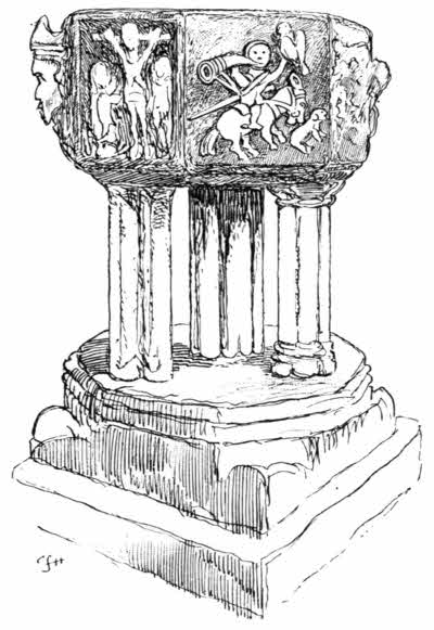
The description of architecture without the aid of illustration is a vain and futile thing, and what the likeness of this work is let the drawing herewith attempt to show. The tower itself is an earlier building, of the thirteenth century, but tower and spire taken together are of no great height—about 100 feet. The effective tracery[62] of the eight windows surmounted by gables is all of one pattern, except a window on the north side, whose feature is a wheel. The font is one of the most remarkable in Cornwall. It seems to be of the fourteenth century. Its five legs are of different shape. The strangest feature of its eight sculptured sides, which include a most clumsy and almost shapeless representation of the Crucifixion, is a curious attempt at a hunting scene, rendered in very bold relief. A huntsman on horseback is shown, holding a disproportionately large hawk on one upraised hand, and a queer-looking dog bounds on in front, in a ludicrous attitude. This font is historically interesting, as figuring in the disgraceful doings of the Parliamentary troops, who in 1644 occupied Lostwithiel and used the church as a stable; baptizing a horse at it, and calling it "Charles," as Symonds, the diarist trooper, tells us, "in contempt of His sacred Majesty."
Probably one of the longest leases on record is alluded to, on a stone in the wall of a shed at the corner of North Street and Taprell's Lane, in the inscription: "Walter Kendall of Lostwithiel was founder of this house in 1638. Hath a lease for three thousand years, which hath beginning the 29th of September, Anno 1632."
There is little in Fowey for the landsman. Its chief delights are upon the water: boating or sailing on the river, or yachting out to sea. Yachtsmen are familiar figures, both at the inns and hotels of the actual town, and at the new hotel outside, overlooking the Channel from Point Neptune. A thirsty yachtsman, asking for some "Cornish cider," revealed by accident one article at any rate which Cornish local patriotism does not approve. The Cornishman, it appeared, although believing in most things Cornish, drew the line there, and Devonshire cider was offered instead, with the admission that, although there was Cornish cider, no one who could possibly help themselves would drink it.
The coast round past Point Neptune and by the wooded groves of Menabilly, on to Polkerris, a queer little fisher-village, is much better made[64] the subject of a trip by sailing-boat than a tramp along those rugged ways; and then, returning, the direct road from Fowey to Par may be taken, past the lodge-gates of Menabilly, at Castle Dour.
The name originated in "Castell Dwr"—i.e., the "Castle by the Water"—an ancient granite post, or cross, known as the "Longstone." It is seen standing on a plot of grass in the road. This is the tombstone of a Romanised Briton, and formerly bore the inscription, "CIRVSIVS HIC IACIT CVNOMORI FILIVS," plainly. It is not now so easily read.
Soon the way leads almost continuously down hill to Par. On the hedge-bank to the right is a striking modern wayside cross, bearing the inscription, "I thank Thee, O Lord, in the name of Jesus, for all Thy mercies. J. R., May 13, 1845, 1887, 1905." It was erected by the late Jonathan Rashleigh, of Menabilly.
At the foot of the hill is Par. The name of the place means, in the Cornish language, a marsh, or swamp, and Par certainly lies almost on a level with the sea, where a little stream wanders out of the Luxulyan Valley on to the sands of a small bay, opening to the larger bay of Tywardreath. The original character of this once marshy spot is very greatly hidden by the many engineering and other works established here by J. T. Treffry. Here his Cornwall Minerals Railway, running across country to the north coast at Newquay, comes to his harbour; and his mines, canal, and smelting works make a strange industrial[65] medley, through whose midst runs the main line of the Great Western Railway.
The great enterprises of that remarkable man have long since suffered change. His railway is now the Newquay branch of the Great Western, his mines and canal have fallen upon less prosperous days, and the great chimney of the smelting-works, 235 feet high—"Par stack," as it is called—no longer smokes. The pleasant humour of the neighbourhood long since likened silk hats, the "toppers" of everyday speech, to the big chimney, and he who wore one was said to be wearing a "Par stack."
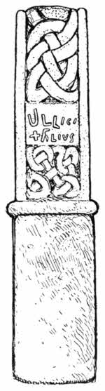
There is no gain in the scenic way by following the coast from Par to Charlestown. Nothing of any outstanding character appears along those coastwise paths, which are long and obscure. This is not to say that the road inland is in any way delightful. It is, in fact, a plaguey ill-favoured road, for when you have left the various railway bridges and junctions of Par behind, you come to a very Gehenna of a place; a sterile plain through whose midst the highway proceeds bumpily. Many years ago the miners turned the land at this point inside out, in search of copper, and now that they have long left it, the place remains the abomination of desolation, where nothing will grow amid the mundic and heaps and hollows of tailings. South of the road at Biscovey, past this desolate region, stood an ancient granite cross, minus its head, but still seven feet eight inches high, known as the "Biscovey[66] Stone," and serving the humble office of a gatepost. It was in 1896 removed to Biscovey churchyard. Its original function was that of a monument to one Alroron, and it bears on its two broad sides, amid curiously interlaced decorative patterns, the inscription "—Alroron Ullici Filivs—."
The dusty road leads through Holmbush, a suburb of Charlestown, which took its name from the wayside "Holly Bush" inn. Charlestown itself is more curious than beautiful. It is, in fact, the port of St. Austell, of which it is really an extension, and was formerly called Polmear. Charlestown is a place with one small, but very busy and crowded dock; and the dock and the quays, and all the roads into and out of the place are a study in black and white, and barrels. The stranger to Cornwall, proceeding westward for the first time, is apt to be puzzled by these strange evidences. He has come, unaware, upon the first signs of the great and prosperous Cornish china-clay industry. The whiteness of everything that is not black is caused by the leakage of the china-clay, and the blackness of everything that is not white is the result of coal-dust.
China-clay is a substance greatly resembling chalk, and varying from a putty-like consistency to a powdery brittleness. A little of it is inevitably dropped in the cartage down from Carclaze, inland, where it is got, through St. Austell, and down to the port, and a little more is spread about in loading the vessels that take it abroad; and so, as "mony a mickle makes a muckle," there is generally a good deal of china-clay pervading the place. The mountains of clean new barrels, just fresh from the cooper's, are for packing the clay for export. Charlestown also does an import trade in coal, hence the alternative to Charlestown's sanctified whiteness, but when it rains, as it not infrequently does in Cornwall, the result here is a grey and greasy misery, compact of these two substances.
China-clay is decomposed granite, rotted by the action of water during uncounted thousands of years. Up at Carclaze and further inland, at St. Stephen's-in-Brannel, it is dug out of quarries that were once open workings for tin. The deposits are of great depth and extent. Although so easily dug out, the white clay in its natural state is mixed with hard and gritty particles of quartz, and has therefore to be subjected to a refining process, to separate that undesirable element. The method of separation is very simple, the clay being subjected to a washing by which the heavy, useless particles remain, and the soft material is carried down into a series of tanks. There it is left to settle, and the water is then[68] drawn off. The clay is then allowed to dry, and is finally dug out and packed in barrels. Modern improvements in the preparation of china-clay have been chiefly directed to the quick-drying of the masses in these tanks, and minutes are now taken instead of the months formerly occupied in natural evaporation. China-clay, it may be added, is used for many other purposes than the manufacture of porcelain, and, although the Staffordshire and foreign potteries use it largely, it is extensively employed in loading calico, and in giving inferior cottons a specious and illusory excellence. It enters also into the composition of the heavier and more highly glazed printing papers, chiefly those used for printing illustrations.
St. Austell and Carclaze owe their prosperity, in the origination of all these things, to William Cookworthy, who first discovered china-clay in England. He has his memorial in Plymouth, where he lived for many years, for one of the fine series of modern stained-glass windows in Plymouth Guildhall shows him as chemist and porcelain-maker; but the landowners of Carclaze and the people of St. Austell have certainly fallen short of their duty by failing to set up a statue of him in some prominent place.
William Cookworthy, a native of Kingsbridge, in South Devon, was born in 1705, one of the seven children of another William Cookworthy, a weaver, who died early and left his widow and family with very narrow means. They owed their sustenance, and the children owed their[69] education, to the Quakers of Kingsbridge. William was apprenticed to a chemist and druggist, and eventually established himself in the same way of business, wholesale, at Plymouth. The firm of Bevan & Cookworthy prospered early, and Cookworthy at thirty-one years of age very largely freed himself from its cares and devoted himself to preaching. Ten years later, in 1745, he became interested in kaolin, or china-clay, which until 1708 had been found only in China, giving that country the entire output of porcelain, which from the land of its origin obtained its very name of "china." Cookworthy, in common with several other of his contemporaries, wished to produce "china," and when news came in 1745 that china-clay had been found in Virginia, he commissioned a Quaker friend to obtain some for him. Travelling much in Cornwall, he himself discovered a coarse variety of it on Tregoning Hill, in Germoe, and a little later found the great deposits at Carclaze, in the parish of St. Stephens, behind St. Austell.
In that year, 1758, he began experimentally making porcelain at Plymouth. Already, in 1709, Dresden china was being made from the kaolin found in Saxony, and a little later than his own beginning the Sèvres porcelain factory was using a deposit found at Limoges. He was joined by Lord Camelford, and a patent for making china was obtained in 1768, but the Plymouth factory was not at any time remunerative, and the works were removed to Bristol and eventually into[70] Staffordshire. Cookworthy died in 1780, not in any way advantaged by his discovery.
The town of St. Austell—"Storsel," locally—does not in the least know how it came by that name. An altogether uncertain "Augustulus" has been presumed, while others think they find glimmerings of a hermit "St. Austolus." It is a town of narrow, crowded streets, with little of interest apart from the fine parish church, chiefly of the early part of the fifteenth century. The font, however, is Norman, of the very marked Cornish type, consisting of a bowl supported on four legs ending in grotesque faces. The fine Perpendicular tower and the south aisle, richly carved in the stubborn granite with numerous shields and devices bearing the emblems of the Passion and Crucifixion, are among the most ornate in Cornwall.
A mysterious inscription, whose meaning is still hotly debated, is found above the west door, immediately surmounting a sculptured group representing the "pelican in her piety." The old story of the pelican wounding her breast—"vulning herself," ancient writers call it—for the sustenance of her young, is here thought to typify the sacrifice made by our Blessed Lord and Saviour for our sakes; and in this light the inscription above may be read. The rudely sculptured letters of it form the words and initials—
The original view was that RY DU was the correct rendering, signifying in the Cornish language "God is King." Of the meaning of INRI there can, of course, be no question; it is "Jesus Nazarenus Rex Judæorum." It is now sometimes held that, as the lower line is Latin, the upper is Greek, and is a contraction for Kyrius Christus, i.e., "Christ is Lord." Yet other attempts take us into the Syro-Phœnician and Hebrew tongues, and read the meanings, "Dearly Beloved," or, "He gave us His blood." But no one will ever definitely put the question to rest.
There is but one other really interesting object in St. Austell. That is the famous, but mysterious, Mengu, or Menagu, stone, removed of late from the Market Place to the spot known universally in St. Austell (but not officially named), as "Fool's Corner." It is placed, or was placed, it is said, where the boundaries of the three manors of Trenance—Austell, Treverbyn, and Towington—met. A brass plate fixed upon it in 1892 gives a certain modicum of information respecting this slab, but it is little enough, and to this day the words written by Walter White, in his "Londoner's Walk to the Land's End," of 1854, hold good. "Enquire," he says, "for anything remarkable in the town, and you will hardly fail to be told of the Mengu Stone, regarded with some veneration by its possessors because no one knows anything about it." But is not that precisely the reason why so many things are venerated? There is something of the sublime[72] in the mere vague importance of this stone, from which proclamations and announcements of local public events have from time immemorial been made, and it is as important to St. Austell as the famous stone of Destiny from Scone, now in the Coronation Chair at Westminster Abbey; the stone on which the ancient Scottish kings were, and our own monarchs now are, crowned.
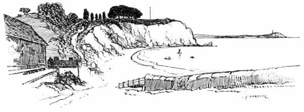
Returning to the coast, at Charlestown, Porthpean is reached; apparently a small holiday-resort of the burgesses of St. Austell. You see from this sketch exactly what it is: a little sandy bay with a few row-boats and sailing-vessels, a few bathing-machines, and a refreshment-house or two. More or less steep and obscure paths lead from it round Black Head, and so down hill into Pentewan, a very busy little port with railway-sidings and docks, and vessels waiting cargoes of tin-ore and china-clay.
Mevagissey, three miles or more, by Pennare and the cliffs, is two staggeringly steep miles distant[73] by road, ending in a murderous crooked descent. At the same time, it is all nonsense to say that cycling is not possible in Cornwall. Work, courage, and good, reliable brakes are requisite, it is true; but although a good deal of hard work and much walking uphill (and some down) are necessary, cycling, after all, saves effort, here as elsewhere. In the far from bracing climate of Cornwall, the exertion of carrying one's own body is often more tiring than even pedalling hard uphill. Even on the shocking coastwise bye-roads, apt often to be mere cascades of loose stones, and full of sharp turns, it is often better to have a cycle than to be without one. Even so, letting the machine go down these dubious ways, I murmur, as did the pious knights of old, travelling the haunted valleys and the darkling woods, 'In manus tuas, Domine,' and brave the unknown perils that lurk behind hairpin corners and down steep gradients.
Mevagissey is said to derive its name from Saints Mewan and Issey, to whom its church is dedicated. It is a little town as crowded together as Polperro, but not by any means so picturesque. Also it faces more directly upon the sea, and although it offers no sands for the visitor and has a very fishy, smelly little harbour, it has in many ways been modernised. Take it for all in all, Mevagissey looks its best from the sea. Perhaps Mevagissey has been frightened into modern ways, for it had an unexampled experience among Cornish villages in 1849, when cholera was so[74] rampant that it was deserted until a thorough cleansing was effected.
If we may trust a satirical saying of Fowey and St. Austell, the Mevagissey people are not, or were not used to be, given to acknowledging authority. One man they considered to be as good as another, and thus the old local by-word may yet be heard in the district: "Like the Mevagissey volunteers; all officers and no privates." But the allusion is over a century old, and belongs to that volunteering epoch when Napoleon was threatening to invade England; so let us hope things have altered since then.
There are sands of some small extent at Portmellin, up out of Mevagissey and then steeply down, half a mile distant, to where the land begins to trend abruptly out towards Chapel Point, and a few bungalows have, in consequence, been lately built in what was until recently a lonely hollow. Looking backwards for many miles, the china-clay works on the distant hills about St. Stephen-in-Brannel shine white, like the glorious camp of some heavenly host.
Always steeply up, the road goes on to Gorran, a mile inland, with Gorran Haven, a little crabbers' and shrimpers' village, as a kind of seashore annexe. The Dodman, a desolate headland, shuts out everything to the westward and forms the eastward horn of Veryan Bay. On its cliffs, of three hundred feet and more, a coastguard station looks out upon many empty leagues of troubled waters.
St. Michael Caerhayes lies snugly in a little bay within the greater bay of Veryan. The road, curving a little way inland, out of sight of the sea, descends steeply through overhanging trees and suddenly emerges upon a level strand, where the sea comes rolling in, over sands that afford a foothold as unyielding as the floor of a room. On either side of the inlet rise picturesque rocks, those on the western side the bolder of the two, and draped, moreover, with luxuriant vegetation, and further crested with larch and pine. Whether you look out to sea, or, standing on those yellow sands, face inland, the scene is of the most romantic description and worthy of the great Skelt himself, of the famous "Skelt's Juvenile Drama." Indeed, those massed and jagged rocks, with darkling fissures, on whose summits the pine-trees seem to cling desperately, might well have served as models for the set scenes of Skelt's thrilling stage, in "The Red Rover," or "The Smuggler," or other of his melodramas. Out to sea, in the "offing," ships hover; inland, under the lee of the wooded rocks, rises a castle. The place is instinct with drama, and it has a name of the strangest—St. Michael Caerhayes—but it is quiet enough for all that, and there is no village.
The castle looks sufficiently thrilling, and might, with its surrounding fitly set the stage in Ruddigore, but the inevitable guide-book spoils the thrill it gives, by letting us into the secret of its being built in 1808, when country mansions took the form of "castles" only for "picturesque"[76] reasons. No bad baronet resides there, only the worthy commoner family of Williams; and any one who is afraid of a person called Williams, who lives in a sham castle, must be a poor creature, even though the castellan does display threatening notice-boards, setting forth what trespassers may expect to suffer. St. Michael Caerhayes was anciently the seat of the famous Trevanion family, extinct a century or more ago, and their old house demolished to make way for the present building. There are many place-names in Brittany parallel with those in Cornwall, and St. Michael Carhaix is one of them. Not only so, but a justification of Cornwall and of the Breton "Cornouaille" calling cousins is further shown by a singular occurrence which happened during our wars with France towards the close of the eighteenth century. Among the French (or rather Bretons, for Brittany is not France to a Breton, any more than Cornwall to a Cornishman is England), among the Breton prisoners, therefore, landed at Falmouth, was one Jean Trevanion de Carhaix.
In Mevagissey the people talk strangely about the seclusion sought for at St. Michael Caerhayes, and tell weird tales of photographers and artists prevented from taking views of this lovely spot. So it was, perhaps, not altogether without trepidation that the sketch for the accompanying illustration was taken, from the seashore. No angry Williams, no brutal bailiff, appeared; and so perhaps the Mevagissey folk exaggerate. And[77] since then a report of the visit of an antiquarian society to the dread castle itself has appeared, by which it seems that the owner had not lured the party into his stronghold with a view to casting them into noisome dungeons, or having them flung from the battlements, or anything else in that full-flavoured way. He simply welcomed them, as any civilised being would have done, and the only outstanding feature of the day seems to have been his remark that, except the collections of different kinds in the house, there was really nothing of antiquity left; not even the stone sculptured with arms, of the time of Henry the Eighth, which the guide-books declare to be here, but is not.
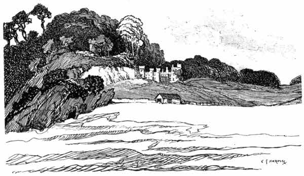
The Church of St. Michael Caerhayes stands high, somewhat inland. One comes to it through a wan and sorry avenue of spindly sycamores,[78] past the lodge-gates of the "castle"; and then it is seen standing in a bald, exposed situation beside the road. The last vestiges of the olden Trevanions are seen in the church. An alien fowl has nested on the site of their ancient home, but still the church houses the rusty helmets of their funeral armour, and a sword, said to be the identical falchion wielded by Sir Hugh Trevanion at Bosworth, August 21st, 1485, hangs among them. The last Trevanions, whether pure-blooded, or merely Bettesford-Trevanions, would seem, according to the evidence of the monumental inscriptions of a century or so ago, their natural force abated, to have slid early and gratefully out of an existence of pain and suffering.
But the most interesting object in the church, interesting because of its mystery, is a black-painted, life-sized statue, in Coade-ware, dated 1812, of a naval officer, with a real sword. The singular thing is that, although the antiquity of the thing is of the slightest, nobody knows who is represented by it. It is thought to be one of the Bettesford-Trevanions. Yet, although we have lost count of this recent statue's identity, the mummified Pharaohs of thousands of years ago are identified with certainty.
Veryan, the village that gives a name to the bay, does not lie upon the seashore. You come to it round the majestically romantic cliffs past Port Holland, a small fisher-hamlet perched upon the rocky outlet of a quite solitary valley, and thence a little way inland, and presently out[79] again and very steeply and lengthily down, so that you wonder when you will reach the bottom, to Port Loe, a gloomy inlet amid dark overhanging cliffs. Down there is the poor fishing village, in a primitive state, absolutely untouched by pleasure-seekers, and apparently not thriving in its fishery. But its situation down there, below the echoing cliffs reverberating to the mocking cries of the sea gulls, is magnificent.
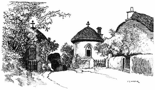
Veryan, on the other hand, is a picture of inland prosperity. It is a long, scattered village, beginning on a hill and continuing down through a wooded valley, with the church at the bottom, and ending on another hilltop. And at either end, the road is flanked by two strange old thatched round-houses, with a cross on the roof of each. The local story is that they were built[80] by "Parson Trust," to keep the Devil out of the village; but the identity of "Parson Trust" has not been established. The simplicity which not only believes in a personal Devil, but assumes that he must of necessity come by road, is essentially and delightfully Cornish.
The road out of Veryan leads directly to Gerrans Bay, passing under the shoulder of the strikingly sudden hill known as Carn Beacon. It is a hill upon a hill, a sepulchral barrow heaped up upon a height overlooking the sea; placed in this commanding position by way of doing greater honour to the ancient chieftain buried there. This was, traditionally, the sixth-century Cornish King and Saint, Geraint, or Gerennius, who died in A.D. 596, from whom the village and the bay of Gerrans are named. He is not to be confused with the Arthurian Geraint, who died in battle. Tradition has been often proved true, but the gorgeous story which told how the King had been buried here, in a golden boat with silver oars, and with his sword and crown, has been disproved, flatly enough, for the barrow was opened in 1855, and only a stone chest containing the ashes of Geraint, or another, was found. "Sold again!" as Smith Minor of the Lower Fourth might say.
The village of Gerrans calls for little remark. It stands high, some distance back from the sea, and therefore suffers considerably from the severe competition of its offshoot, Portscatho, down below, a thriving seaside place on Gerrans Bay.
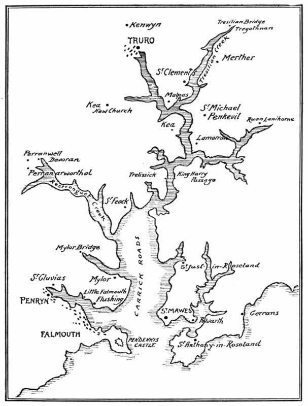
Three miles along a narrowing peninsula bring[82] one to St. Anthony-in-Roseland, where a charming little Early English church, with stone spire, stands in the grounds of Place, a handsome mansion belonging to the Spry family. In front of it rest the calm waters of St. Mawes Creek, looking across to Polvarth and Porthcueil. The extremity of the peninsula is occupied by St. Anthony's lighthouse, lighting the entrance to Falmouth Harbour, over against Pendennis, where the channel is one mile wide.
The great harbour of Falmouth and the many creeks of the estuary of the Fal, running far inland to Truro and Tresilian Bridge, rival the Hamoaze and the estuary of the Tamar in size, and more than rival them in beauty. Or perhaps, instead of setting them in competition with one another, it may be said that their beauty is of different character. Along the shores of Hamoaze and Tamar, the great commercial and naval and warlike interests of Plymouth and Devonport form striking features, and you can by no means lose sight of them until Saltash is passed. In Falmouth Harbour and along the broad estuary of the Fal, past Carrick Roads and so on to Malpas, towns, commerce, and shipping are only incidental and remote. If you want Falmouth, you must go seek it; if you would seek its smaller brother, St. Mawes, on the hither side, you must almost make diligent quest; and as for the villages of St. Just-in-Roseland, Mylor, St. Feock, Lamorran, Ruan Lanihorne, and others, why, they are all tucked away in creeks, in a kind of Robinson Crusoe reclusion. To say that the[84] creeks of Falmouth Harbour and the estuary of the Fal resemble a hand with spreading fingers is a ready and irresistible figure of speech, but it is a hand with at least nine fingers, of very varying size. They are St. Mawes, or Porthcueil Creek; St. Just Creek; Ruan Creek; Tresilian Creek; Truro River; Roundwood Creek; Restronguet Creek, Mylor Creek, and Penryn Creek. It is about nine miles, measured direct on the map, from the entrance to Falmouth Harbour, between Pendennis and St. Anthony's lighthouse, to Truro, and a little longer to Tresilian Bridge, but the course is anything but straight, and therein—in the winding wooded shores, with inviting channels opening out on either side—lies much of the charm of these waterways.
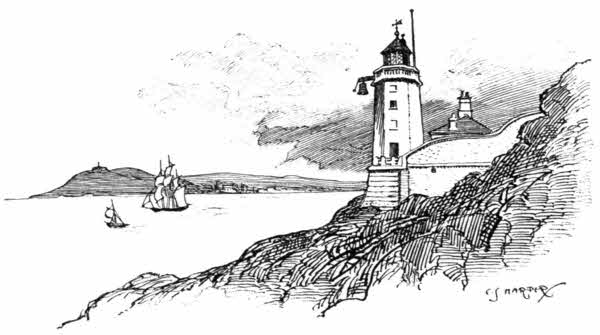
The district on this, the eastern, side of Falmouth Harbour, is Roseland, not by any means[85] so named from roses, but rather from "rhos," meaning "moorland." It does not nowadays seem a good description. You figure a moor as a ghastly inhospitable upland, where it always rains or snows, and where the bleak winds beat upon the traveller on its unsheltered wilds. Now the Cornish "Roseland" is, in fact, a good deal nearer a land of roses than a terrible district of savage moors; and although part of it is undoubtedly high and exposed, it is not by any means an unfertile spot, and it abounds in the most delightful valleys, deep down, where the last salt ripples of the creeks lap lazily to the roots of oak-woods, and where the airs are warm and steamy; where not merely roses will grow, but sub-tropical plants flourish, and the fuchsia and the geranium come to amazingly vigorous developments. Such is Roseland.
St. Mawes, and Falmouth too, and indeed most of the places beside these waters, wear a very foreign look. The warm, languorous climate, inducing luxuriant and exotic growths and unusual ways of building, is largely responsible for this. St. Mawes, too, is built up-along from the waterside, on the face of a hill almost cliff-like. It owes its name to an Irish saint, who is variously styled St. Machutus, or Mauduit. He is the St. Malo after whom the well-known port in Brittany is christened. It is an ill-sounding name for a saint, whether we call him "Mauduit" or "Malo," reminding one of the rhyme in Valpy's "Latin Delectus":
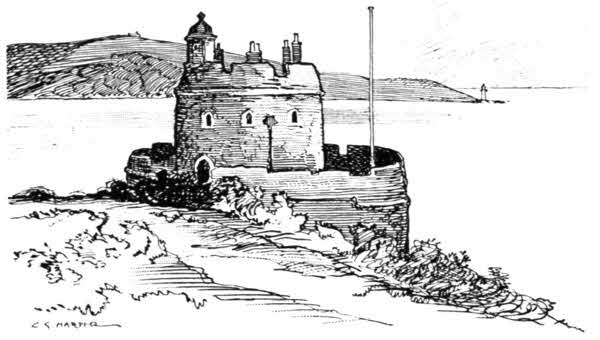
St. Mawes Castle shares with Pendennis, on the opposite headland, the duty of defending the entrance to Falmouth Harbour from the open sea; but the saints—St. Mawes and others—preserve us from reliance upon such defenders! They may have been formidable castles of the battery kind when originally built by Henry the Eighth, who, apart from his strange matrimonial experiments, is a very much misunderstood monarch, but they could not nowadays give an enemy the slightest hesitation. All the same, elaborate pretences are maintained, and Pendennis and St. Mawes are girdled about with War Office prohibitions; just[87] as though they were not shams that fail to deceive any one.
Historians, too busy with the domestic affairs of Henry the Eighth, and too interested in the great religious cataclysm of his reign, do not award him the title of "patriot king" that is really his due. He was a mighty builder of coastwise batteries against possible invasion; not only ordaining the building of them, but travelling much to see that they were built upon the most effective situations. From the coast of Kent to the Isles of Scilly his pot-bellied batteries are to be found: formidable in their day and still often occupied by details of Garrison Artillery playing a great game of make-believe, in which neither the foreigner nor the Englishman has any faith. Latin inscriptions carved on the exterior walls of St. Mawes Castle give Henry his due, and, he at last being dead, piously hope Edward the Sixth will resemble him. Here is the English of them:
"Henry, thy honour and praises shall always remain."
"May happy Cornwall now rejoice, Edward being chief."
"May Edward be like his father in deeds and reputation."
I think the person who composed that last line and also the other person who cut it in the stone must have smiled at it, just as every one has done in all the three and a half centuries since.
Half-way across the entrance to the Harbour[88] is the Black Rock, visible at low water, but covered at the flood. It is the subject of a story which tells how a Trefusis of Trefusis, not living on altogether satisfactory terms with his wife, determined to be rid of her in an ingenious way. "Shall we, my dear," said he, "sail down the harbour and land at Black Rock?" "Agreed," she replied, unsuspecting; and so they proceeded to the spot. He handed her ashore, and then jumped again into the boat and made off, leaving her, as he supposed, to drown. But unfortunately, from his point of view, some fishermen later on brought her off and home. The lady bade them wait, and her husband would suitably reward them. "To the Devil with you!" he exclaimed, in a fury; "you have played me a sorry trick indeed, and so you'll get nothing. You might have earned gold by leaving her there!"
There is ample opportunity in crossing from St. Mawes to Falmouth by steamer to perceive the truth of Carew's remark, that a hundred sail of vessels might anchor in Falmouth Harbour and not one see the mast of another. In these latter days this magnificent haven is not put to much use, and Falmouth has since 1850 ceased to be the West Indian mail-packet station. In that year its long and honourable connection with the Admiralty and the Post Office, which had been continuous since 1688, ended in favour of Southampton.
The town of Falmouth is seen hiding snugly away at the opening of Penryn Creek, on the[89] inner side of the low-lying isthmus connecting the headland of Pendennis with the mainland. It is not an ancient place, and did not, in fact, come officially into existence until 1660, although some few years earlier the custom-house had been removed from Penryn and a market had been established in 1652. On August 20th, 1660, a proclamation was issued by the King, in answer to a petition by Sir Peter Killigrew, commanding that "Smithike, alias Penny-come-Quick, shall for ever after this day be called, named, and known by the name of Falmouth."
This was a great triumph for the Killigrew family, who had for half a century been endeavouring to found a town on this site, two miles nearer the sea than the old corporate town and port of Penryn. At that period the Killigrews were seated at the mansion of Arwenack, of which some few portions remain near Falmouth railway-station, and they foresaw great profits accruing to them on a town being built upon their land. Penryn had been built in its more inland situation at a remote period when, by reason of raids and invasions, it was dangerous to be seated near the sea, and the position of Arwenack was certainly better for shipping. But the vested interests of Penryn were endangered by the Killigrew proposal, and Penryn, and Truro, and Helston as well, long bitterly opposed it, foreseeing much injury to themselves in a rival springing up. The site of Falmouth was at that time occupied only by two clusters of cottages that[90] could scarce even be termed hamlets. They were named Penny-come-Quick and Smithike, or Smithick. The first of these places took its singular name from the old Cornish "Pen-y-cwm," that is to say, "Head of the vale," to which the Anglo-Saxon "wick"—i.e., "village"—had afterwards accrued. "Smithick" was probably the site of a wayside smithy.
Falmouth town is practically one long, very narrow, and not very clean waterside street of closely packed houses and shops, which shut out all except occasional glimpses of the beautiful harbour, seen from a quay here and there, or framed in by narrow alleys giving upon steps going down to the water. There is much of the nautical Dibdin and Wapping Old Stairs feeling about this long, long street of Market Strand, with the strong sea air blowing in upon the otherwise stuffy thoroughfare through these dark-browed openings. Suggestions, too, of old smuggling days are found in queer sail-lofts overhanging the water; suggestions not without plentiful warranty in old records, for we know that smuggling proceeded impudently and openly at Falmouth in the last quarter of the eighteenth century. The sheer matter-of-course of it raises a smile. Men spoke of being—as of in the army or the navy—in the smuggling "service"; which at once shows how widespread and highly organised the operations were. Captain Pellew, brother of Lord Exmouth, sent to Falmouth to put down smuggling, actually found some of[91] his own officers running contraband cargoes of wine, in open port and in broad daylight.
As you go seaward, past the railway station, the almost island promontory of Pendennis rises up, and stretches a much greater distance out to sea than the explorer who seeks to round the point at first supposes. A fine, broad carriage-road describes a loop round this headland. "Pendinas," "the headland castle"—for that was the original form of the name—has been, as the name itself implies, from the earliest times a place of defence, but the only known event of any moment that is remembered in connection with it is the stand here made for the King by Sir John Arundell of Trerice, then in his eighty-seventh year, and known in all these parts as "Jack-for-the-King." It was one of the most memorable deeds done in those troublous, long-drawn contentions between King and Parliament. With the exception of Raglan Castle, in Monmouthshire, which held out to the last for King Charles, and only surrendered on August 19th, 1646, Pendennis Castle was the last stronghold to fly the Royal Standard. It capitulated on August 16th, only three days earlier, after a vigorous six months' siege, and when hunger, rather than any quality of the enemy, had brought the garrison low. Hence the Queen had embarked for France two years earlier, and the Prince of Wales departed for Scilly in February 1646.
The stranger is more likely to be impressed by the ugly lines of sharp-pointed pike railings[92] that surround the precincts of Pendennis Castle, and have been richly tarred, lest by any chance the spikes are not sufficiently formidable, than by any appearance either of strength or picturesqueness that belongs to the place. The military genius that finds a first line of defence in the messy horrors of tar, seems something not much better than the old practice in the Chinese Army, of making horrible grimaces, wherewith to strike terror into the enemy.
You see, on returning to Falmouth from Pendennis, how entirely land-locked the harbour appears to be. Not the slightest indication points to which way the Channel lies. Yet this enclosed water has been ruffled by great and disastrous storms, and in one of them, off Trefusis Point, directly opposite the town, the transport Queen was lost, in January 1814.
The climate of Falmouth is tearful. I may be unlucky in the matter of weather here, but I have never yet been at Falmouth when it did not rain. But it is also phenomenally warm. St. Gluvias, by Penryn, is said to be the warmest place in England. The Sailors' Home, on the quay by Arwenack, gives earnest of these warm conditions. It is a great, grim, eighteenth-century mansion of red brick, but made beautiful, almost transfigured indeed, by a wonderful fuchsia, covering the whole of the frontage up to the first-floor windows.
In the humblest cottage-gardens grows the fuchsia. It flourishes even in the merest cobble-stoned[93] backyards, enclosed within white-washed walls, and neighboured by the washing-stool and tub, and the clothes hung out to dry; and it is amidst such apparently unsuitable surroundings, rather than in the most carefully tended gardens, that this gorgeous alien seems most to prosper. For the fuchsia is an alien, brought into Europe in 1703, from the Pacific coast of South America, and named after an old-time German botanist of the sixteenth century; one Leonard Fuchs. All through the West of England the fuchsia has become—not common; we must not use that word, lest by any chance we should seem to slight so exquisite a plant—but usual, and especially it flourishes along the coasts, and thrives so greatly that it grows in the open all the year round, and frequently attains such dimensions that the stems of old-established plants are not uncommonly nearly as thick as a man's arm.
Yet in 1788 there was but one fuchsia in England, and that was in Kew Gardens. Soon after that date an enterprising nurseryman of Hammersmith, one Lee by name, had secured cuttings, and was selling plants at one guinea each. Thenceforward the spread of the fuchsia was rapid.
The variety seen in Devon and Cornwall is nearly always that with abundance of small blossoms: scarlet petals, and blue or purple sepals.
The parish church of Falmouth is almost the oldest building in the town, but it is hardly[94] venerable. It is galleried within and hangs gloomily upon the narrow street, squalidly mingled with a cab-rank. It was built in 1663, and has the peculiarity of being dedicated to Charles the First, King and Martyr; a distinction it shares with three other churches in England and one in Wales; i.e. those of Tunbridge Wells, Charles Church, Plymouth, Peak Forest, Derbyshire, and Newtown, Montgomeryshire. A further peculiarity is that its tower is not square on plan.
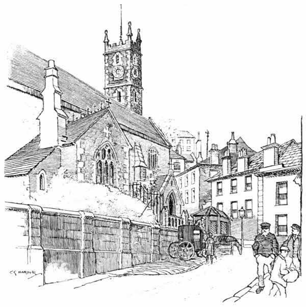
There are many other public buildings in the town, none of much interest; but it is interesting to know that there was once a Mayor of Falmouth who thanked God when the gaol was enlarged. He, or his remark, is quite famous, but I have no record of the period in which this worthy, so thanksgiving for benefits received, flourished. There is, however, no doubt at all that, if it was in the sixteenth century, when such doings as those of the piratical Lady Killigrew (of whom we shall hear at Penryn) were possible, not only the enlargement of a gaol was required, but a special assize as well.
I believe the most interesting place in Falmouth is, after all, not the famous harbour, nor Pendennis Castle, but Burton's Old Curiosity Shop. It is a quite famous institution, and no one who has ever been to Falmouth, and has not explored this home of curios, can really be said to know Falmouth as intimately as he should. This sounds like an advertisement, but Burton's is as superior to puffery as a museum would be; and indeed it is not remotely unlike a museum. True, the exhibits are for sale, but such a large proportion are so eminently undesirable for the private purchaser that they assume the character of museum exhibits unlikely ever to find another home. Such, for example, is the skeleton of a whale washed up some years ago between Cadgwith and Porthoustock. The imagination boggles at any private person buying that. It would seem, indeed, that Burton (who[96] is now deceased, and his son reigns in his stead) had a flair for curiosities and antiques of all kinds, quite irrespective of commerce. He could resist nothing, and was a fine miscellaneous feeder in this sort. But at the same time an excellent man of business, keen on odd and striking advertisement; as when he offered to purchase for £500 Smeaton's old Eddystone lighthouse tower, demolished by the Trinity House in 1882. He proposed to re-erect it on the site of his shop and store it with his curios, but the old tower found a home on Plymouth Hoe instead. One may visit the Old Curiosity Shop and wander at will, unattended, through its many rooms, and never be solicited to buy; and great is the number of those who use this privilege.
Among the oddest of these collections is a strange assemblage of inn and trade signboards, mostly of Cornish origin, most of them so fantastically grotesque in spelling and unconsciously humorous in phrasing, that they would almost appear to be inventions, produced to astonish and to raise a laugh, were it not that they are obviously old, and that the proprietor keeps a register of their place of origin. Thus runs the signboard of Ellen Tone's "Tempurence Hottell," from Herodsfoot, near Liskeard:
The signboard of one Roger Giles easily bears away the bell. It has been printed before now, but is too good, whether genuine or not, to be passed over:
ROGER GILES,
Surgin, Parish Clark and Sculemaster, Groser & Hundertaker
Respectably informs ladys and gentlemans that he drors teef without waiting a minit, applies laches every hour, blisters on the lowest tarms, and vizicks for a penny a peace. He sells Godsfathers kordales, kuts korns, bunyons docters hosses, clips donkies wance a munth, and undertakes to look after everybodys nayls by the ear. Joesharps, penny wissels, brass kanelsticks, fryin pans, and other moosical hinstruments hat greatly reydooced figers. Young ladies and gentlemen larnes their grammur, and langeudge in the purtiest mannar, also grate care taken off their morrels and spelling. Also zarm singing, tayching base vial, and all other sorts of fancy work, squadrils, pokers, weazels, and all country dances tort at home and abroad, at perfeksun. Perfumery and snuff in all its branches. As times is cruel bad I beg to tell ee that i has just beginned to sell all sorts of stashonery, ware, cox, hens, vouls, pigs, and all other kind of poultry, blackin-brishes, herrins, coles, scrubbin-brishes, traykel, and godley bukes and bibles, mise-traps, brick-dist, whisker seeds, morrel pokkerankechers, and all zorts of swatemaits including taters, sassages, and other garden stuff, bakky, zizars, lamp oyle, tay kittles, and other intoxzikating likkers, [98]a dale of fruit, hats, zongs, hair oyle, pattins, bukkits grindin stones and other aitables, korne and bunyon zalve, and all hardware, I as laid in a large assortment of trype, dogs mate, lolipops, ginger beer, matches, and other pikkles, such as hepson salts, hoysters, Winsre sope, anzetrar—Old rags bort and sold here and nowhere else, new laid eggs by me Roger Giles; zinging burdes keeped, such as howles, donkies, paykox, lobsters, crickets, also a stock of celebrated brayder.
P.S.—I tayches geography, ritmitmetic, cowsticks, jimnastics, and other chynees tricks.
Flushing, a little over-the-water town opposite Falmouth, shares with the neighbouring St. Gluvias the reputation of being the warmest place in England. It is said to have been founded by Dutchmen, from Flushing in Holland. Near by it is the hamlet curiously known as Little Falmouth; a place with a few waterside houses and remains of a granite-built dock, commanding views down to Falmouth and Pendennis, which looks like an island from here. Little Falmouth, with its decaying dock, forms a picturesque scene of blighted hopes.
The old town of Penryn, at the head of Penryn Creek, is even more dirty than Falmouth, and does not look prosperous. Falmouth, as Penryn surely foresaw, has filched away much of the trade, and although the shipping of granite from the neighbouring quarries of Mabe and Constantine gives employment still, it is not an increasing[100] business. The parish church is quite apart from the town, in the village of St. Gluvias. The saint of that name appears to have been a Welshman. He spelt his name "Glywys," a fearful mouthful for a Saxon to deal with, and apparently not easy even for a Cornishman, seeing that Cornwall has modified the name. Glywys was brother to St. Cadoc, or Cadwg, and I have no doubt called cousins with half a hundred others.
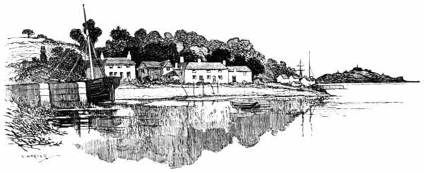
Penryn is closely associated with two Lady Killigrews, who are generally confused almost inextricably with one another. The Killigrew family of Arwenack, where Falmouth town now stands, had striven from about 1602 for a new town and market to be planted there, and thus earned the undying hatred of Penryn; and so it happened that when Sir John Killigrew and his wife quarrelled and fought, he for divorce and she against it, about 1620, it seemed the most natural thing in the world for her to take refuge in Penryn,[101] and there, encouraged by the bad blood of the place, to protract ruinous litigation with her husband. All the evidence seems to show that she was as bad a character as possible, even though she came of an old landed family, the Fermors, afterwards Barons Lempster and Earls of Pomfret. This Lady Jane Killigrew was at last divorced, but the unhappy Sir John did not long survive his victory, and his unamiable wife thereupon presented to the Corporation of Penryn the tall silver Killigrew Cup still in existence, inscribed: "1633 From Maior to Maior to the towne of Permarin, where they received mee that was in great misery, Jane Killygrew."
The earlier Lady Killigrew was Mary, wife of another Sir John, grandfather of the unhappy man just mentioned. It was in January 1583 that the Spanish ship Maria, upon which she exercised her piratical genius, sailed into Falmouth Harbour and cast anchor. The crew remained on board, but the two merchants who owned her cargo went to a Penryn inn. Lady Killigrew seems to have entirely originated the scheme of piracy and murder that was carried through. She procured a boatload of fishermen, sworn to secrecy, who at midnight swarmed aboard and murdered some of the Spaniards, and flung others into the sea. They then took the vessel to Ireland. The spoils of the Spanish ship consisted of holland-cloth and leather, together with two hogsheads of Spanish pieces of eight. It had been intended to cajole the two merchants[102] aboard, on some pretext, and so to murder all concerned with the vessel, but they remained ashore. Not even in those times was it possible to commit piracy and murder in home waters altogether with impunity; and by some means the owners heard of what had really happened, and sought redress of the Government. In the end, Lady Killigrew and two of her fellow-conspirators were found guilty and sentenced to death. Unfortunately, the influence brought to bear on behalf of Lady Killigrew procured her a pardon. The others, not being persons of quality, were hanged in an expeditious and workmanlike manner.
Round Trefusis Point opens Mylor Creek, a mile and a half long, with Mylor village appearing at the opening and the much larger village of Mylor Bridge at its inland extremity. Mylor is a favourite place for afternoon excursions from Falmouth, and there are farmhouse tea-gardens amid much charming woodland scenery.
St. Melor, to whom the church is dedicated, and after whom the village of Mylor is in turn named, was traditionally martyred here. Other legends, however, place the scene of his death in Brittany. He was son of Melian, King of Cornu-Gallia, or Brittany, in the sixth century. Melian himself is said to have been killed in A.D. 537, by his brother, Rivold, and is regarded as something of a saint in Brittany. The village of Guimiliau enshrines his name.
Rivold then, having ended King Melian, mutilated his son, Melor, by cutting off his right hand[103] and left foot; the object being to invalidate him from the succession to the throne, the Armorican laws forbidding any who suffered from physical disabilities from becoming King. The affectionate servants of Melor, however, provided him with a silver hand and a brazen foot, which became miraculously endowed with the powers and attributes of his lost natural members. Melor, sent to the monastery of Saint Corantine, became so saintly and therefore so dangerous to the usurper Rivold, that his death was resolved upon. One Cerialtan, a man-of-all-work in crime, was commissioned to end him; his promised reward being "as much land as he could see from the summit of Mount Coc"—wherever that may be. Cerialtan, in workmanlike manner, cut off Melor's head as he lay asleep, and conveyed it to Rivold, who carried out his compact to the letter, if not to the spirit; for he caused Cerialtan's eyes to be put out, and then had him to the crest of that high place and bade him look upon the land!
And that is all I know about the Life and Times of St. Melor; or at any rate, that is the most likely among the different marvellous stories from which the investigator is at liberty to choose. But legendary vagueness pervades all of them, and there is the very wide choice of dates between A.D. 411 and 537 for the speculative to select from.
Mylor church lies in a hollow, a favourite situation for churches in Cornwall. Although now chiefly in the Perpendicular style, some[104] portions of a former Norman church, which must have been a building of considerable richness and beauty, remain, including three Norman doorways, all of unusual design. The hood-moulding of that on the north side represents a snake, with its head to the west. The south doorway, illustrated here, has, it will be observed, some curiously Flamboyant tracery added to the round arch, with an odd variety of Perpendicular panelling at the sides. The identical pattern, peculiar to Cornwall, is found in a similar position on the south porch at Lelant, near St. Ives.
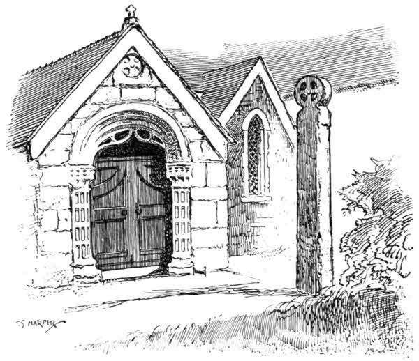
A monument in the church recalls a dramatic and terrible shipwreck that happened scarce two miles away, off Trefusis Point, in Falmouth Harbour. The epitaph briefly refers to it as under:
"To the memory of the warriors, women, and children who, on their return to England from the coast of Spain, unhappily perished in the wreck of the Queen transport, on Trefusis Point, January 14th, 1814."
Three hundred lives were lost on that occasion, and one hundred and thirty-six of the drowned were buried here.
To Mylor belongs the distinction of possessing the tallest cross in Cornwall. Exactly what it is like you may see from the illustration. It does not actually look the tallest, because some seven feet of its length are embedded in the ground. It measures in all 17 feet 6 inches. No one until 1870 knew it to be a cross at all, for beyond the memory of man it had fulfilled the useful office of buttress to the south wall of the church, with its head covered up. In that year, during the restoration then in progress, its nature was disclosed. It was, however, a matter of considerable difficulty to raise so large a block of granite again upright, and help was obtained from H.M.S. Ganges, then lying in Falmouth Harbour.
The pastime of curious epitaph-hunting, which helps to occupy the time of many explorers in the country, may be indulged in at Mylor with[106] certain prospect of reward. Here is a taste of their quality:
"In
memory of mr.
Joseph Crapp, ship
wright. who died ye 26th of
Novbr 1770. Aged 43 years
Alass Frend Joseph
His End war Allmost Sudden
As thou the mandate came
Express from heaven.
his Foot it Slip And he did fall
help, help, he cried, and that was all."
Opposite Mylor Creek, on the eastern side of the harbour, is the creek of St. Just-in-Roseland, with St. Just's church down by the waterside, among the trees.
The parson of St. Just-in-Roseland must surely be a kindly man. Instead of threatening or rebuking the numerous visitors from Falmouth, who come down the creek in boats and land to explore the place, and have doubtless in the past pillaged the ferns and other things growing in the beautiful churchyard, he displays the following notice in the lych-gate: "Visitors are requested not to touch anything in the churchyard, and then, by calling at the rectory, all those from beyond the county of Cornwall will be welcome to a gift plant or tree, as a souvenir of their visit to St. Just-in-Roseland."
In the great roomy church, which must always have been, as it is now, many times larger than[107] the needs of the place, there may be noticed a tablet which describes how John Randall, for one thousand years from his death in 1733, has "given to ye poor Widows and fatherless children of ye parish, not having parish pay, Twenty Shillings yearly, and Ten Shillings yearly to ye Minister, for preaching a Funeral Sermon."
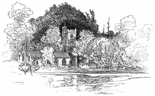
The next creek on the western side of the harbour is that of Restronguet, a name which appears to mean "deep channel." Dense woods line its banks, with the park of Carclew half-way along, upon the left hand, and on the right the modern port of Devoran, carved out of the parish of St. Feock in 1873, with the Penpoll Tin Smelting Works fuming away, a mile below. Devoran is at the terminus of a mineral railway from Redruth,[108] which thus brings tin and copper-ore to deep-water quays. Restronguet Creek will, however, need dredging, for the mine-water, charged with mud, flowing down from the pits about Gwennap, is shoaling the fairway, and has almost choked the forked endings of the creek at Perran Wharf. This is the waterside extension of Perranwell and Perranarworthal, i.e. "Piran the Wonderful"; the really wonderful St. Piran, who voyaged from Ireland to the north coast of Cornwall on a millstone. The grass that grows in the mud-choked creek stretching towards Ponsanooth is in some way affected by the sea-water in the ooze, turning it to the loveliest yellowish-green imaginable.
Round Restronguet Point the channel comes to St. Feock, a tiny village on a little creek of its own. The church here has a detached belfry, standing beside the road, at a higher level than the body of the building; and over the lych-gate entrance to the churchyard is an old vestry or parish-room. A similar building is seen at the entrance to the churchyard of Kenwyn, north of Truro.
The most exquisitely wooded reaches of the Fal are found above St. Feock, where the river narrows and the banks rise more abruptly. The scenery at this point, and on to Malpas and Truro, strongly resembles that of the river Dart, and many are of opinion that it is really superior. But these comparisons form the thorniest of subjects.
At the hamlet of Trelissick is the well-known ferry of "King Harry Passage," now a steam-ferry conveying vehicles as well as pedestrians. The "King Harry" whose name gives the passage a touch of romance, is Henry the Eighth, who is said to have stayed a night at Trelissick, when on his way to inspect the site of Pendennis Castle.
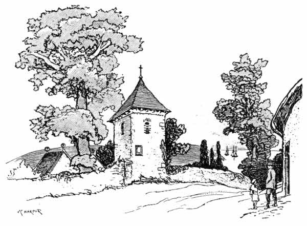
The woods of Tregothnan, the wide-spreading park belonging to Lord Falmouth, come now into view, where Ruan Creek opens on the right, running three miles in an easterly direction. The creek takes its name from the village of Ruan Lanihorne, at the furthest extremity, where the waters of the Fal run white with the washings from upland clay-workings, like a river of milk,[110] and the mud resembles cream-cheese. Midway is Lamorran, the detached tower of its church washed by another branching creek.
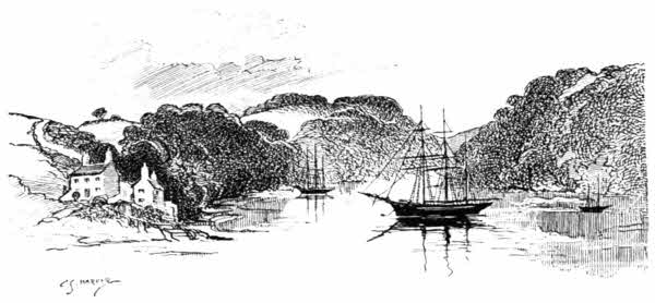
Returning to the main stream, Malpas is reached in another mile and a half, past Tregothnan and the hillside church of St. Michael Penkevil on the right, and the ruins of Old Kea church on the left. St. Michael's churches are generally on heights. This is on the Headland of the Horse; for that is what "Penkevil" means. Just as the Cornish word "eglos," for church, closely resembles the French église, so it will here be noted how nearly like the French cheval is the Cornish "kevil," for horse. In the restored church are monuments to Lord Falmouth's ancestors, notably to the famous Admiral Boscawen. The St. Kea who gave his name to Kea church was a fifth-century Irishman who lived awhile in Wales, in Cornwall, and in Brittany.
Malpas is said to mean "smooth passage,"[111] although the word certainly seems to be a corruption of malus passus, a bad passage. It is locally "Mopus." But whether a good or ill ferry, it is certainly a very beautiful spot.
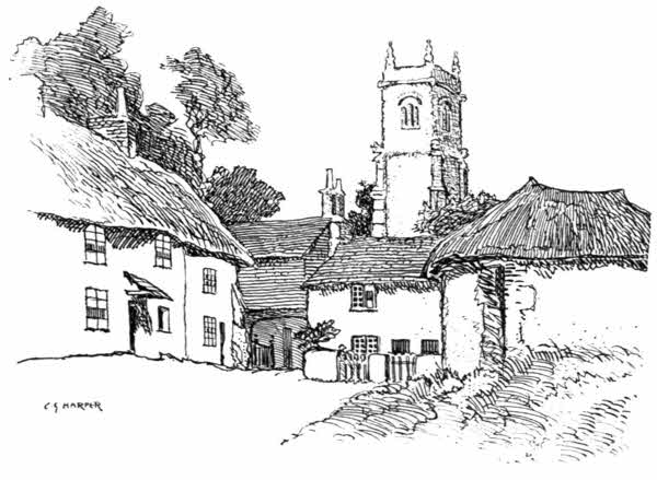
Tresilian Creek, the ultimate extension of these waters, here branches off to the right, with the waterside village of St. Clements round the first bend, its rustic cottages and church embowered amid tall trees. There is a charming little corner, illustrated here, behind the old church, whose weathered age, and the bull's head and other symbols of the four evangelists, that look curiously down from the angles of the tower, demand to be put upon record. A very tall Cornish cross, of the fifth or sixth century, stands at the[112] back entrance to the vicarage, with an abbreviated inscription in large letters running up the shaft. It has been expanded into ISNIOCVS VITALIS FILIVS TORRICI.
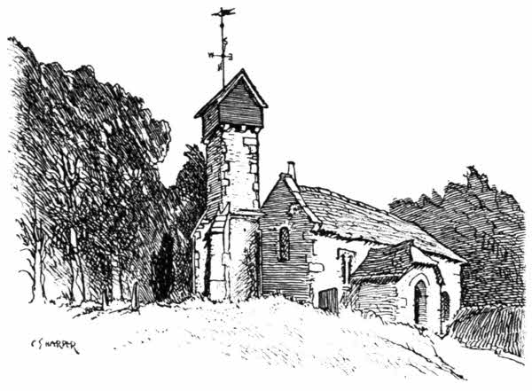
Higher up the creek, a little distance inland on the right, is the odd-looking little church of Merther, quite solitary except for one woodman's cottage. It is dedicated to St. Cohan, or Coanus, and owes most of its strangeness to the wooden, box-like finish to its tower: giving the effect of a sanctified pigeon-house. A little statue of St. Cohan, brought from his desecrated Holy Well, is within. The church is not now used for services, and is only retained as a mortuary chapel. "Merther" signifies "martyr," but history, and[113] even tradition, are silent on the reason for conferring the name.
Tresilian Creek (the name "Tresilian" means "the place of eels") ends at Tresilian Bridge, spanning the dusty highway between Grampound and Truro. Here is the battlemented gateway to the park of Tregothnan.
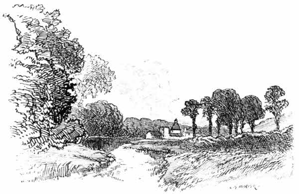
The quiet pastoral scenery, and the elms and other trees here fringing the river, present a picture very little like Cornwall.
The bridge is modern, but the spot is historic; for this is that Tresilian Bridge where the long contest in the Civil War in the West was brought to a conclusion by the surrender of the Royalist Cornish army under Lord Hopton, to Fairfax, March 14th, 1646. It was an inglorious end to a struggle that had opened so brilliantly for the King[114] at Stratton, when Grenville and Hopton smote the Parliament men hip and thigh, close upon three years earlier; but time told continuously against the King, whose troops grew more and more undisciplined and dispirited, while the earlier raw levies of the Parliament had become the famous Ironsides, who knew little of defeat.
The final advance of Fairfax, commanding the forces of the Parliament, into Cornwall was swift and certain. He was at Exeter on February 8th; at Chulmleigh on the 14th; and took Torrington by storm on the 16th, when he got Hopton's men on the run. Thence he advanced and entered Launceston on the 25th, and had come to Bodmin Downs by March 3rd, Hopton's force retreating and dissolving before him. The Prince of Wales, who hitherto had lain at Truro, found it prudent to change his residence to Pendennis Castle, Falmouth, and soon afterwards sailed for Scilly. Hopton at last saw the hopelessness of further resistance, and, after treating with Fairfax from March 8th, surrendered here, on terms, on the 14th. The terms were mildness itself: officers and private soldiers being allowed to depart to their homes on taking an oath not to fight again against the Parliament; and the officers were, in addition, permitted to keep their arms and horses.
Truro River runs straight up for two miles from Malpas, the cathedral of Truro rising up from the valley ahead, and shining white amid a setting of green trees and blue distant hills like some unearthly building too beautiful to have been built by man. Very little else is seen of Truro until quite close to the quays, where the navigation ends, and it is something of a surprise to find the city a place large enough to number 11,562 inhabitants. That is a small population, but it is large compared with the expectations raised by distant views.
The name of Truro is said to derive from Tru-Ru, the "three streets," or roads; but there are four roads into Truro, and its streets are many more than three. Bodmin is the county town of Cornwall, and Launceston rivals it, but Truro has of late years risen into equal, if not greater, importance, on account of its population, double that of Bodmin, and by reason also of its more accessible situation. Bodmin still keeps its assize business, and the county gaol is situated there, giving a certain sinister significance to the information "he's gone to Bodmin"; but Truro, as the[116] capital city of a newly constituted diocese, has a greater future, unless the Cornish folk become much more criminal than they are now, which is not expected of them.
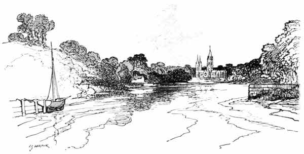
Truro lies down in a valley and the Great Western Railway stalks across to the north of it on gigantic viaducts, the newer streets running up towards the railway station. It is a clean, granite-built place, with a well-defined aristocratic air, and down the gutters of its principal streets, which are chiefly paved with granite setts and would thus be very noisy if there were more traffic, run clear streams of water. As an old county centre, the chief place of meeting for the landed and leisured families of Cornwall in the old days before railways, when Truro had a "season," and the society of Cornwall came hither to their "town houses" to indulge in its gaieties, the aristocratic air it keeps is by no means accidental.[117] The "Red Lion" Hotel in the Market Place was formerly one of these mansions, as its fine old unaltered front shows. Foote, the actor, was born there.
Truro was raised to the dignity of a cathedral city in 1877, when the new Cornish diocese was established, and the old parish church of St. Mary in High Cross became automatically the Cathedral. But the patriotic Cornish feeling which had thus at last again brought about a bishopric and a cathedral in the West, about eight hundred years after the see had been removed from St. Germans to Exeter, was not content with making a mere parish church serve the occasion, and steps were soon taken to build an entirely new cathedral. Such a thing as the building of a cathedral in England had not been known for many centuries; the full efforts of churchmen had been employed, ever since the Reformation, in preserving and repairing those we already possessed, not in creating new cathedrals. Moreover, most of our cathedrals have been the products of centuries of growth. Even that of Salisbury, the one example of an ancient cathedral finished according to its original design, was not completed in less than a hundred and forty years. Over £100,000 has gone to the building of Truro Cathedral, begun in the laying of the foundation-stone by the Prince of Wales on May 20th, 1880, and completed in the autumn of 1909, in the finishing touches then put to the western towers.
The old church of St. Mary was demolished to[118] provide the site, but the fine Late Perpendicular south aisle was spared and incorporated with the building, designed in the Early English style by J. L. Pearson, that forms the cathedral to-day.
High Cross, in which the cathedral stands, is not a very roomy square of houses and shops opening out of the Market Place in the centre of the city, by a narrow passage, and upon other streets by somewhat broader ways. But it is along this passage that the stranger usually approaches. The cathedral is indeed new, but the old-established cramped surroundings are quite characteristic of ancient cathedral cities, and the calculated picturesqueness of the south side of the building, viewed from this point, resembles that of some North German cathedral. There the central tower and its stone spire, and the lesser western towers and spires group richly together, with the still smaller but very prominent south transept tower and its copper spirelet, a very German importation. The poisonous oxidised green of that copper spirelet is flagrant enough to spoil the whole day of an artist. Down beneath it you see the surviving sixteenth century aisle of old St. Mary's. I am glad they spared that aisle, for it is not only beautiful in itself, but its venerable presence here serves to illustrate that peculiarly English virtue, a continuity with the past, a sense of history even in things new. But what will future generations say about a late nineteenth-century cathedral whose general style is that of the thirteenth century, and yet whose[119] oldest part is genuine sixteenth-century architecture? It could, perhaps, be wished that the chimes of the cathedral clock had been harmonised to another tune than the hackneyed "Westminster Chimes," that are noble enough in the clock-tower of the Houses of Parliament, where they originated, but are tiresome when repeated all over the country. The ancient proverb is sadly at fault, for it is possible to have too much of a good thing.
The new beauty of Truro Cathedral at present lacks those weatherings that only time can give. The fine-grained granite and the Box stone dressings have not attained the stains and bloom of years, and so it is impossible to altogether judge the merits or drawbacks of the exterior; but that the architect strove to be pictorial, and that he rather overstrained in that direction, seems undeniable. The building, only three hundred feet in its greatest length, from east to west, is really one of our smallest cathedrals, six feet shorter than Rochester, and it is ornamented to a degree that in places spoils the effect. This is very noticeable in the south door, the usual entrance. It is contrived in the south transept and is loaded with ornamentation that emphasises the naturally squeezed-in appearance. The over-enrichment was a mistake, but the cramped nature of this part seems to have been unavoidable, considering the extreme narrowness of the site here.
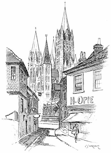
The interior discloses none of these limitations, and exhibits a noble clerestoried nave of nine bays and of fine proportions. A very notable feature is the beautiful baptistery close by the south door. Its many slender columns and the artfully arranged half-light set off the rich stained-glass with the effect of jewels. The choir is a[121] light and graceful and glorified continuation of the nave. Most of the windows are already furnished with stained-glass, whose subjects include a representation of Wesley preaching at Gwennap: a more liberal-minded inclusion than any of which Hawker of Morwenstow would have been capable, with his bitter remark that Wesley had made the Cornish change their sins; not get rid of them, you know.
A certain specious air of antiquity is given to the north transept by the old monuments from St. Mary's, restored and built into the walls. Notable among them is the Robartes monument of 1614. And history is being quickly made here, for already Truro has come to its third bishop and the cathedral is beginning to accumulate relics. Thus we see in a case on the east wall of the south transept the pastoral staff presented to Dr. Benson, the first Bishop.
There are also war memorials in the cathedral: tablets and flags that tell eloquently of the latest great effort in the art of murder by wholesale. It is a bitter commentary upon Christianity that in twenty years from the beginning of the cathedral such things should be necessary. But the fault was not ours, and no patriotic Englishman would have those memorials away, for they show that we can still hold our own against attack. "The men are splendid," as a famous dispatch from those sun-scorched fields ran. Of their officers it were kinder to keep silence, but perhaps their failure was merely the fault of the system.
There is an interesting museum of the Royal Institution of Cornwall in Truro, with illustrations of South American scenes a good deal too prominent on its walls; and there is a curious old inscription carved in granite on a wall in the Market House. It belonged to an older building, and runs thus: "Ienkin Daniel, Maior. Who seks to find eternal tresvre, mvst vse no gvile in waight or measvre, 1615."
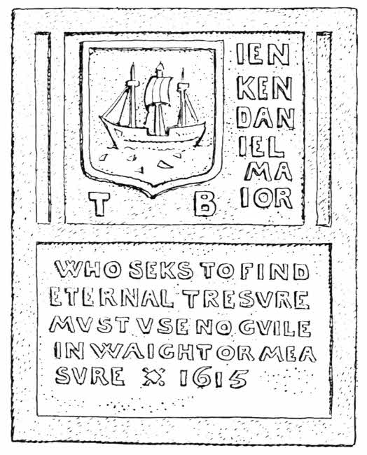
Resuming the coast from Falmouth and leaving that town by Swanpool, an easy woodland road leads past the little sandy bay of Maen Porth and, avoiding Rosemullion Head, comes to the hamlet of Mawnan Smith, whence most travellers go direct down to the crossing of the Helford River at Durgan. But the church and the original village of Mawnan, such as it is, lie straight ahead.
The church of Mawnan is far remote from the ordinary tourist track. Very few are those who, exploring the rugged and greatly indented coasts of Cornwall, endure to the end and do not presently take some of the distant headlands and the obscure nooks and corners on trust; and Mawnan stands above a remote little Land's End of its own that overlooks the otherwise solitary mouth of the salt estuary called the Helford River. You come past a few houses and then, through a farmyard, to the church.
The inquisitive tourist may be recommended[124] to visit that church, not that it possesses anything above the average of architectural interest in Cornwall, but because it is a prime example of what is done in the High Church way in the nooks and corners. Obviously it is ardently desired to put back the clock of progress at Mawnan, for the interior of the church is lavishly decorated with texts and admonitions in the old Cornish language, which became extinct so long ago that nobody outside the ranks of scholars has the least recollection of it; and it is quite certain that the villagers of Mawnan do not understand it, any more than they would Coptic or Chaldee. So when they read on these walls, among other things, "Da thym ythgu nesse the Thu," they are obliged to take on trust the translations of this phrase and others, that are thoughtfully provided on cards. This particular example means, it would appear, "Good it is to me to draw near to God"; to which one might offer the criticism, that the way would probably be rendered easier by the adoption of a language more readily understanded of the people. No one, however, would be in the least likely to criticise these things if they were done only out of archæological zeal; but they are evidences of obscurantism, and, taken with other things, eloquent of an attempt to recover a lost priestly domination. The other evidences are not lacking; notably among them the notices displayed of some precious "Society of King Charles the Martyr," among which it is sought[125] to restore the old "Office for January 30th," introduced by Bishop Duppa of Winchester at the Restoration in 1661; an Office long ago removed from the Prayer Book, which is so much the better by the loss of it. There is not so much to complain of in the passage that runs, "Preserve from sacrilegious invasions those temporal blessings which Thy Providence hath bestowed on Thy Church"; for, put in other words, this is nowadays a prayer against Disestablishment and Disendowment; and we have all of us the right of praying for our continued existence. But few will be found to defend the supplication, "Give us grace by a careful and studious imitation of this Thy blessed Saint and Martyr," meaning thereby Charles the First. There are few who are not sentimentally sorry for that unhappy King, born to trouble, and earning more by his own actions; and we hate[126] Cromwell and his men. But those must be very few indeed who are prepared to regard Charles as a Saint and a Martyr, and when any attempt is made to make him one we forget our sympathies for a cultured and good-living King, unfortunate enough to be born into distracted times and to be born without tact, and unequipped with the sense of keeping faith with his opponents; and we say that Charles was absolutely untrustworthy and a danger to the nation, and that he deserved his fate.
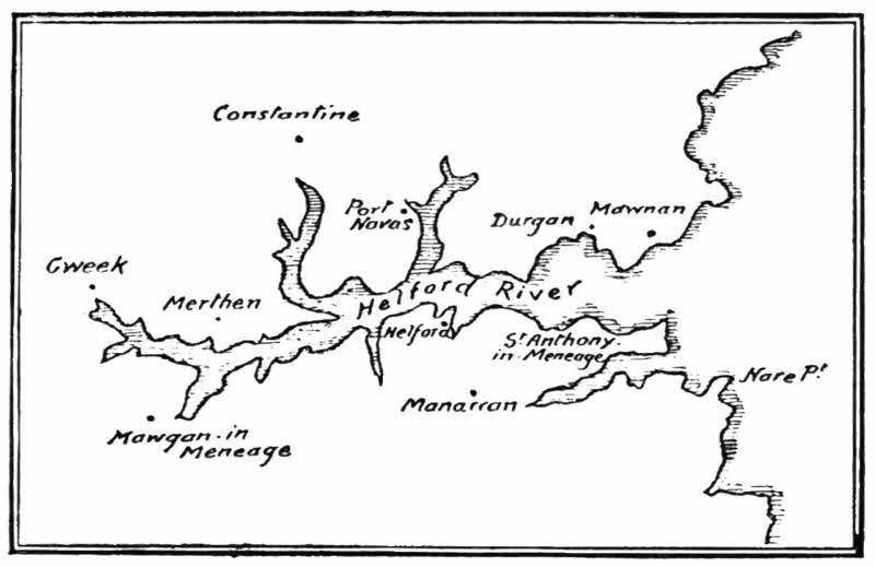
The Helford River is a miniature Falmouth Harbour, with subsidiary creeks. It is about six miles long and from half a mile to a quarter of a mile wide, and is frequented only by a few small yachts and sailing-boats. Above the passage-house at Durgan comes the singularly retired hamlet of Port Navas, in a small creek, with a few thatched cottages smothered in roses and jessamines. Yet the place is not so retired and remote from the sophisticated world but that one of the cottages boldly displays the notice "Afternoon Teas"; not merely "teas" that are meals, but "afternoon teas" that are, in London at any rate, understood to be, not so much teas taken in the afternoon (and when else should they be taken?), as a sparing cup and an insufficient cake, in conjunction with a great deal of more or less scandalous small-talk:
Polwheverill Creek runs up on the right to the granite-quarrying village of Constantine, but[127] the main Helford River continues past the oyster-beds of Merthen to the hamlet of Gweek, where its farthest point is reached.
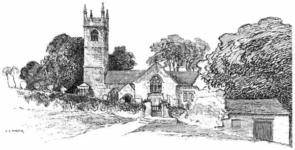
Returning round its southern shores, Mawgan-in-Meneage stands amid great swelling green hills, wooded in rich parklike manner, at the head of a tiny inlet. The St. Mawgan who has given his name to this place, and to Mawgan-in-Pydar, on the north coast of Cornwall, was the sixth-century Welshman, Maucan (the name means "master"), who was head of a religious collegiate establishment in Pembrokeshire, and there instructed many of the missionaries to Ireland and Cornwall, who afterwards became sainted, in the copious hagiology of the West.
Ecclesiastically, this village of Mawgan is "in Kerrier," but it is generally styled "in Meneage": the second syllable pronounced as in the word "vague."
But "village" is only a conventional term, as applied here. There are but half a dozen scattered cottages to keep company with the large and beautiful church.
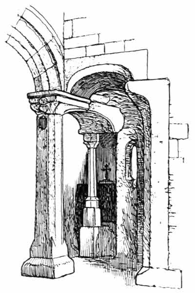
I sketched this view of Mawgan church in "soft weather," with rain oozing down—not falling—a way it has in Cornwall. And a rustic came to the stable opposite and opened the door, and said, "Come forth, my son." I expected a boy to come out in reply to that somewhat Biblical and patriarchal invitation, but it was a horse! So, just as in Brittany, where you only get the "vraie Breton bretonnante" far[129] away from the towns, you find your characteristic expressions in the remote nooks and corners of Cornwall.
The greater part of Mawgan church is of the late Perpendicular period. A curiously constructed hagioscope, at the angle of the south transept, is equally remarkable for the large blocks of granite used in it, and for a low side window, now blocked up by the addition of a vestry. There is a somewhat similar, but not so good, hagioscope at Cury.
A long way down Helford River from Mawgan comes Helford, a hamlet in the parish of Manaccan. Helford is at the opposite side of the ferry to Durgan, and lies down in a deep hollow of the hills. Many charmingly rustic cottages and a delightful old farmhouse face an inner creek. It is hot and steamy at Helford, and great pink ivy-geraniums ramble over the house-fronts, sprawl over the thatch, and peep inquiringly into bedroom windows.
Manaccan sits upon the hill-top. The great uncertainty often existing as to the origin and meaning of place-names is well illustrated here. Manaccan is well within the district of Meneage, which, by fairly general consent, is taken to mean the "stony district," but there are those who declare it to be in its origin "mynachau," that is to say, "monkland." "Manaccan" has also generally been considered to mean "the monks," but as the church is dedicated to Saints Menaacus and Dunstan, it seems more likely that the[130] place takes its name from the first of these. Menaacus, Mancus, or Marnach, an early bishop, is buried, according to William of Worcester, in the church of Lanreath, near Fowey, and Lanlivery church is also dedicated to him.
The church is partly Early English, and has a very good Norman south door. A curious feature is the very flourishing fig-tree that grows out of the wall at the junction of the tower and nave, on the south side.
Manaccan stands on a lofty hill, softly clothed in rich fields and luxuriant trees, not in the least characteristic of the stony Meneage district in which it is situated.
From the heights of Manaccan a steep road, heavily shaded by tall elms, leads to a parting of the ways, whence you may go direct to St. Keverne, or turn aside to the left for the Durra Creek of Helford River, which is some two miles in length, ending in what map-makers style "Dennis Point," a corruption of "Dinas," an ancient British word signifying a fortress of the earthwork and wooden palisade type, constructed at the extremity of a headland, with the approach across the neck of it cut off by a ditch. There is one of these strongholds on either side of the entrance to the creek from the sea. Rabbits hold the fort to-day, but should there come a time when invasions threaten these parts, there can be little doubt of the eternal and unchanging requirements of strategy bringing these salient points again into use, just as, when the last conflicts in the great civil war were disturbing the nation, the Royalists established themselves here, only to be turned out by Fairfax.
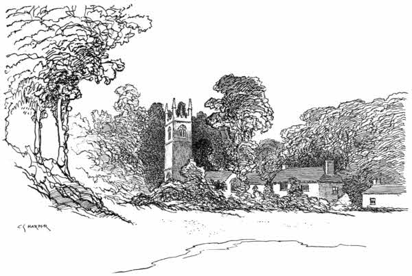
The[133] Durra Creek is generally passed by. Tourists hasten on to St. Keverne, and know nothing of the lovely rugged woodland road that runs beside the water to the church—one can scarce say the village for there are but two or three houses, including the vicarage—of St. Anthony-in-Meneage. St. Anthony stands at the very verge of high water, where a little beach ends, on the landward side, in grassy banks and blackberry tangles, from which spring great elms. Trees close in everywhere, with the grey granite tower of the church in their midst and a lovely old vicarage adjoining, wrapped, as it were, in flowers. There is not, nor ever could have been, any need for a church at this spot, and thus the legend accounting for its origin may very well be true. According to this story, some notables voyaging from Normandy in mediæval times were in great peril of shipwreck, and vowed St. Anthony a church if he would only bring them in safety to shore. They made land here, in the Durra Creek, and accordingly the church was built at the place where they set foot. There are numerous legends of this kind in Cornwall, and all around our coasts; and there is, in general, no occasion to doubt their truth, the absolute uselessness, as a rule, of these votive churches being presumptive evidence of the genuine character of their story. At the same time, it is[134] impossible to believe that St. Anthony, or the saints to whom those other churches are dedicated, personally intervened because they were promised churches in places where they could not possibly advance the cause of religion. Surely we ought to have a better opinion of the saints than to believe them animated by such appeals to personal vanity.
The church of St. Anthony-in-Meneage fell gradually into decay. It was "awl davered," as they say in these parts, i.e. mildewed, and was not restored until recent years, when its mouldy interior was cleaned and the rotting woodwork removed. The usual cheap and nasty fittings of pitch-pine have been installed in their place. It was impossible to spare the decayed woodwork, of which two fragments remain in the tower. The vicar, at the time when the present writer was here, brought them forth to show a boating-party who had landed on the beach, and the party gushed plentifully over them. "How beautiful! how interesting!" they exclaimed; insincerely, because any beauty or interest they may once have had has utterly vanished, and left merely two almost formless logs, not good enough for firewood. The really interesting object no one understood or appreciated. This was the beautiful granite font of the thirteenth century, an exceptionally interesting example, one of the somewhat rare inscribed fonts. It is adorned with shield-bearing angels[135] and has the inscription, "Ecce Karissimi de Deo vero baptizabuntur spiritu sancto," with the initials, Q.P., B.M., B.V., P.R., repeated. No one appears ever to have explained the significance of those initials, but it may perhaps be considered that they are not only those of the donors, which seems obvious enough, but that they are also those of the storm-tossed voyagers who gave the church.
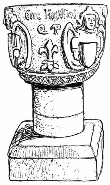
Inside the protecting shoulder of Nare Point lies Porthallow, a fishing cove, and beyond it, in the next bight, is Porthoustock, whose fishing is now mixed with the exportation of granite.[136] Up out of Porthoustock, over the hill and on to the next point, and you have come to the most recently tragical outlook upon the Cornish seas, for there, offshore, lie the Manacles rocks. No one but a seaman would take particular note of them, for they do but rise unobtrusively from the water.
Their odd name, forbidding and ominous though it be, and apparently allusive to the fast hold they often keep upon vessels unlucky enough to go out of their course among them, is only accidental; their original title having been, in the Cornish language, "maen eglos," the "church stone." Why they were so called does not appear. A bell-buoy, floating out there, giving out a harsh knell, might seem to justify the name, but the rocks were so called long centuries before the Trinity House placed their buoy here. There is no sadder sound than that of a bell-buoy, tolling on the brightest day with the note of a funeral knell; a likeness well justified here, for many have been cast away on the Manacles, notably in the wreck of the Dispatch transport, January 25th, 1809, when sixty-four were lost; and in that of the John emigrant ship, May 1855, with the loss of nearly two hundred.
The terrible wreck of the American steamship Mohegan, on Friday, October 14th, 1898, is the latest tragedy associated with the fatal Manacles. The vessel was on its way to New York, and had left London the day before, carrying fifty-three[137] saloon passengers, a crew of one hundred and seven, and a stowaway. Between half-past six and seven o'clock, when the saloon passengers were at dinner, every one on board was suddenly terrified by a violent crashing and grinding and a succession of shocks, indicating only too surely that the vessel had run upon a reef. All the ship's lights went out, and the horror of darkness was added to the peril of the occasion.
The sun sets at nine minutes past five in the evening on October 14th, and it is normally quite light for an hour later. It is therefore incapable of explanation how, in something like another half-hour, the Mohegan should have been as much as ten miles out of her course, especially as the south-westerly trend of the land towards the Lizard must have been very noticeable. Nor are these coasts ill-lighted. The Eddystone and Falmouth harbour lights, which the Mohegan had already passed, and the Lizard light ahead, form a remarkable triangular display for the guidance of the mariner. But it should be noted, perhaps, that the last half-hour of daylight may be especially dangerous. The lighthouses have already lit their warning beams, but they are only faintly to be seen in the still radiant western sky, and only gather strength when the afterglow has died away and darkness falls upon the restless sea and the sombre coast. Another explanation of the captain being so far out of his reckoning was sought in the Mohegan being a new ship, and her compasses possibly not[138] true; but nothing can actually be known, for all the officers of the ship were drowned. A strong south-easterly wind was blowing at the time, and the bell-buoy on the southern ledge of the Manacles at such times rings loudly; but no one on board appears to have heard its warning. Only two boats could be launched, so swiftly did the Mohegan sink, and one of them was capsized. The Porthoustock lifeboat saved many, but one hundred and six were drowned.
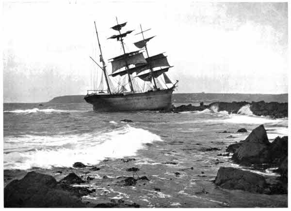
A landsman, looking out on some calm day from the low headland that stretches insignificantly out to sea south of St. Keverne cannot easily comprehend the dangers of the scatter of rocks extending seaward for nearly a mile and a half. The spot is by no means dramatic. It is even commonplace, and has no hint of the scenes of terror and despair that have been enacted out yonder. And the photographs of the wreck that were afterwards plentifully taken are probably the tamest among such things, showing merely the funnel and the four masts standing upright from the waves and disclosing that the Mohegan sank on an even keel in comparatively shallow water. Those views, taken from the water, on a calm sea, only, in the present writer's imagination, add to the pity of the occasion, for in shallow water and so near land, it seems exceptionally hard that so many should have lost their lives. The remarkable attraction of the Manacles rocks for vessels was illustrated the following year, when the Paris strayed among them, happily[139] with no disastrous results. The Glasgow barque Glenbervie struck in moderate weather one night, in January 1902, on the Ray, a rock two miles distant, off Lowlands Point, and although the crew were saved, the vessel became a total loss.
The narrow and miraculous escapes from among this tangle of reefs have been many. The Cornish Magazine, now extinct, once published an article, in which the writer spoke of a Porthoustock fisherman telling him, from memory, the names of thirty vessels of all kinds, from steamships down to ketches, that had been totally lost here. He told a thrilling tale of a ship drifting inshore in a fog, and of the captain anchoring until the fog cleared away, when he sailed off in safety, to the astonishment of the many who had collected on the cliffs. There was also the story of the steamship which came so close to the cliffs that the noise of her engines could be distinctly heard on shore, but she, too, got away. Many have been the ships among the Manacles, and no word ever said about it; their captains even going the length of covering over the name of their vessels with a sail, lest their mistake in navigation should be published to the world.
The village of St. Keverne lies rather over a mile inland.
"St. Keverne" is another form of "St. Piran." It has also been spelled "Keveran" and "Kieran." Its church is very large and roomy, and is one of those few in Cornwall that[140] have a spire. The fine inscribed font has demi-angels at the angles, holding crossed swords.
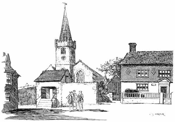
In the churchyard, among other memorials of shipwreck, is the granite cross, bearing the simple inscription, "MOHEGAN, R.I.P." marking where lie many of the dead who were lost in that wreck. Near by is the touching epitaph upon "Charles Cyril Brownjohn, London, aged 23. S.S. Mohegan, Oct. 14, 1898. The devoted and only son of a widowed mother. He never said an unkind word to her in his life."
I do not think there were ever any distinguished persons born at St. Keverne. One notoriety, Sir James Tillie, was born here, and one other was vicar, as would appear from the records[141] of 1467, in which, among a number of piratical Cornishmen, who had helped themselves to a quantity of merchandise from a Breton ship, we find the vicar, whose share of the booty was three tuns of wine. An order was given to arrest these enterprising persons, but they could not be found; and so St. Keverne apparently had a new, and let us hope, a better, vicar.
Striking inland from St. Keverne for Coverack Cove, something of the stony character of the Meneage and Lizard districts is seen, together with a good deal of the widespread lack of signposts common to all Cornwall, but particularly distressing here. Wherever it is possible for a stranger to lose his way—and that is very often here—be very sure that the County Council has forgotten to place a sign-post; and furthermore, be equally certain that, at those points where no one is likely to go wrong, there will be very informative ones: exercises in the obvious. But there is a deeper depth than this. A fork of roads may be duly sign-posted, but it often leads to another, and a much more puzzling and quite lonely fork, a long way ahead, where not the least indication is vouchsafed. You are lucky if you do not at last find yourself in the yard of some "farm-place," and have to return a mile or more.[143] Sorrow's crown of sorrow is, however, attained when a signpost is seen in the distance. You hurry up; it points the way to, let us say, the "Hotel Parvenu," one of the several up-to-date barrack hotels that have of late risen upon desirable view-points. I want to know why these things should be; not the hotels—we know the reason of them—but why they should be allowed to play these dirty tricks on travellers. We cannot all be guests; nor, perhaps, would very many who could. Why, then, should the County Council permit the existence of these purely commercial notices?
Coverack village, down upon the Cove, was the scene of the Dispatch transport wreck in January 1809. A monument in St. Keverne church narrates how over sixty were lost on that occasion, including Major-General Cavendish. They were fresh from the blood-soaked fields of Spain and the retreat upon Coruña.
Those who originally named Black Head, beyond Coverack, could scarce have had any choice in the matter, for it is a lowering, sullen-looking point. But the rock is rather a dark green in its original tone, when closely examined. It is, in fact, the famed "serpentine" rock that extends all the way from this place, past the Lizard, to Mullion.
The way round by the cliffs to the next headland, Pedn Boar, and beyond it to Caraclowse Point, where there is a "cliff castle," is wearying in its ups and downs with a stream to cross in one[144] rugged valley, without being exceptionally fine; but the paths or ragged grasslands on the way to Kennack Sands give easier going. Kennack Sands form the only available sandy foreshore for many miles along this rugged coast, where the savage cliffs descend as a rule sheer to the water, and the jealous sea generally leaves but a narrow sandy selvedge at the ebb. Small wonder, then, that bungalows for summer bathers have appeared here.
But the trivial urbanities of Kennack soon fail him who fares by the cliffs on to Caerleon Cove and Poltesco. Brambles clutch at his clothes and bid him stay; stones, loose and knobbly, and tripsome, lie along the path the coastguards seem to patrol all too seldom, and presently the small cove of Caerleon appears, with a stream running down to it and the derelict works of an abandoned serpentine factory on the shore. Up inland, past a cottage, with a notice declaring that trespassers will be prosecuted (which of course the wise pedestrian treats with contempt), and then past a tree-surrounded farmhouse, displaying the more hospitable intimation of new milk being sold, the watery valley of Poltesco is reached, where a great mill-wheel, amid a paradise of ferns, is worked by the spattering stream. I should think Poltesco might be a very tedious place on a wet November day, and not good for rheumatism; but, as an American girl tourist remarked, in summer it is "just heavenly."
Abandoning the coast at this point, and content[145] with seeing Ynys Head in the distance, I walked the half-mile uphill to Ruan Minor, a pretty little village with a very small but very perfect little Perpendicular church, whose pinnacled tower, although well-proportioned, is not higher than the roofs of the village houses.
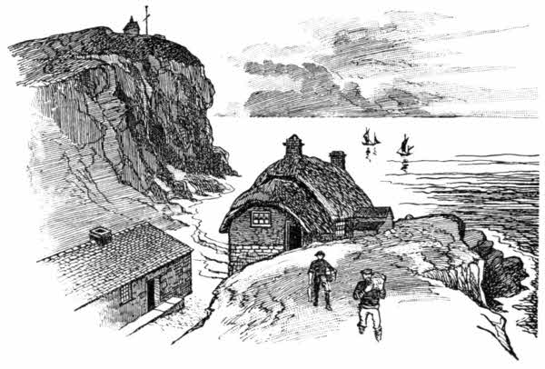
The half-mile hence to Cadgwith Cove is a zigzagging and steep descent. Deep down lies the village, with a street clinging to the sides of the descent and thatched cottages at the bottom, facing the sea; one or two in front of their fellows standing on a rocky projection called "The Rodden." The sea comes hissing in upon a pebbly beach, alongside tall, sheer cliffs.
It is even steeper up out of Cadgwith on the[146] coastguard path to the Lizard than on the other side; an obscure path leading up to scrubby fields and a modern villa called "White Heather," facing the sea in what seems a not altogether permanently safe position, considering that the "Devil's Frying Pan" is in front of it. This is a chasm formed in the cliffs by the falling in of the roof of a cave, leaving a huge pit-like opening in the cliff-top, with a neck of land forming a natural arch on the edge of the cliffs. Down below, the sea comes foaming and hissing at high tide among the scattered boulders in a way that suggested to some imaginative person the idea of a frying-pan. A not very safe path leads round the landward edge of this place; but the best and most impressive view is from the sea. It is a very short boating trip from Cadgwith to the Devil's Frying Pan.
A boating trip is certainly the best method of seeing the coast between Cadgwith and the Lizard. You see more, and to better advantage, than by tramping round the interminable headlands and down one not very interesting valley, up to the next hill, conscious all the while that the real beauty of the coast lies under your feet, in the sea-fretted caverns that the waves never leave. The finest of these is Dolor Hugo: ogof, the old Cornish word for "cave." This is a magnificent cavern in the dark but richly variegated serpentine rock. The archway rises high overhead, admitting boats easily in calm weather, but the roof soon descends and exploration cannot be[147] pushed far. The Lizard boatmen, too, are very alive to the dangers of the place. The solemn beauty of it and the heavy ground-swell impress the stranger with a full sense of the risks incurred in visiting Dolor Hugo, except in the calmest weather.
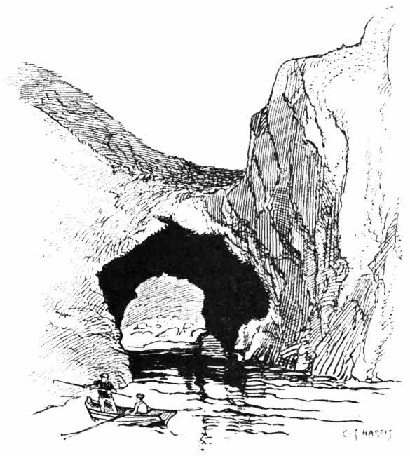
At Cambarrow, the next headland, is the cavern[148] of Ravens' Hugo, a narrower fissure, the entrance hung with wild growths. Then comes the sheer cliff called "The Balk," where serpentine quarries may be observed, and round its precipitous adamantine wall the deeply cleft little Church Cove, known also as Perranvose, Parnvoose, or Lizard Cove.
Church Cove itself is an almost solitary place, a narrow strip of beach between sheer rocks; but the cottages along the tree-shaded lane that runs up to Landewednack are as homely and sheltered, and as richly embowered in roses, fuchsias, honeysuckle, and hydrangeas, as any place in the West. All around is the level, treeless, windswept heath of the Lizard district, but down in this sheltered hollow one is in the atmosphere of a conservatory. Perhaps one person among every hundred of those who come to Lizard Town discovers Church Cove and the village of Landewednack, which is the mother-village whence Lizard Town, half a mile away, has sprung; and the ninety and nine return home, having just caught a glimpse of the lighthouse, and think, vainly, they have seen all there is to be seen.
I have quite a budget of curious facts concerning Landewednack and its church. To begin with, it is the parish church of that odd collection of houses—the very negation of architecture—"Lizard Town," which occupies the plateau just beyond this dell. That a place should elect to style itself "Lizard Town," when it might be, and properly is, Landewednack, is an odd study in[149] perversity. Landewednack church is also the most southerly church in England, and in it was preached in 1674 the last sermon in the Cornish language. A few years later, 1683, died the Rev. Thomas Cole, stated in the register to have been 120 years of age. In the churchyard lie a number of persons who died of the plague in 1645, but the spot where they were laid is unmarked.
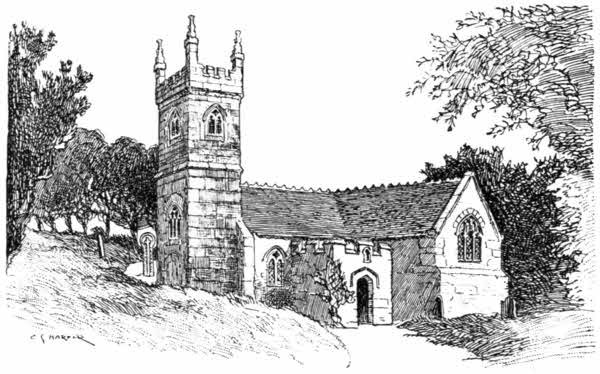
Furthermore, the stranger will not fail to observe that the huge stones of which the tower is built are partly grey granite and partly of local serpentine, giving a curiously irregular chessboard kind of appearance. The dedication of the church is said to be to St. Winwaloe. The place-name has its fellow in Brittany—that other Cornwall—in Landevenec.
The church of Landewednack consists of nave, north aisle, and a south transept, which has a low side-window at the angle formed by its eastern wall and the wall of the nave. The font, dating from about 1404, is mounted on four modern pillars of polished serpentine. The bowl bears an inscription including the name of the rector at that period, "I.H.C. D. Ric. Bolham me fecit."
And now we come to Lizard Town. No one ever planned Lizard Town, any more than its houses were designed. They were merely built, and the "town," which is a simple collection of cottages and a hotel or two of sorts, is much smaller than many villages. Its population, including Landewednack, is only 683. Lizard Town simply grew at haphazard, on the extremity of the level, heather-clad waste of the Lizard promontory, and with so little directing hand or purposeful mind that its component houses form hardly any recognisable lines of streets, running in any definite directions. They may be fitly likened to a flock of sheep huddled together, facing all ways, to escape a tempest raging from all quarters at once. The population appears to a casual observer to consist wholly of families of Jose and Roberts, all inter-related, like the Cadgwith people, who are all either Janes or Stevenses. And they are nearly all workers in serpentine, whose little workrooms and shops are all of one peculiar pattern, with a small show-window closed at night by a hinged shutter.[151] In every one of these shanties a lathe is at work shaping the rough serpentine rock down, and then turning it into one or other of the many ornamental articles exposed for sale in the windows: paper-weights, candlesticks, pen-trays, models of the Eddystone lighthouse and of Cornish crosses, and so forth; beautifully polished. "Serpentine" gets its name from the coloured streaks and patches it displays.
The "Lizard district" is the name given to all that boldly projecting peninsula south of the Helford River: the district that is properly "Meneage," the "stony district," but "Lizard" is only rightly applied to the actual headland. It has nothing to do with the reptile lizards, but is equal to the Welsh "Llidiart," indicating a rocky height. There is a Weston-under-Lizard in Staffordshire. The peninsula forms the most southerly projection of England, and the Lizard Point by day or the Lizard Light by night is the first glimpse homeward-bound voyagers obtain of old England from the decks of the great steamships passing up Channel. It is a wild, but scarcely picturesque land, consisting of a high, but level, plateau of heaths and moors. Goonhilly Downs, in its centre, in spite of their name, are not hilly, nor are they what we generally understand to be downs, but just gently undulating, or even flat, stretches of uncultivated and uncultivable land that by some are styled "dreary." But the justness or otherwise of that expression entirely depends upon the circumstances[152] of the moment. Given bad weather, Goonhilly Downs and the whole Lizard peninsula are, indeed, dreary to the traveller, for shelter along the exposed roads, for the most part treeless, lonely, and quite innocent of hedges, is unobtainable for many miles; but in fine weather the purple heather, the occasional wooded hollows and the innumerable grey boulders scattered in these wilds, make a pleasant holiday jaunt. From a cycling point of view, the roads are perfection, and although dreariness is again the word when a cyclist strives along them in the teeth of a gale, to be blown mile after mile on a cycle with the wind is exhilarating. There are few villages here. Inland from Lizard Town you see the church-tower of Grade peering across the flats, but it is a village only of "farm-places." Grade church takes its name from St. Grada, Crida, or Credanus, a more or less mythical companion of St. Petroc, but it has been re-dedicated to Holy Cross.
Even less of a village is Ruan Major, whose church is seen amid a cluster of trees on the right of the road to Helston. Ruan Major is a paradoxical place, much smaller than Ruan Minor, consisting as it does of a church and a farmhouse. St. Ruan, or Rumon, its godfather, was a sixth-century Irish hermit who resided here—if that mode of living may be called residence—both before and after he went to Brittany, where he was not altogether favourably received. That he was much better thought of in Cornwall[153] and Devonshire seems evident in the places named after him, and in the great honour paid to his relics at Tavistock Abbey. The farm at Ruan Major and the little woodland distinguishing the place from the surrounding open heaths perhaps represent the "nymet," or sacred enclosure made by St. Ruan around his hermitage.
Such then, with an occasional old manor-house and park like Trelowarren, Bochyn, and Bonython, the last near Cury, formerly seat of the old family of Bonython, is the wide district at the back of Lizard Town. Strangers simply hurry over it, by motor-car or Great Western motor-omnibus, all anxious to reach the Lizard itself, and to explore Kynance Cove and be off again.
The Lizard lighthouse is three-quarters of a mile distant from Lizard Town. It occupies the extremity of the point, the Ocrinum of Ptolemy, and is the successor of a lighthouse first erected in 1619 by Sir John Killigrew. That early light was only established in the teeth of the strongest discouragement by the Trinity House, which in those times adopted what seems to us an extraordinary policy, directed against the increase of lighthouses. Sir John Killigrew proposed to set up a light here at his own expense and to gather voluntary contributions from ship-owners towards the cost of it, but he found it necessary to first obtain a licence to do so, and therefore petitioned James the First to that effect. He would pay twenty nobles a year for leave to[154] collect voluntary sums for a term of thirty years. This proposition, submitted to the Trinity House, produced the criticism that a light was not required upon the Lizard, and that in fact any such light would be dangerous, for it would serve as a beacon for pirates and foreign enemies. But the King, really in this instance the Solomon his flatterers pretended him to be, disregarded the unfavourable report, and granted the petition, with the only proviso that the light should be extinguished in time of war, when the approach of an enemy was suspected. Killigrew thereupon began and soon completed his lighthouse, much to the anger of the coastwise people. "The inabytants neer by," wrote Killigrew, "think they suffer by this erection. They affirme I take away God's grace from them. Their English meaning is that now they shall receve no more benefitt by shipwreck, for this will prevent yt. They have been so long used to repe profitt by the calamyties of the ruin of shipping that they clayme it heredytarye, and heavely complayne on me."
A year's working, including the cost of building, cost Sir John Killigrew £500. The light displayed was a brazier of coal, and this alone cost ten shillings a night. As for the "voluntary contributions" expected, they were simply nonexistent, and in consequence Killigrew petitioned for, and obtained, the right to levy dues of one halfpenny a ton on all passing vessels. Even then, he took nothing but a loss out of his enterprise,[155] for shipowners, backed by the Trinity House, refused to pay, and in the end the lighthouse was pulled down.
The existing lighthouse dates from 1748, when a Captain Farrish proposed a building that should display four lights. This was a wholly commercial speculation. Farrish proposed to pay a yearly sum of £80 to the Trinity House for leave to build, and obtained a lease of sixty-one years; but the lease was taken over and the lighthouse actually built by Thomas Fonnereau. The lights were first displayed on August 22nd, 1752, in the presence of a great assemblage of people, who had come long distances to honour the event. Two lights appear to have been substituted for the four in 1792, but not until 1813 did the coal braziers give place to oil, and oil was replaced by the electric light in 1878. About 1902 the lights were reduced to one powerful revolving electric beam, the strongest in the world, visible for twenty-three miles, and showing once in every three seconds. It is aided in foggy weather by the most dismal of foghorns.
Hard by the lighthouse stands a notice-board of the National Lifeboat Institution, giving a plain record of the doings of the successive lifeboats that have been established down below, in Polpear Cove.
The Lizard lifeboats have rendered noble service, as shown by the board telling the doings of them:
| LIFEBOAT ANNA MARIA. | ||
| Lives Saved. | ||
| 1861. | Aug. 10.—Schooner, Hurrell, Penzance | 4 |
| 1868. | March 27.—Schooner, Selina, Swansea | 2 |
| 1873. | " 1.—Barque, Fomahault, Griefswald | 11 |
| 1879. | June 15.—Brig, Scotscraig, Dundee | 9 |
| 1882. | Aug. 9.—s.s. Mosel, Bremen | 27 |
| LIFEBOAT EDMUND AND FANNY. | ||
| 1886. | Sept. 28.—s.s. Suffolk, London | 24 |
| 1887. | March 13.—Schooner, Gipsy Queen, Padstow | 5 |
| 1888. | " 10.—Barque, Lady Dufferin, Plymouth | 17 |
| 1893. | " 4.—s.s. Gustav Bitter, Newcastle | 3 |
| 1897. | Nov. 23.—s.s. Landore, Liverpool | 12 |
| 1898. | Aug. 6.—Barque, Vortigern, London | — |
| 1900. | Nov. 24.—Glint, Stavanger | 4 |
| LIFEBOAT ADMIRAL SIR GEORGE BACK. | ||
| 1907. | March 17-18.—s.s. Suevic, Liverpool | 167 |
| 1907. | July 23.—Ketch, Fanny, Bideford | 3 |
The bald, unvarnished statement in this list under date of March 17th to 18th, 1907, giving the list of saved from the Suevic, hides the very narrow escape of the passengers and crew of that White Star liner. She was homeward-bound from Australia, and had on board between three and four hundred passengers, and a cargo of frozen meat. In the middle of the night she struck upon the Brandies Rocks, immediately under the Lizard lighthouse; thus affording another extraordinary instance of the fatal attraction this, the most salient southerly point of land in England, has for vessels, in spite of the[157] lighthouse exhibiting the most powerful light in the world. The Lizard, Cadgwith and Mullion lifeboats put out, on hearing the news, and landed many of the passengers, and one hundred and forty were taken off by the tug Triton of Falmouth. Fortunately the weather was moderate. The hull was severed by dynamite about a week later, and towed round to Falmouth.
Scattered reefs stretch out beyond Lizard Point, and form the special dangers of the place. They are known in general as "The Stags." A vessel, wrecked on the Stags about 1845, was driven on to the island rock of Crenval, where the crew refuged all night, while the good ship was being reduced to matchwood by the waves. The next morning they were brought ashore, and were greeted by their own cat, which had either swum to land, or had been carried on the wreckage. Its tail had somehow been nipped off in the process. The cat was sold to an innkeeper in Lizard Town, and was long looked upon as very much of a hero.
Immediately to the eastward of the lighthouse is the funnel formed in the cliffs by the falling in of the roof of a cave known as Daws' Hugo. This subsidence happened on February 19th, 1847, and the hollow thus produced was immediately given the name of "Lion's Den." Beyond it is Housel Bay, with a hotel on the cliffs. The rugged Penolver Head comes next, and then the amphitheatrical Belidden Cove, with Beast, or Bass Point, enclosing it.[158] Lloyd's signalling station, displaying the word LLOYD'S in gigantic letters on its sea-front, stands on Beast Point. Hence inward and outward-bound ships are telegraphed to London as having "passed the Lizard." Beyond Hot Point, the next headland, the coast comes to Kilcobbin Cove and again to Church Cove.
From Polpear Cove to Kynance Cove is a tramp to be undertaken only by the leisured. The distance is but four miles along the cliffs, but the hurried persons who oftenest come to the Lizard have not the time or the inclination for it, and go direct across from Lizard Town.
The way to Kynance Cove from Lizard Town is strictly a pedestrian's journey and lies largely upon the tops of hedges. Those who have never yet made the acquaintance of a Cornish hedge cannot fail to be surprised at this, but a hedge in the Home Counties and a hedge in the West Country are apt to be very different things, and a Cornish hedge is generally a substantial bank of stones and earth, not infrequently with a broad, well-defined footpath on top. Such hedges are those that partly conduct to Kynance Cove.
But I shall proceed by the cliffs, first noting the cave that is to be seen at low water down at Polpear, and the Man-o'-War Rocks out at[160] sea. The name was originally "Maen-an-Vawr," the "great stones," but the tradition of the wreck of a transport there has definitely changed it. The cliff-walk passes "Pistol Meadow," in which numerous mounds still show the places where the seven hundred dead on that occasion were buried. Only two persons are said to have been saved. It is strange that neither the date of the wreck nor the name of the ship has been preserved.
Old Lizard Head, the "false Lizard" as it is sometimes called, gives way to Crane Cove and the larger cove of Caerthillian, where a stream comes down a ravine to the shore. This in turn is succeeded by Pentraeth Beach and by the tall cliffs of Yellow Carn, with the rock of Ynys Vean, i.e. "Little Island," about as big as Westminster Abbey, below.
And down there in front is Kynance Cove, a not very remarkable place at high tide, but of a justly famous beauty at low water. You look down upon it from the cliff called the "Tar Box," which has not the slightest suggestion of tar in its composition: it is properly "Tor Balk." A stream comes swirling down the rock-strewn valley that descends to the Cove. It is from this the Ky-nans, i.e. "Dog's Brook" it is said, that Kynance Cove takes its name.
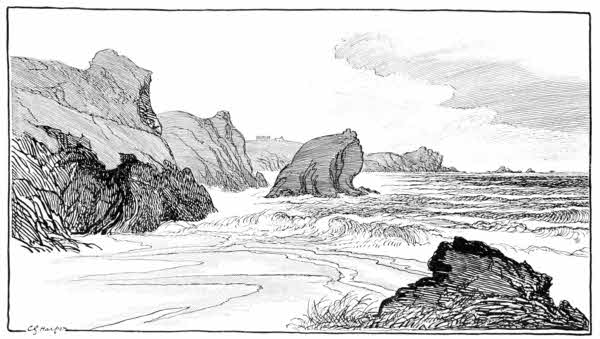
There are but two or three cottages here. Not yet has a hotel been built, but who knows how long before such a thing shall come to pass, and it be possible to sit at a window of its[161] dining-room, overlooking this most typical Cornish scenery, while a German waiter, introducing the soup, asks: "Thig or glear?" May it be long years yet!
Every one knows that the beauties of Kynance are only unveiled at the ebb. Then the sands, the delightful, soft, light-yellow sands appear, where were only heaving waters, and the great islanded rocks are seen embedded in them. There is plenty of colour, and plenty of drawing too, at Kynance: the streaked black, green, purple, red, and pink serpentine rocks, the yellow sands, and the translucent green sea glow brilliantly under a sunny sky; and under any conditions, except fog, the Cove at ebb is full of striking forms. On the west side, between the mainland and the crag called Asparagus Island, rises the Steeple Rock, sometimes called the Soap Rock, from the veins of steatite it contains. It is no fanciful name, for quarries of steatite were worked long ago in the cliffs beyond Rill Head, and the product dispatched to wholesale soap-boilers, and also to Staffordshire, for use in pottery-making. No asparagus now grows on Asparagus Island, which is a rather fearsome, craggy place to climb, especially as not merely a fall on jagged rocks is possible, but a descent afterwards into the horrible green depths of the sea, where the congers live. For this chamoising over the rocks rubber-soled shoes are the best and safest. In them you may dare things not easily to be contemplated in less pliant footgear,[162] and thus may scale the pinnacled rock, and look down from its further side on to Gull Rock and the deep-water channel below.
But the most engaging thing about Asparagus Island is the Devil's Post-Office, which (facilis descensus Averni, you know!) is quite easily reached. It is in working order just below half-tide. At the flood it is entirely submerged. Sometimes it is known as the Devil's Bellows, or again as the Devil's Throat; but whether it be Throat, Bellows, or Post Office, the personality of the owner is unchanged. This natural curiosity is a fissure traversing the entire mass of Asparagus Island, through which the sea-water is forced in conjunction with air, emerging violently and with a reverberating rumbling report, through a narrow slit, not unlike a letterbox. To "post a letter" at this aperture immediately after one of these spoutings is rather a startling experience, unless you have been told of it beforehand. You unsuspectingly lean over and hold a piece of paper at the orifice, and it is rudely and violently snatched away, to the tune of a harsh indrawn snarl, a sound just as though a giant had sharply drawn his breath in between his teeth. And very often it will happen that, in a sudden outrush again of air and water, your letter will be returned to you full in the face on the instant, with a most discourteous drenching. There are gorgeous caverns, dry at low-water, round past the Steeple Rock, known as the Drawing-Room, the Kitchen, and[163] the Parlour; but the finest view-point at Kynance is eastward, back towards the Lizard, with the Lion Rock in the foreground.
The Lion Rock is doubtless so called because it has a certain majesty of outline, and because it does suggest a crouching attitude, as of an animal in readiness for an attack. But it does not look like a lion, and indeed lacks a head, and without a head the noblest lion is a poor thing. But it is true that the longer you look at the Lion Rock, the more you are impressed.
Let those who seek to return direct inland to Lizard Town have a care how they follow the direction indicated by a signpost, which obligingly indicates "The nearest way to Lizard Town." I am inclined to think that the old piskies, devils, and malicious sprites that used to inhabit Cornwall and lure travellers out of their way, now occupy the bodies of all those people who have anything to do with signposts. They generally manage in some way to mislead, and very often indeed they are repainted at the height of the tourist season, when strangers are mostly about; and who else beside a stranger has any need of a signpost?
That is to say, the first part of the repainting—the obliterating of the inscription—is done then: the re-lettering may, and does, wait. This is a joke so entirely after the heart of one of those inimical old sprites that I am convinced, though they be gone, their wicked souls go[164] marching on in the persons of road-surveyors and people of that breed.
But the wickedness of the Kynance Cove signpost lies in the fact that, although it tells of Lizard Town, its arm points slightly away from it, along a rough cart-track. Now, as in an otherwise roadless and pathless moor such as this the inclination is always to follow any sort of a track, how much more likely then it is that the stranger should take this cart-track, especially when the signpost points to it! And, you know, it leads right away inland; and at last, after a long while, you see Lizard Town, miles away on the right, across the flatness of the heath. In tracking then across to it, in that hummocky wilderness of gorse and heather, you soon grow quite familiar with Erica vagans, the Cornish heather, which botanists say is peculiar to the soil of this district, and get an intimate acquaintance with the prickly qualities of gorse.
Resuming the way along the cliffs from Kynance, Rill Head projects boldly, with a pile of rocks on its summit known as the Apron-String. Here, according to the legend, the Devil dropped an apron full of stones he was carrying, to build a bridge across Channel for smugglers to come over. In despair, he then abandoned the task. I do not think this can be a genuinely old legend, for the Cornish, in company with all seashore peoples, were too prone toward smuggling, and thought it too natural a thing, for the suggestion of a devilish coadjutor to come from them.[165] "The Horse" is the name of the next headland, with a dangerous saddle-backed ridge, infinitely tempting to adventurous climbers who do not mind bestriding it, with the knowledge that a false step will probably send them to Kingdom Come on the moment. In the dour, black little Cove, "the Horsepond," overlooked by beetling cliffs, is Pigeon Hugo, only to be seen from a boat.
The scenery has here again attained to a black and savage grandeur, and the sea is not to be reached at all except at the deep hollow in the cliffs known as Gue Graze. Here were situated the soapstone quarries, and streaks of steatite, the "soapstone" in question, are easily found. They are of a dirty white hue and the substance feels greasy or soapy to the touch. Chemically, it is "magnesia," and commercially is generally known as "French chalk," used in softening boots and shoes, and by tailors.
The bold promontory of Vellan Head now leads round to Pol Cornick, and then to the bastioned heights of Pradanack, where Mullion Island comes into view, a long way ahead. The chance explorer here has the scene entirely to himself: to himself and the gulls, and the bunnies that inhabit among the bracken and grey-mottled boulders.
A final stretch of cliff-tops, and you presently are looking down upon Mullion Cove, properly "Porthmellin," for the village of Mullion is close upon a mile inland. "Porthmellin" means Mill[166] Cove. Mullion Island, a great black rock with some real grass on it, stands guardant, as it were, in advance, with other black and monstrous rocks on either side, those over to Poldhu blacker than their fellows; and gulls, emphasising the blackness and their own whiteness, poise, screaming, in air against them.
A smart hotel—I do not know the name of it—stands on the headland and seems to insolently hint that, even here, mankind has tamed the wilds. He certainly has made the Cove, down there, look toy-like, and the road up to Mullion village now resembles that through some ancestral park. But nature has provided the huge and savage setting that makes the little enfolding walls of the harbour, the little pool within, and the two or three little houses, look smaller than they really are. A general deceptiveness as to scale pervades the Cove: the rock of Mullion Island is, for instance, a mile in circuit, and does not appear to be one quarter that size. But the calm of a typical August day is the deepest deception of all. It requires one of the autumn equinoctial gales to reveal the innate unconquerable savagery of the place, when a strong man can scarce stand before the wind, and giant waves leap over the arms of the harbour and rush, seething and hungry for prey, up the shore.
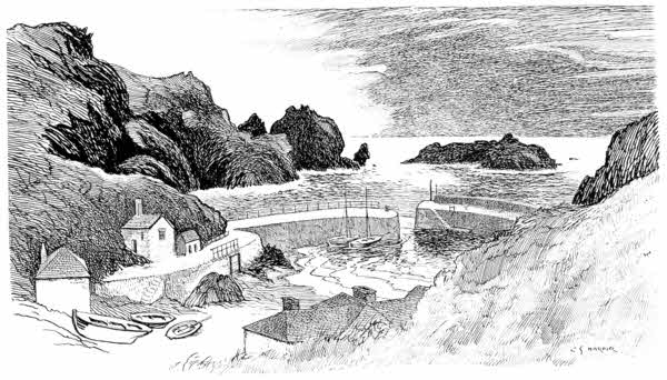
There are many records of wrecks at Mullion Cove and the cliffs between it and the Lizard. From them I take that of a wreck on the rocks of Mên-y-Grib = "Rock like a Comb," in 1867.
Undoubtedly the Cornish coasts have their mysteries, but none of them is quite so mysterious as the wreck of the Dutch barque, Jonkheer Meester Van de Wall van Puttershoek, which happened on the night of March 25th, 1867. This vessel, of 650 tons, Captain Klaas van Lammerts, homeward-bound from the East Indies with a cargo of sugar, coffee, spices, and tin, was worth about £45,000, and had twenty-five persons on board. She had been observed, the afternoon before, beating up Channel in a gale, and it was then noted that she was being very clumsily handled and would perhaps not succeed in rounding the Lizard. The wreck took place at night, and all on board were drowned, except one man, a Greek sailor, who was discovered the next morning, climbing along the rocks between Polurrian and Poldhu.
"My name," he said, "is Georgio Buffani. I was seaman on board the wrecked ship, which belonged to Dordrecht. I joined at Batavia, but I do not know either the name of the ship or that of the captain."
He repeated this extraordinary statement at the inquest on the drowned, and being shown a list of Dutch East Indiamen, picked out the Kosmopoliet, as a likely one. The inquest therefore was concluded on the assumption that this was the lost vessel. The Greek then left and was not again heard of. Soon afterwards, however, the Dutch consul at Falmouth came with the captains of two Dutch Indiamen then lying[168] in port. One of them declared that the Kosmopoliet would not be due for nearly another fortnight, and was convinced that the lost ship was the Jonkheer. The vicar of Mullion then appeared with a fragment of flannel he had found, marked "6 K. L." "Yes," said the captain, "it must be the Jonkheer, for those are the initials of her captain, Klaas Lammerts."
"On the Friday following," continues the vicar, "when the consul and this Dutch captain again visited Mullion, the first thing handed to them was a parchment which had been picked up meanwhile, and this was none other than the masonic diploma of Klaas van Lammerts."
There were some curious incidents in connection with this wreck, and the Greek sailor himself was something of a mystery: a kind of Jonah to ships. It was the third time, he said, he had been wrecked, and on every occasion was the sole survivor. It was noticed as singular that he was wearing a lady's gold watch and chain; and piecing one suspicious circumstance and another together, very grave thoughts were entertained that there had been a terrible mutiny on board. But the secret of it was shared alone by the Greek sailor and the sea. The coast was thickly strewn with coffee-berries and sugar-baskets from the cargo of the wrecked ship. Penzance speculators who carted many tons of coffee away, lost heavily when it was discovered that the berries had all been spoiled by sea-water.
The smuggling and the wrecking that once[169] distinguished Porthmellin and Mullion village may be traced in old records: the wrecking, I hasten to say, not of that criminal, murderous type which produced wrecks, but the fierce hunger for wreck of the sea which animated all coastwise dwellers, and is still only dormant.
The chief smuggling incident is that of the Happy-go-Lucky, an armed lugger of fourteen guns, commanded by one Welland, of Dover. She was located off the Cove on April 4th, 1786, by the revenue-cutters Hawk and Lark, and captured after a running fight in which Welland was killed.
As to the "wrecking," an account, written in 1817, tells us vividly about it.
"The neighbourhood is sadly infested with wreckers. When the news of a wreck flies round the coast, thousands of people are instantly collected near the fatal spot; pick-axes, hatchets, crow-bars, and ropes are their usual implements for breaking up and carrying off whatever they can. The moment the vessel touches the shore she is considered fair plunder, and men, women, and children are working on her to break her up, night and day. The precipices they descend, the rocks they climb, and the billows they buffet to seize the floating fragments are the most frightful and alarming I ever beheld; the hardships they endure, especially the women, in winter, to save all they can, are almost incredible. Should a vessel, laden with wine or spirits, approach the shore, she brings certain death and ruin to many[170] with her. The rage and fighting, to stave in the casks and bear away the spoils, in kettles and all manner of vessels, is brutal and shocking. To drunkenness and fighting succeed fatigue, sleep, cold, wet, suffocation, death. Last winter we had some dreadful scenes of this description. A few in this neighbourhood, it seems, having a little more light than others, had scruples against visiting a wreck that came ashore on a Lord's day, lest it should be breaking the Sabbath; but they gathered all their implements into a public-house and waited until the clock struck twelve at midnight. Then they rushed forth; all checks of conscience removed."
There is scenery here, to be explored at low water, as fine as that of Kynance itself, if not finer. At any rate, it is of a more stern and rugged order. Mullion Cave is a cavern indeed, with a generous opening and deep black depths which it is the proper thing here to illuminate with torches, or by the more ready, if also more evanescent, method of lighting a newspaper.
Mullion village, away up inland, has a church dedicated to St. Melyan, and some fine old bench-ends; but Mullion is perhaps more celebrated through Miss Mary Mundy, the "Old Inn," and Professor Blackie.
Many years ago, in those days when railways were uncommon in Cornwall, and when the comparatively few tourists generally walked, the "Old Inn" at Mullion was made famous. Those were remarkable tourists in that era. You can see[171] exactly what they were like by referring to old pages of Punch, where they will be discovered, generally pictured by John Leech, in peg-top trousers, and wearing hats like inverted pudding-basins, and long side-whiskers, which they were for always pulling out, superciliously, between finger and thumb. Things have greatly altered since then, perhaps for the better, perhaps not. I will not presume to say. But I do hope pudding-basins and Dundreary whiskers (otherwise "let-us-prays") and peg-top trousers will not come in again.
Those were the times when poets and literary men of repute, walking round the coasts, did not disdain to write tributes in the visitors' books of rustic inns. There were few inns and no hotels, and visitors'-books were rarities. To-day, they all abound, but you will seek in vain for any literature left behind by visitors, whose tributes are generally of the kind I observed at Land's End, among which one person had described himself as "King of the Cannibal Islands," and incautiously expressed a desire to eat the donkey outside, he felt so hungry. To this a later visitor had added, "Cannibal indeed!"
Professor Blackie in 1872 made the "Old Inn" and Mary Mundy who, with her brother, kept it, famous. He wrote fourteen verses in her book—no fewer than that!
Mary Mundy was, I believe, very proud of them, but they just serve to show that when a literary man, or a professional man, writes undress[172] verses, so to speak, he is capable of many lines that not only will not scan, but are also in horribly bad taste. The patronising air, the liberty taken with the landlady's name, are they not insufferable? and the fleshly delight over roast duck and cream, is it not revolting? The verses are entitled: "Laudes Hospitii Veteris, et Dominae Mariae Mundae."
Long ago Mary Mundy and her brother left the "Old Inn," and at this time of writing they are old and poor. How it came that they were jockeyed out of their house I shall not tell here;[175] they will tell it at Mullion; but those who did it, I like to think, did not reap the reward they expected, for the increased business looked for has gone to the great new hotels built overlooking the sea itself, from which Mullion is one mile distant.
A coastguard path runs along the cliffs from Mullion Cove, descending to the sandy shores of Polurrian, and thence to the smaller, but still sandy, Poldhu Cove. Enterprising builders of hotels have erected large and florid and up-to-date caravanserais here, and golfers have impudently taken possession of the waste-lands. And wireless telegraphy presides visibly over the scene; visibly because, although wireless in one sense, it still has taken, besides the four enormously tall iron and steel towers that stand on Poldhu headland, a vast quantity of interlacing wires to form this chief among the Marconi stations. Those great towers, with their staircases that go winding round and round to the dizzy summits, are an obsession, not only here, but[177] all over the Lizard district. You may see them quite easily, ten miles away.
It is the last touch of modernity; and yet, you know, although these towers are so ugly, they are the visible representatives of an invisible power of communication through the ether that is very much more wonderful than any tales of magic ever told in Cornwall.
For the other modern things in Cornwall—barrack-hotels, golfers, "tinned" bread, and scientific methods of dealing with the milk—there is no excuse. Before these developments, Cornwall—save in the matter of overmuch rain—was near perfection.
The curses of modern Cornwall, from the point of view of any one who prefers honesty, old-fashioned ways, and the continuance of the ancient manners and customs of the delightful country west of the Tamar, are High Churchism, golf, tin bungalows, huge caravanserai hotels, and tinned bread. To these some might add "Riviera" expresses and motor-cars, for they are opening up, between them, the uttermost corners of what was once a difficult land for the tourist; and the more you do thus "open up" Cornwall, the less like the dear delightful old Duchy it ever becomes, and the more closely it approximates to the cockneyfied shores nearer London.
Golf is certainly the prime offender. It is a scourge that has devastated the once beautiful wild sandhills and coastwise heaths, and reduced[178] them to the titivated promenading grounds of the wealthy bounders who generally used to confine their energies to the unhealthy atmosphere of the billiard-room. The newer order of things is better for the bounders, but very bad for the unconventional beauties of the wilds. That desolating game is producing, here as elsewhere, a loafer class of caddies, cockneyfying and undermining the sturdy Cornish character, and changing the uprising rustic youth into a loafing, cigarette-smoking type of wastrel who becomes unemployable and vicious when youth is left behind, having learnt nothing but the vices of the rich, which they have not the means to satisfy, while they have lost, beyond recovery, the habit of industry. It was a bad day for England when golf crossed the Scottish border and invaded our land.
Most of the other curses of Cornwall are the direct and inevitable outcome of better local intercommunication, and of easier travel and the consequent increase of tourists and summer residents. Few ever foresaw, when corrugated, galvanised iron was introduced, how in less than a generation the tin Bungalow and the Simple Life would go hand in hand, and settle on the loneliest spots to be found along our seaboard. I will leave it for future philosophers to determine which invented the other; whether the Bungalow produced the Simple Life, or whether an already existent desire for the simplification of existence produced the Bungalow; with passing references[179] to the Servant difficulty and to that latter-day institution, the Week-end. But it is now a well-understood and greatly practised thing that you may cheaply live in a tin house in the wilderness, without servants, on tinned provisions, and on tinned bread from the nearest machine-bakery, and yet be in the intellectual movement of the time, and without reproach, even though your sanitary arrangements be such that even the old-time cottager might consider scandalous, and although, with the lengthening of your sojourn, your rising zareba of empty tins makes ever more squalid the surroundings.
Machine-made bread is a very real offence and distress to any one who has known Cornwall for a considerable number of years, for it is a comparatively recent introduction. Until quite lately, Cornwall was one of the last strongholds of that admirable lady, the old-fashioned housewife who was proud to make her own bread. She would, dear lady, as soon thought of getting outside help for having the beds made, as purchasing what she would have called, with contemptuous inflection, "Baker's bread." But nowadays not only the resident, but the farmer even, and the veriest cottager, gets his loaf from the baker's cart that has now taken to calling for orders every morning, even in rural districts, as though they were merely London suburbs. And such a perverted taste in bread exists that not merely decent "baker's bread" now prevails in these parts, but a dry, husky, leathery kind, that is[180] baked in tins, which Providence never intended bread to be.
From Poldhu the cliffs die down for an interval and disclose a flat shore. The little church lying down there, on the other side of the sandy cove, its small detached tower half built into the rocky hillside, is that of Gunwalloe. There is no village of Gunwalloe, and the living is held with that of Cury, two miles inland. Scarce removed above high-water mark, and in storms exposed in a large degree to the fury of the waves, the lonely situation of Gunwalloe church excites much wonder. Legends tell with misty vagueness that it was founded here as the result of a vow made by a storm-tossed mariner that, should Providence bring him safe to land, he would build a church where he came ashore. There is not the least reason for doubting the truth of this, and indeed it is the only probable explanation of a church being built on such a spot. The existing building is a late fifteenth-century structure obviously replacing a very early building, of which the bowl of a Norman font is the only relic. The usual mean and skimping restoration and refitting with pitch-pine may be noticed here.
St. Winwaloe, to whom the church is dedicated, died, in A.D. 529, Abbot of Landevenec, in Brittany. His life was written by Abbot Wurdestan of that place, in A.D. 884. "Gunwalloe" is simply a perversion of his name, which is sometimes also written "Guenole." A curious epitaph may be noted, on John Dale, drowned April 1808, in attempting the rescue of a sailor wrecked on Loe Bar.
It is a disastrous sign of the times that at Cury, and here at Gunwalloe, Ritualistic excesses are alienating from the Church of England even those few who have hitherto adhered to it. These doings so angered the people a year or two back that they threw the pictures and candles and other Romish frippery into the sea; but the folly of it goes on, and theatrical parties, wrongly styled religious processions, of clergy proceed occasionally, with pomp of vestments and swinging of incense, to the shore, reciting prayers for those drowned at sea, who, poor souls are quite beyond this sort of thing. Even the bunches of flowers the children are taught to throw into the waves don't help them to salvation.
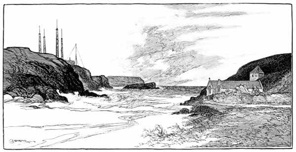
Among the many wrecks at Gunwalloe, the story of what is called the "Dollar Wreck" stands out most prominently. On a stormy night in 1787 a Spanish vessel struck on the cliffs by the church and became a total loss. She had among her cargo a great quantity of silver dollars, computed at the lowest at seventeen tons weight. Ever since that time the story of the "dollar[183] wreck" has been kept alive, not only by tradition, but by scattered coins being occasionally flung upon the beach by the waves, after some exceptionally heavy storm. Gunwalloe, in fact, reeks with well-authenticated stories of dollars. The earliest among these is that of a wonderful dream by a Mrs. Jose, not long after the wreck. She saw in the vision a heavy bag of dollars lying on the sands, and begged her husband to go and secure it. He laughed the idea to scorn, but she persisted and was so in earnest about it that she got up and dressed; and there, sure enough, lay the bag of dollars. But just as she was rejoicing over the find, a number of wreckers happened along this way and seized the treasure for themselves, quarrelling over it until they resorted to bloodshed.
In 1845 a serious attempt was made to secure the buried dollars. The position of the wreck was located, iron stanchions were fixed in the cliffs, and a stone dam built out to enclose the spot, with the intention of pumping out the water, but when those preparations were on the eve of completion a storm came and utterly abolished all the works. Another party of adventurers tried, about 1865, and sank a shaft into which the sea burst, and in 1872 a further effort was made. The scheme of operations was on this occasion altogether different, the idea being to introduce pipes into the water and by powerful pumps to suck up the sand and incidentally the dollars. But storms made short work of that[184] enterprise also. Attempts are even now in progress for the recovery of the treasure that has been waiting over a hundred and twenty years for the finding.
A mysterious wreck, not, however, so mysterious but that it was quite certainly the result of foul play, happened on Gunwalloe sands on April 21st, 1890. The steamship Brankelow, from Cardiff for Cronstadt, with a cargo of 3,000 tons of coal, ran at full speed ahead at midnight on to the sands. Fortunately it was not rough weather at the time, and the crew were got off safely, although it was stated that they were all drunk. The cause of the vessel being driven directly for the land was found to have been a malicious tampering with the compasses by Trades' Union men at Cardiff, and by violent damage done wilfully to it on the voyage. Two magnets had been inserted at Cardiff, by which the needle was wrong to the extent of five points. The Brankelow eventually became embedded in the sand and was a total loss.
Up out of Gunwalloe the road skirts Halzaphron Cliffs, and thence descends to the sands of Loe Bar. At Halzaphron on November 4th, 1807, the ill-fated Susan and Rebecca transport, homeward-bound from Buenos Aires, was wrecked. Of the 180 on board, forty-one were drowned and buried on the cliff-top. H.M.S. Anson took the sands on Loe Bar, December 28th, 1807, and was wrecked, with the loss of her captain and sixty sailors.
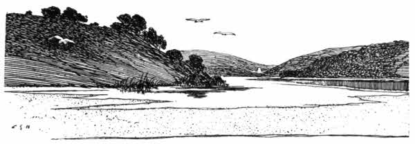
Loe, or properly Looe, Bar is a belt of sand thrown up by the sea, obstructing the outflow of a stream called the Cober, which has too feeble a discharge to clear away the obstruction, causing the valley running two miles and a half inland to Helston to assume the aspect of a lake. In the summer these waters would to some degree percolate through the sand, but in the winter's rains they could not escape so quickly, and consequently the level of Looe Pool would rise by some ten feet or more, a source of some inconvenience. From this arose an ancient custom, by which the corporation of Helston presented the lord of the manor with a leathern purse containing three-halfpence, soliciting permission to cut the sandbar and so permit the water to escape. Permission graciously accorded, workmen were engaged who cut a trench in the sand, and so the stream burst through and regained its summer level. This done, the sea began to choke up the outlet as before, and the process was repeated the next winter.
This quaint old custom is now a thing of the past, it having been of recent years somewhat belatedly realised that a culvert constructed under Looe Bar would effectually drain the waters off, without the periodic cuttings.
But Cornwall being the Cornwall of legends, it was known perfectly well that satanic agency and not natural forces originally produced Looe Bar. Time was, according to these legends, when Helston was a thriving port, with trading vessels sailing up the estuary. It was Tregeagle who did the mischief. Every one in Cornwall has heard of Tregeagle, the dishonest steward, who pervades many legends and lives in many centuries, these stories not being particular in the matter of ten centuries or so. Set to work by St. Petroc at Gunwalloe, his task was to carry sand in sacks across the mouth of the estuary and empty them at Porthleven. Laden with a sack of enormous size, the doomed spirit was wading across when one of the wicked demons, who were always on the watch for him, tripped him up, and the contents of the sack fell into the sea.
Helston is nowadays a quiet, uninteresting town, by no means looking its age. It was in existence at the time of the Norman Conquest, for it appears in Domesday Book as "Henlistone." Of its castle, as likewise of its old-time Parliamentary importance of returning two members, nothing is left; and only once a year does Helston advertise its existence to the world, when its annual Furry, held on May 8th, is duly chronicled[187] in the newspapers. It attracted more attention in 1907, because that was the year of Sir William Treloar, a native of Helston, being Lord Mayor of London; and the sun shone that day on the unwonted spectacle of a Lord Mayor jigging down the principal street of Helston in the Furry Dance:
Such is the chorus of the Furry Song, sung to an immemorially ancient tune. The Furry, which some hold to be a survival of the Roman "Floralia," and is obviously in any case a celebration in honour of spring, is observed with great earnestness and is officially recognised by the Mayor and Corporation of Helston, who take active part in it.
The woods of Penrose descend beautifully to the shares of Looe Pool, and they are exchanged with some regret for the not very interesting cliff-road on to Porthleven, a small harbour town, situated on steep hillsides overlooking a pool. Granite is shipped at the quays, and much yacht- and boat-building is carried on. Inland is Breage, a village lying just off the modern high-road between Helston and Penzance, and suffering from the fact that it has thus been shouldered aside, in the deviation of traffic. You may perceive,[188] in the following lines, the pronunciation of the place-name:
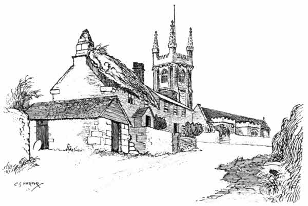
The church is dedicated to a woman-saint, Breaca, one of the band of Irish missionaries who landed at Hayle River. It is a large and fine[189] building. A prominent feature of the interior is a fresco, discovered of late years, representing the Saviour as the benefactor of all callings. The almost nude figure, ten feet high, is crowned. Gouts of blood, like crows' feet or broad-arrow marks in shape, are plentifully distributed over body and limbs, and all around are shown some fifty articles of handicraft, including scythe, rake, saw, trowel, plumber's iron, harp, zither, pitcher, cart, plate, sickle, axe, anchor, anvil, and horseshoe, all connected with the figure by spurts of blood, typifying the blood of Christ crucified sanctifying all callings. The wheel on which the figure stands seems to typify eternity. A similar fresco has already been noted at Poundstock.
The coast from Porthleven offers no exceptional features until after passing Trewavas Head, when the smooth expanse of Praa Sands is seen.
Here the iron barque Noisiel, of Plymouth, was driven ashore in a storm on the night of Friday, August 4th, 1905, and became a total wreck. She was on her way from Cherbourg with 600 tons of armour-plate, and weathered Rinsey Head only to become embayed off Praa Sands. Anchors were let out, but failed to hold on the sandy bottom, and the Noisiel was driven in, broadside on, and the waves speedily broke her back. The crew mostly jumped overboard and struck out for the shore. Two of the nine aboard were drowned. The vessel was a total loss. Some of the armour-plates still remain, half buried in the sand.
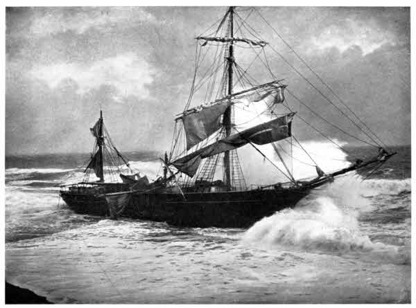
A little way onward and a quarter of a mile[190] inland is the fine old embattled tower of Pengersick Castle. It stands in a pleasant meadow, and is now part of a "farm-place." The tower is of comparatively late date, and seems to have been built in the reign of Henry the Eighth under mysterious circumstances, by a person named Millaton. We need not believe the tale that he had committed a murder in some distant shire, and hid himself here, building the tower for defence, in the event of justice nosing him; for the arrival of a stranger and the hasty building of a defensible tower would at once have attracted undesirable curiosity. Moreover, the masonry is of such exquisite fineness that it is quite evident it was only built at leisure and by the most skilled of craftsmen. Millaton is further said to have lived here with his wife an unhappy existence. They hated one another to extinction; but at last he pretended a reconciliation and planned an elaborate dinner to celebrate the event. After dinner he raised his glass, in a toast, and drained it off. She followed suit. Then said she: "Yours was poisoned, and in three minutes you will be a dead man!"
"So was yours," he rejoined, "and you will be a dead woman in five minutes!"
"No matter for that," replied his wife, "for I shall have two minutes left, in which to kick your dead body!"
Germoc lies just inland from this place. Its church, in a hollow beneath the high-road, is[191] dedicated to St. Germoch, another of the Irish saints. "St. Germoe's Chair," a canopied stone building, stands in the churchyard. The corbel-stones of the south porch are carved with figures of monkeys.
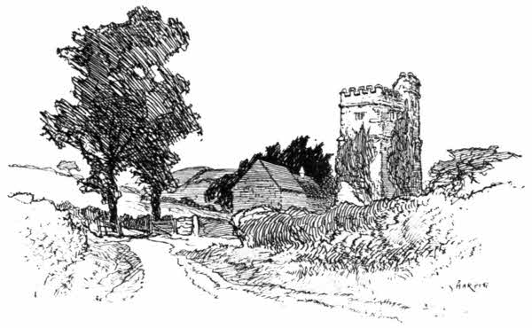
Beyond Pengersick comes Hoe Point, and then Prussia Cove.
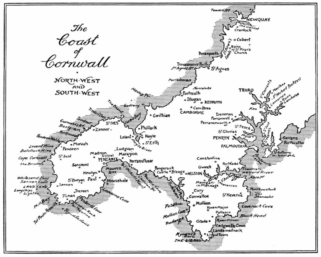
I had for long years wished to come to Prussia Cove, but for one reason and another had always fallen short of it. If you are staying, for example, at Penzance, Prussia Cove is a little beyond your ken; and if Lizard Town or Mullion is your headquarters, then again the place is remote. Therein you perceive at once a survival of its ancient solitary and out-of-the-way situation, which made the place an ideal smugglers' resort. For Prussia Cove is famous above all other places in Cornwall in smuggling annals. Not, mark you, the mere legendary smuggling tales, but sheer matter-of-fact details about the shy industry: details that are so hard to come by; facts for which the historian of smuggling cries aloud, and rarely gets. There are two coves: Prussia Cove, originally named Porth Leah, and Bessie's Cove, separated from one another only by a projecting reef. Bessie, who gave her name to the westerly of the two inlets, was one Bessie Burrow, who kept an inn called the "Kidleywink,"[194] on the cliff-top. "Kidleywink" was not precisely the sign of the house: it appears to have been an old slang Cornish term for a public-house.
The "King of Prussia" who imposed that title upon the erstwhile Porth Leah was not in the first instance Frederick the Great, but John Carter, the eldest of a family of that name who were settled here in the eighteenth century. Among the eight Carter brothers and two sisters, children of one Francis Carter, miner and small farmer, who died in 1784, we hear in detail only of the three brothers, John, Henry, and Charles. Ostensibly all small farmers and fisherfolk, they were really smugglers on an extensive scale; "free-traders" in a bold and open way, greatly respected round about by all the squires and considerable people who knew them. They had, each one of them, the reputation of being honest men who would touch nothing that was not their own, and sold excellent cognac, hollands, and other articles at fair prices. Very well thought-of men, I assure you, with whom some "great men," darkly hinted at, did not disdain to enter into partnership.
John Carter took his nickname of "King of Prussia" from the boyish games of "King of the Castle" in which he and his brothers used to fleet their youth away, and the name stuck to him in after life, as often is the way with great and celebrated personages. Even so, Dickens, the "Boses" (for Moses) of his and his brothers' games, became "Boz"; and Louisa de[195] la Ramée, who as a baby lisped her name, "Ouida," became in after years famous in that signature. So the "King of Prussia," i.e. John Carter, is in good company. In 1770 he built a substantial stone house on the cliffs, and appears to have used it in part as a residence, partly as a store for smuggled goods, and in some degree as an inn (I fear quite unlicensed) known as the "King of Prussia." There he lived until 1806, and from a small battery he had constructed he had the impudence to fire on one occasion upon the Fairy revenue sloop, which had chased a smuggling craft into the cove and had sent in a boat-party. The boat retreated, and notice being given to the collector of customs at Penzance, a military force was despatched to reduce his fort, by taking it in the rear. The smugglers retreated to the "Kidleywink" and the soldiers then left for Penzance, perhaps having demolished Carter's emplacements.
Elsewhere than in Cornwall all these things would have produced bloodshed; but nothing more seems to have been said about the affair, which is delightfully, entirely, and characteristically Cornish; own cousin to Irish escapades, just as the Cornish might, if they cared to do so, even call cousins with the Irish themselves.
Of Charles Carter we hear little, but of Henry—"Captain Harry"—a good deal. He had many adventures; was "wanted" by the excise and fled to America; returned and recommenced adventurous smuggling voyages to Roscoff in[196] Brittany; was made prisoner of war in France, and then settled as agent for his brothers in Roscoff. He had all his life been troubled by the qualms of religious fear, and had in 1789 become converted. In after years he retired and lived in a small way as a farmer in the neighbouring hamlet of Rinsey, where he died in 1829. He wrote his Autobiography, a human document of singular interest, and preached fervently while still actively a smuggler, doubling the parts of saint and sinner in the most extraordinary way; entirely without suspicion of false dealing. He feared God and failed to honour the King, in the important respect of chousing him out of his inland revenue as far as it was possible for him to do. He lived respected and died lamented. I have had occasion to refer to him at length elsewhere[B] and I have no doubt that, according to his lights, he was an entirely honest man.
Prussia Cove at the present time of writing is a place wholly uninteresting. The "King of Prussia's" house was pulled down in 1906, and a new road is on the site of it. Caverns, said, of course, to have been the Carters' storehouses, yawn darkly in the low cliffs, above high-water mark. A barbed-wire squalor abounds along the winding road, and through the garden of an uninviting residence you come down to Bessie's Cove and the dark rocks going sheer into the water; always with "Trespassers will be Prosecuted"[197] staring you in the face from makeshift posts and notice-boards.
Going up out of the region of these singular developments, I met a man raking over some stones recently placed in the road: a good-looking man, with a beard and an indefinable air of being a retired officer of the Royal Navy. He asked what I wanted there, a question I thought impudent; but giving the inoffensive answer that I had been seeking Prussia Cove, the scene of Carter, the smuggler's activities, and could not find Carter's house, he replied that he thought people coming to see the place for that reason was sheer morbidness.
"How so?" I asked.
"Oh!" said he, "all that kind of thing is past and done away with; and besides, I've had the house pulled down; and this is a private road."
"Oh!" I rejoined, "the deuce it is, and you have! Who does it belong to, then?"
"To me; but don't you trouble about that. Go just where you like."
I told him, as nicely as possible, that this was precisely what I intended to do; and then this apparently contradictory but not unamiable person began to dilate upon the want of respect the Cornish had for antiquity. The text for this was the cantankerous nature of two old maiden ladies, who jointly owned an old wayside smithy on the high road between Ashtown and Germoe. When one had agreed to sell it to my informant,[198] if he could obtain her sister's consent, he went to the other sister with the proposition.
"What does my sister say?" she asked.
"She agrees."
"Then I won't!"
And as neither would agree upon anything concerning it, the building was unsold and went tenantless. Thenceforward, it fell into disrepair, and eventually fell down altogether.
Laughing at this ridiculous, but true, story, I went my way. I discovered afterwards that the narrator of it was the locally famous Mr. Behrens, who has purchased the land in and about Prussia Cove and has figured in some bitterly fought right-of-access cases here.
The headland beyond Prussia Cove, forming the eastern horn of Mount's Bay, is Cuddan Point. The meaning of "Cuddan" is said to be dark, or gloomy, but there is nothing exceptionally so in this not very striking point, and the autumn corn-fields render the approach to it even cheerful. But there is nothing gained by toiling to its extremity. The embattled granite house looking over Mount's Bay from hence is known as Acton Castle. From it the coastline can be plainly seen for miles.
Whichever way you go, by cliffs or by the high road, to Perranuthnoe, the way is extremely dull, and Perranuthnoe—now called locally merely "Perran"—is a dull little village. According to a wild legend, it was to the shore by Perranuthnoe that an ancestor of the Trevelyans came on horseback[199] from the submerged land of Lyonesse between Land's End and Scilly. The roaring waters that had engulfed that fabled land and its 140 churches could not keep pace with his marvellous steed.
The scenery has for several miles past been distinctly inferior in interest and beauty to that of Mount's Bay and westward; but as it is the most truistic of truisms that every eye forms its own beauty, there may conceivably be those who can find it otherwise. The proof, or disproof, of the assertion lies with the explorer; he is a poor creature that takes his opinions ready-made.
Regaining the dull high road from Perranuthnoe, the very considerable village of Marazion is met, fringing the highway. There is very much more of Marazion than those who look at it from below would suppose, but as the view from Marazion is infinitely better than any view of it, there need be no curiosity cherished by Penzance visitors looking eastward, as to what is there, immediately over the shoulder of the hill, beyond the Mount. Yet, if there can be no interest in Marazion, there is plenty of the antiquarian kind in its parish church of St. Hilary, over a mile distant, away back in a north-easterly direction, in a lonely situation off the road. It was in 1853 that the body of the church was burnt down, with the exception of the Early English tower, with stone spire, remarkable in Cornwall, where spires are rare. In the rebuilt church, removed[200] from the churchyard, now stands the famous "Constantine stone," inscribed
IMP . CAES . FLAV . VAL . CONSTANTINO . PIO .
CAES . NOB . DIVI . CONSTANTI . PII . AVG . FILIO.
Rendered in full, this, the longest Romano-British inscription in Cornwall, becomes a dedication to the Emperor Constantine the Great. The date has been fixed at A.D. 307. The stone was perhaps a milestone, but there is very much more about the ruling monarch than modern travellers would welcome, and if there was ever a mileage inscription as well, it has wholly disappeared. It will probably be conceded by all that in the matter of milestones, at any rate, we are superior to the Romans. It is a somewhat curious coincidence that a contemporary milestone has in recent years been discovered at Tintagel, bearing an inscription to Licinius, co-ruler with Constantine.
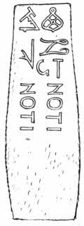
A more mysterious stone exists at St. Hilary. This is the well-known but imperfectly understood "Noti-Noti stone" a seven-foot long block of granite, inscribed with those two words and six[201] not very distinct symbols supposed to represent masonic tools. Some antiquaries are disposed to regard it as the tombstone of an unknown Notus, the son of Notus; but the meaning is quite uncertain.
But to return to Marazion, where another insoluble problem awaits us and wordy warfare continually rages around the derivation of the place-name. It was once alternatively, in the local speech, "Market Jew," and thus arose the popular legend that the Jews anciently established here a market for tin. But it seems reasonable to suppose that "Market Jew" was only a corruption, by people who had almost wholly forgotten the now extinct Cornish language, of the Cornish words marghasiou, signifying "markets." Those "Jews" are supposed to have really been Phœnician traders. A further theory, that the name derived from Margha-ziawn, meaning "market-strand," deserves consideration. But whatever may be the truth, there is no doubt that here was situated a tin-smeltery in very remote times, for in 1849 the ruins of such a building were discovered. The Marazion people styled it, of course, the "Jews' House," and some of the "Jews' House tin" found there is to be seen in the museum at Penzance. A great deal of ingenuity, unsupported by any real evidence, has been employed in attempts to solve the meaning of the place-name, and it has been put forward that the spot was originally inhabited by a colony of Jews, who handed down[202] the bitterness of their exile by styling it "Mara-Zion," i.e. "Bitter Zion." Still another theory has been advanced, namely that St. Michael's Mount was the original Marazion, from the Hebrew, "marath-aiyin," "the landmark"; the Mount being the most prominent object for many miles out to sea. So it will be perceived that there is no lack of choice.
Coming down the long street of Marazion to the shores of Mount's Bay, the most remarkable scene in Cornwall opens out before you. There stretch the flat curving shores of the bay, fringed with sands, but for the most part solitary, with the last miles of the Great Western Railway running along the levels, just above high-water mark; and Penzance town showing white in the distance, three miles away. There are more beautiful bays in Cornwall, and better sands, and repose rather than ruggedness is the note of the scene; but the great distinguishing feature of Mount's Bay—the feature that gives the bay its name—is St. Michael's Mount, rising majestically in the sea off Marazion, half a mile distant from the mainland, with its castle and priory, now the residence of Lord St. Levan, cresting the rocky pyramid with a coronet of towers and pinnacles. St. Michael's Mount is an inspiring sight, whether you are in expectation of seeing it or not. But nothing is unexpected in the way of scenery nowadays. You know what lies round every bend of the road. If we could only recapture the unexpected, how fine that would be!
But, whether you first see St. Michael's Mount at high tide, when it is an island, or at the ebb, when it is joined to the land by half a mile of slimy, seaweedy causeway, it is grand.
At the same time, I like best to think of St. Michael's Mount as I first saw it, on first coming into Cornwall. I had come by train from Paddington, and the day had long given place to night. The weary train pulled up for the ticket-taking at Marazion Road, and in the quiet interval the wind boomed about the station buildings, and the wash of the waves could be plainly heard on the sands. Eagerly one looked out upon the night for a possible glimpse of the famous Mount, and there indeed, guided by a twinkling light so high that it looked like a star, the eye saw vaguely a monstrous pyramidal bulk, a something darker than the surrounding darkness. "It is the Mount," I said, and a thrill of romantic delight possessed me.
Well, you know, St. Michael's Mount is 231 feet in height. It is no mean altitude, and the rise is so sharp up its sides that one need not be of the Falstaff kind, fat and scant of breath, to find the climbing it something tiring on a hot day. But St. Michael's Mount the next morning was a less impressive object than that darkling glimpse gave warranty for. It was inevitable. Just as the impression overnight had been finer than expected, so the reality suffered. But ordinarily St. Michael's Mount does not disappoint; always with this proviso, that you do not see its bigger[204] brother, Mont St. Michel, on the coast of Normandy, first.
An ingenious eighteenth-century writer remarked of St. Michael's Mount that "it seemed emblematic of a well-ordered State, its base being devoted to Trade and Commerce, its sides to the service of the country, and its summit to the glory of God." By "trade and commerce" he indicated the little village and harbour at the foot of the Mount, and the reference to the glory of God was of course an allusion to the remains of the Abbey, but what he could have meant by "the service of the country" I cannot tell, unless by any chance it was an allusion to the ineffectual popgun battery mounted on the crags.
The history of St. Michael's Mount begins like most history, in uncertainties. It is supposed—and much criticism has not destroyed the supposition—that it is the place called Iktis, referred to by Posidonius, who travelled in Britain during the first century before the Christian era. He spoke of the "little islands called Cassiterides, lying off the coast of Iberia," from which much tin was obtained, and then mentioned the isle of Iktis, in Britain. It is quite clear, therefore, that the supposition that by the Cassiterides he meant the Scilly Islands, or any islands in Britain, must be baseless. They were what we know as the Balearic Islands, off the coast of Spain, the Iberia of the ancients. But in other writers we find the Cassiterides to indicate tin islands in general.
Diodorus Siculus, who was contemporary with Julius Cæsar, and wrote a Universal History, a considerable undertaking for one man even then, appears to have copied a good many of the statements made by Posidonius, in addition to having described places seen in his own travels. He is not always regarded as a reliable authority, but there seems no reason to doubt the essential truth of his statements. Referring to "Belerion," otherwise Cornwall, he says: "The inhabitants of that extremity of Britain both excel in hospitality and also, by reason of their intercourse with foreign merchants, are civilised in their mode of life. These people prepare the tin, working very skilfully the earth which produces it. The ground is rocky, but has in it earthy veins, the produce of which is wrought down and melted and purified. Then, when they have cast it in the form of dice-shaped cubes, they carry it into a certain island adjoining Britain, and called Iktis. For, during the recess of the tide, the intervening space is left dry, and they carry over abundance of tin to this place in their carts. And there is something peculiar in the islands of these parts lying between Europe and Britain, for at the full tide the intervening passage being overflowed, they appear islands, but when the sea retires, a large space is left dry, and they are seen as peninsulas. From them the merchants purchase the tin of the natives and transport it into Gaul, and finally, travelling through Gaul on foot, in about thirty[206] days they bring their burdens on horses to the mouth of the river Rhone."
That Diodorus should refer to "islands," rather than the one island that becomes a peninsula at low water, has been held as a proof that he knew nothing at first hand about this coast, but it may well be that in the changes known to have taken place here, other islands have disappeared. Quite apart from the fantastic legends of the lost land of Lyonesse between Scilly and the Land's End, where the lone waters, empty except for a few intervening reefs, now roll, it is quite certain that at some early period what is now Mount's Bay was a forest. Hunt, in his "Popular Romances of the West of England," tells us—not romancing: "I have passed in a boat from St. Michael's Mount to Penzance on a summer day, when the waters were very clear and the tide low, and seen the black masses of trees in the white sands, extending far out into the bay. On one occasion, while I was at school at Penzance, after a violent equinoctial gale, large trunks of trees were thrown up on the shore, just beyond Chyandour, and then with the other boys I went at the lowest of the tide, far out over the sands, and saw scores of trees embedded in the sands. We gathered nuts—they were beech-nuts—and leaves in abundance." I, too, have found, cast upon the shore, traces of this submarine forest.
Now it is a curious thing, in this connection, that, among the various names by which St. Michael's Mount has been known, including the[207] earliest of all, "Din-Sûl," or the "Fortress of the Sun," is that of Carregloose-in-coes, which, spelled in slightly different ways, means the Hoar Rock (that is to say the grey rock) in the Wood. "Coes" appears to have been a form of the early British "coed," for woodland. The town of Cowes, for example, in the Isle of Wight, takes its name from the woodlands that once occupied its site. St. Michael's Mount was once, therefore, a part of the mainland, and if we observe, still further, that the Chapel Rock on the approach to it, and the great pyramidal form of the Mount itself are hard greenstone and granite, resting upon slate and clay, we shall see exactly why they remain whence all other land has disappeared.
That foreigners, in times long before the Romans came to Britain, were accustomed to resort to this neighbourhood for tin has already been shown, and that they were Phœnicians is certain. Many people dismiss the Phœnicians as a people almost as mythical as the phœnix itself, but they were the earliest maritime traders. They were the people who founded Carthage, and they penetrated to the ends of the known world. Also they were of a strongly marked Semitic, or Jewish type; and thus ancient Cornish traditions about "the Jews" are well based on facts.
As "St. Michael's" Mount the island became early known. At some uncertain time the Archangel is said to have appeared here to some hermits, and the place was therefore already holy when St. Keyne came from Ireland in A.D. 490[208] and visited it. Edward the Confessor, in the eleventh century, granted St. Michael's Mount to the Benedictine Abbey of Mont St. Michel in Normandy, and until the reign of Henry the Fifth it remained the property of that Abbey, with a priory established on its summit. It was then transferred to the Abbey of Sion, in Middlesex.
The Abbey of Mont St. Michel and the Priory of St. Michael's Mount were fortresses, as well as religious establishments. The monks had fortified themselves for their own protection, and the strongholds seemed so useful to men of strife that we early find St. Michael's Mount seized and held by them when trouble was brewing. Thus, when Richard Lion-heart was a prisoner abroad, one Henry de Pomeroy got possession of the Mount on behalf of John. But when Richard, contrary from all reasonable expectation, returned, the position became untenable, the garrison yielded, and Pomeroy opened one of his veins and bled himself to death; a more excellent way than reserving himself for the picturesque and long-drawn agonies that in those times were the penalty of high treason.
A more desperate affair was that of 1471, when the Earl of Oxford, and a party of fugitives from the Yorkist crowning mercy at Barnet, fled from the vengeance of Edward the Fourth and took possession of the Mount. They came as pilgrims. You may quite easily picture them coming to the shore, pausing a moment at the[209] Chapel Rock, then with a chapel on it; and thence walking the causeway to the Mount, kissing the relics at the foot of it, praying at the two wayside crosses up its steep sides and then admitted to the Priory itself, where, with drawn swords, produced from beneath their travel-stained pilgrims' garb, they soon made themselves masters of the place. Sir John Arundell, sheriff of Cornwall, was sent to dislodge them, and was after several attacks slain on the sands. According to the received account, Edward the Fourth pardoned the Earl of Oxford, on account of his so gallantly defending himself here; but we may well suppose that he "pardoned" him because he could not by other means dislodge this valorous rebel.
The Priory became a sanctuary for Lady Catherine Gordon, wife of Perkin Warbeck, in the time of Henry the Seventh, but sanctuaries were generally violated, and this was no exception. She was dragged out and sent to London.
During the west-country rebellion against the reformed religion in 1549, the Priory having by that time been dissolved and the property granted to the Arundells of Lanherne, Humphrey Arundell held it for the rebels. It was taken and retaken in the fights that followed, and Arundell at last was captured and put to death. The last warlike operations at St. Michael's Mount were the defence by the Royalist, Sir Francis Basset, and the capture by Colonel Hammond, on behalf of the Parliament. Since[210] 1660 it has been the property of the St. Aubyn family.
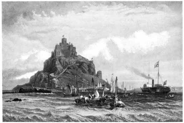
The village at the foot of the Mount, with its little harbour, occupies a humble feudal situation beneath the castle of my Lord St. Levan. If you would seek revived mediævalism in a democratic age, then St. Michael's Mount is the place to find it, for Lord St. Levan maintains a body of gorgeously liveried boatmen to row him across, to and from his island hold; and nowadays, instead of being free to ramble about the craggy sides of the Mount, the stranger must resign himself to a guide. Whether wanton mischief on the part of holiday-makers, or the scattering of sandwich-papers, has aught to do with this changed condition of affairs, or whether it is merely due to the increased consideration the St. Aubyns cherish for themselves since the barony of St. Levan was conferred upon the family in 1887, I will not pretend to say.
The interior of the castellated residence is of somewhat varied interest. The chapel, although originally of Perpendicular architecture, was so altered in the "restoration" of 1826 that it is now merely a melancholy example of what was in those days considered to be Gothic. It is chill and bare and quite without any feature of note, with the exception of one thing that, being just a hole in the floor, can scarce be described as a "feature." This is an oubliette, discovered during the works of 1826.
Romantic novelists have been largely responsible[211] for a general indifference to the very real mysteries and tragedies of ancient buildings, and the public, unable to distinguish between fact and fiction, have agreed to look upon everything out of the common as fiction. Yet here, the workmen of some eighty years ago, removing the old woodwork, discovered a walled-up door in the south wall, and, opening it, a narrow flight of stone steps was revealed, leading down into a grim stone cell, six feet square, without any window or other opening than the door by which they had entered. They were horrified by stumbling in the darkness of that dreadful place upon what proved to be the skeleton of a man of extraordinary height. Who that unfortunate wretch was, flung into this living tomb, to be conveniently "forgotten" and to die of starvation, has never been discovered. The appalling cynicism that constructed this particular example of an oubliette beneath the chapel floor is worthy of remark. While the doomed man lay there, above him the pious castellan and his fellow-villains were praising God.
The Chevy Chase Hall, a room formerly the refectory of the Priory, but remodelled in the seventeenth century, is a small apartment with timber roof. The name now given it refers to a curious plaster frieze representing hunting scenes. The Tower is the oldest portion of the buildings, rising to a total height of 250 feet from the sea. A projecting granite framework, looking out from the south-west angle of the battlements, is known[212] popularly as "St. Michael's Chair." It is really the frame of an ancient lantern, beacon, or cresset, lighted in former times to guide the fishing-boats safely into harbour; but a legend has obtained currency that any sweetheart, or husband, or wife, first taking a seat in it will be "master for life." It is not a difficult matter to edge into the "chair," but it requires rather more agility, and a cool head, to return. In spite of this, very many women do perform the act; which shows at once their superstition and the real keenness they have to obtain the upper hand. But at the same time, it may not inaptly be supposed that, to any contemplative and philosophical man, the spectacle of his chosen one attempting the hazardous feat will be something in the nature of a danger-signal. If the loved one be now ready to risk a broken neck for this supposed advantage, what, he might suppose, will be his chance of happiness?
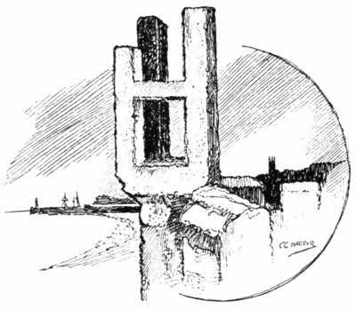
The church-tower peeping over the hill-top on the right hand, as you proceed along the dull flat road to Penzance is that of Ludgvan, and the marshes are those of Ludgvan Leaze. Ludgvan church, although an extremely blue-mouldy edifice, is not without interest and has a particularly good tower. Moreover, there are tablets in it to the memory of the Davy family, of whom the celebrated Sir Humphry, born at Penzance in 1778, is the most notable. Dr. Borlase, who may be described as the father of Cornish archæology, was rector here for fifty-two years, and died in 1772. A well in Ludgvan has, by ancient tradition, the curious property of insuring whosoever drinks of its water from being hanged. It may be testimony to the law-abiding character of the Ludgvan people that they do not set much store by the virtues of their well; but at the same time they are somewhat sly humorists, as perhaps any stranger not duly forewarned may discover, on asking if there is anything of interest in the place. "Oh! yes," you are likely to hear; and then comes the story of the well and an urgent invitation to drink of it, by way of insurance. The origin of this legend is altogether unknown, but may be an entirely distorted recollection of some special property connected with a holy well of St. Lidgean, one of the numerous Irish saints of Cornwall, whose name survives in that of the village.
Behind Ludgvan, rising to a height of 765 feet, is the hill of Castell-an-Dinas, not perhaps so much[214] a hill as a culmination of the downs stretching between the north coast of Cornwall and the south, a distance from sea to sea of only five miles between Marazion and Hayle, and between Penzance and St. Ives of only seven miles. From the hill-top both the Bristol and the English Channels can at once be seen. Castell-an-Dinas is a prehistoric camp, with a modern roughly constructed stone tower, locally known as "Roger's Tower," in its midst. It seems to have been built about the time when one "J. H., aged 63" was buried, in 1823. This person, together with three others of his family who died in 1812, lie within a little walled enclosure on the hillside. He had some dispute with the vicar of Gulval, and so refused to allow any of his family to be buried in the churchyard. Something of a key to his sentiments will be found in the inscriptions within the enclosure: "Custom is the idol of fools," and "Virtue only consecrates this ground."
As Penzance is approached, Gulval appears on the right, its church-tower glimpsed from amid its surrounding trees. The flat fields are devoted to the cultivation of broccoli, and early vegetables, fruits, and flowers for the London market. The saint whose name is hidden in that of Gulval is said to be Wulvella, a Welshwoman, sister of St. Pol de Leon to whom the church of Paul near Mousehole, is dedicated. It is also said to indicate St. Godwald, a sixth-century Welsh bishop-hermit.
Gulval is one of the prettiest churchyards in[215] Cornwall, beautiful with subtropical plants and pampas grass. Behind Gulval, on the little Trevaylor brook, is Bleu Bridge, a footbridge only remarkable for a tall granite pillar at one end, inscribed lengthways QVENATAVCI ICDINVI FILIVS.
Penzance is reached past the fringe of houses called Chyandour, on the level, approaching the railway station, where the Trevaylor brook enters the sea. "Chyandour" means "the house by the water," and probably marks the site of a prehistoric settlement of tin-streamers. Tin-smelting works are now situated on the brook.
Penzance is 279-1/2 miles from Hyde Park Corner, London, by road, and 305-1/4 miles by Great Western Railway. Until some ten years ago, when the Great Western adopted a shorter route, and cut off some of the generous curves with which Brunel had endowed the Cornish portion of the line, the mileage was 328. The name, originally spelled "Pen Sans," and still pronounced so, means Holy Head, or Headland, but there is some uncertainty as to the precise significance. A chapel dedicated to St. Anthony once stood on the bold bluff by the harbour, where the not very satisfactory church of St. Mary, built in 1834, is now situated; and it may have been from this sainted headland that the place-name derived. But for long centuries the Holy Head has been thought that of St. John the Baptist, and when in 1614 Penzance adopted a borough seal, it was the head of the Baptist on a charger they selected for the town's device. The old springtime festival,[217] held from distant centuries in the streets of the town, takes place on the eve of St. John the Baptist, and on the eve of St. Peter.
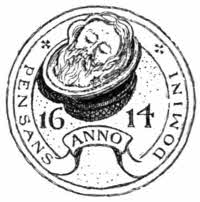
Penzance is by no means a parasite seaside town, existing only for and on visitors. It is a busy market-town all the year round, with a considerable harbour. The long straight thoroughfare of Market Jew Street, rising steadily to the Market House, which is the centre of Penzance, is a street of shops. The Market House is a rather gloomy granite building, with a cupola that bulks out conspicuously in distant views and stands for Penzance. Indeed, in reminiscences of the place you do not so much as think of the sea-front as of this extraordinary municipal building, that shows the ideas of Ionic architecture prevailing in 1837, the time when it was built. The Market House is, in short, the quintessence of Penzance, and that is the reason why I have included an illustration of it. Be quite sure it is not for its beauty, or for the justness of its proportions, nor even for the white marble statue of Sir Humphry Davy that has stood since 1872 in front of it, on the site of the house in which he was born. He is Penzance's greatest son, and was born here in 1778. Philosopher and chemist, and inventor of the miner's safety-lamp, I dare to believe him a greater and a more practical man than Sir Isaac[218] Newton. Davy died at Geneva in 1829, and was buried there.
Davy at any rate was a man far more practical than the wiseacres who built the Market House, blocking up the middle of the street just where it is at its busiest, and where traffic pours in from confluent thoroughfares.
The ancient market-cross stood until recently at its western end.
Penzance market-cross stood until 1829 in the Green Market, but was in that year removed to the corner of a house in North Street. When that house was demolished, in or about 1868, the cross was again moved on, finding a home, appropriately enough, in the west wall of the Market House. There it remained, its inscribed side hidden against the wall, for some thirty years. Loungers leaned lazy shoulders against it, butchers rested sides of meat on it, and it grew, about the head of it, a greasy object. And then some one, in July 1899, hit upon the brilliant idea of removing the cross and cleaning it, and placing it upon a nice new base in the Morrab Gardens, with a metal plate setting forth the year when these things were done. And there it is dripped upon by trees, and although granite is a hard and obstinate substance, yet we have it upon unimpeachable authority that "constant dropping will wear away a stone," and certainly the cross was better preserved by its greasy daily experiences at the back of the Market House than in its present dank situation.
Although it is in shape and size (5 feet 6 inches high), just a typical Cornish cross, it is one of the most interesting: the front of it curiously incised with little holes, while the back, hitherto hidden, bears an inscription, which has been read as "Hic procumbunt corpora Piorum."
Beyond this hub of Penzance is the more residential part, Alverton; and Alverton itself[220] is of two quite distinct periods. Firstly, the delightfully quaint and cosy-looking Regency bay-fronted and plaster-faced villas by the Morrab Gardens, and then the modern stone-built residential suburb about Morrab Road.
The sea-front is quite casual. It boasts a hotel or two and some more early Regency cottages, and the broad asphalted parade, raised by a few feet above the narrow beach, commands widespread views over the shallow waters of Mount's Bay; but it is not thrust forward by Penzance as a great feature. It just happened, so to speak.
Almost coterminous with Penzance is Newlyn, on the west. The name of Newlyn does not indicate "new lake," or indeed, anything new, but derives, like that of Newlyn near Newquay, from St. Newlyna, or Neulwyn, a Breton maiden, who was murdered by a suitor whose love she did not requite. Pontivy Noyala, in Brittany, owes the second half of its name to her.
Newlyn is, of course, a busy fisher-village, and has now got a harbour of its own. They are wilful people at Newlyn, or were, as the following story will show.
Tithe of fish, as of other things, was claimed of old by, and paid to, the clergy, but that is now a thing of the past. The sturdy fisher-folk of Newlyn were among the earliest to resist it. They banded themselves together, painted "No Tithe" on a board which they nailed to a wall, to keep their determination hot, took especial[221] care of their fish-offal, to the sorrow of the gulls, and waited. It was not long before the lawyer came to distrain for tithe. He got it, "in kind." The contents—extremely unsavoury—of various offal-tubs were poured over him.
About the year 1885 Newlyn began to be genuinely astonished. Now your true Cornishman—and they are all Cornishmen and true who live at Newlyn—is not easily astonished; that violent rippling of the mental surface is difficult to accomplish here. So the thing that thus surprised this fisher-town must have been, and was, remarkable. It was nothing less than the discovery of the artistic possibilities of the place. Every one who knew Newlyn knew well enough that it was picturesque: guide-books had told them so, and those who could not discover it for themselves, and knew only of the fishy smells that pervaded the seashore and the crooked alleys, would read to one another in those guide-books, "The village is picturesque," and then perceive that this was indeed the case. But although J. C. Hook had for many years painted Cornish seas, no one had yet painted the life of this place, or of St. Ives, or that of any other among the many characteristic villages of these coasts. Cornish landscapes and seascapes, yes; but the everyday existence of the folk who peopled them had not been revealed to art as a thing well worthy of treatment, alike for its drawing and colour, and for its mingled pathos, nobility, and the virtue of long endurance.
The Newlyners, be sure of that, did not suspect themselves out of the common. Visitors to Penzance discovered Newlyn as a curious place worth a morning or an afternoon's exploration, but not a place where the polite might stay. That is to say, here is no up-to-date hotel, and the folk are, or were, primitive. Their natural politeness cannot be in question.
Then Mr. Stanhope Forbes, who has since attained to the dignity of "R.A.," found Newlyn and perceived its artistic value. He and Frank Bramley were the founders of what has become famous as the "Newlyn School." They painted fish sales, domestic auctions, village weddings, Christmas-Eve in Penzance, "Hopeless Dawn" in a fisherman's cottage when the fishing-fleet has been storm-tossed, and many another episode in the life of the people, and quite early their success brought about the large artist colonies that have since settled, not only here, but at St. Ives, and Polperro, and many another old-world waterside village in Cornwall, their practice that of the pioneers of Newlyn; for although there are different "schools" of fish, pilchards, mackerel, and other, in Cornish seas, there is only one "school" artistic. Now it is a strange thing that although the Newlyn School is essentially English (or perhaps we should say Cornish) in its subjects, its methods are distinctly French in their origin.
It is nothing that the Newlyn School is that of open-air painting, for the Pre-Raphaelites began[223] to discredit the mere studio-painter so far back as 1848; but the peculiarly broad, frank technique, honestly, and perhaps also ostentatiously, displaying the brush work by which its results are obtained, is a distinct importation from the French schools. It has certainly taken root and thrived well here. This purely technical innovation, owing something, but not much, to the impressionists, was applied to subjects that had rarely ever been selected before, and with equal frankness, just as they presented themselves; so that it became with some critics a reproach to the Newlyners that they had no selective qualities, and no power of composition, and merely rendered what they saw, as crudely as a photograph. To which these new men might have replied that a striving after mere prettiness was not their object, but that they did indeed endeavour to render those things they saw around them, just as they were.
That everyday working clothes and sea kit were worth painting was a surprise to the men of Newlyn, and the especial beauty of a weathered and well-worn dress was not easily revealed to the Newlyn women and girls. Many an artist, here and elsewhere, has been sadly put about by the fishermen who, having vanished for a while to "clean themselves and get a bit tidy-like" have come back in some go-to-meeting or other impossible garb; while legends that painters personally disliked cleanliness and order arose from the despair of some at the seeming impossibility of explaining that, artistically speaking, Sunday[224] frocks, tidy hair, and clean pinners were not improvements upon the usual week-day dishevellment, and that to be bare-legged was sometimes better than to be wearing nice new boots. But to-day every one in Newlyn knows much better than that; all have got some idea of artistic terms and slang, and scarce a man among the blue-jerseyed lot who lean against the railings on the cliff-top between going out to the fishing-grounds and digging the potato-patch but has sat as a model or has watched the progress of a canvas.
In these latter days there is added to the traditional Newlyn industries a newer occupation, which also bids to become in course of time traditional. It is that of posing for artists. Be sure that if you loiter here with anything suspiciously like a sketch-book, and wear something of an artistic appearance, you will be hailed by expectant models.
"Would ye like me to sit for 'ee?"
"You're too tidy, I'm afraid," you perhaps say at a venture; but there is no use in that, for it is immediately met with: "All right, sir; I knows what 'ee want. I'll just goo inside an' put on me old hat an' coat."
He does so, and produces articles battered and covered with the dust and mellow tints of age, and hung, like bottles of old port, with cobwebs.
That part of Mount's Bay in which Newlyn is situated is known as Gwavas Lake. Many[225] years ago, the enterprise and daring of the Cornish miners, who had located a vein of tin, caused the opening of a novel kind of mine at the distance of a quarter of a mile from the shore. The Werra Mine shaft was sunk in an iron caisson to a depth of a hundred feet, and tin to the value of £3,000 was dug out before the courage of the adventurers gave way and the speculation was abandoned.
High on the hillside above and beyond Newlyn stands Paul, less a village than a church presiding over a few farms: all very Irish-looking.
I do not think many people would spend much time in considering Paul as the site for a desirable residence. It stands in too lofty and exposed a situation for that: on an upland bracing enough in summer, but in winter a very playground of the winds. Few trees grow on those heights, and thus the tall tower of Paul church is not in the least hindered in its function of standing there as a landmark. From most points of view you perceive it, rising gauntly against the sky-line, in apparent solitude: the bulky tower of a church that must always have been larger than needful for its surroundings.
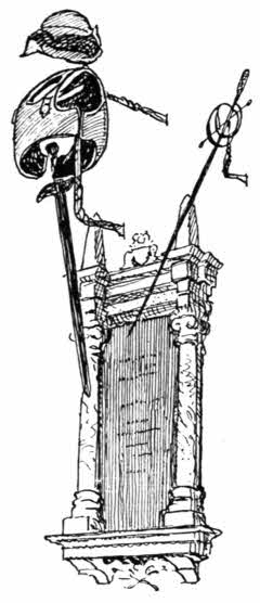
No one ever thinks of adding "Saint" to the name of Paul, although the place derives its name from a saint: not the apostle Paul, to whom the church was long ago re-dedicated, but to St. Pol de Leon, a distinguished sixth-century Welsh missionary, who settled at that place in Brittany. The church contains a monument[226] to Sir William Godolphin, dated 1681, and hung with his helmet, breastplate, sword, and rapier; but Paul is famed for a much more humble person: the well-known Dolly Pentreath, who, according to the monument erected here to her in 1860, by Prince Louis Lucien Bonaparte, was the last person who spoke the Cornish language. The interest of this scion of the Bonapartes in Dolly Pentreath was that of a student of languages. Other Bonapartes might dream of glory and Empire; he was a philologist, and took a great deal more interest in the memory of this old fish-wife, who died in 1778 and spoke a dying tongue, than in marshals and generals. According to surviving tales of the old woman, she was a very unamiable, cross-grained old person; and it has been left to later investigators to throw doubt upon this accidental fame. No one, of course, speaks Cornish now, but phrases and odd words of that extinct tongue are still current. I have heard—it was twenty years ago, at Mousehole—a mother calling her child indoors at dusk, "or[227] else the bukkha-dhu will have you"; and "bukkha-dhu," which means "black spirit," is both Cornish and superstition.
A specimen of Cornish on the monument to Dolly Pentreath renders the ordinary person quite reconciled to its being an extinct language. Here it is: the twentieth chapter of Exodus, twelfth verse:
"Gwra perthi de taz ha de mam: mal de dythiow bethenz hyr war an tyr neb an Arleth de Dew ryes Dees."
That is to say:
"Honour thy father and thy mother: that thy days may be long upon the land which the Lord thy God giveth thee."
No one knows how Mousehole, the fisher-village beyond Newlyn, got its name. It lies, it is true, in a hole, but so also do most of these villages; and there is also a cavern along the shore, beyond the little harbour, but it is not supposed that it originated the name. Mousehole is a smelly place, but its smells are neither so many nor so penetrating as they used to be. It is remarkable for the sturdy old granite manor-house of the Keigwin family in its very midst, with very boldly projecting porch. For many years past it has been the "Keigwin Arms" inn. Some history attaches to it, for it was here, in front of his own house, that Jenkin Keigwin was killed in 1595, struck down by a cannon-ball fired by the Spaniards in their raid of that year upon Penzance, Newlyn, and Mousehole.
St. Clement's Island, just off Mousehole, had once a chapel on its inhospitable rocks.
The cliff-paths from Mousehole for Lamorna Cove trend inland through the farm-place of Kemyll Wartha, and then descend steeply to the landward end of the deeply indented little bay, where the sea comes surging in amid great granite boulders, to the grassy and rushy fringe of a brook hurrying down from a valley dense with trees and undergrowth. Commercial activities, in the way of granite quarrying, are evident on the cliffs at Lamorna.
On the way inland from Lamorna Cove to Boleit, lying a little on the right hand in the picturesque valley, stands the deserted old manor-house of Trewoofe, once the seat of the Levelis family, extinct in 1671. The ruined rooms and the curiously and richly decorated doorway date from about a hundred and thirty years earlier, when it is quite evident that the Levelis family were alike prosperous and filled with the conviction that they would continue in the land for many more generations. They traced their descent from Norman times, and their doings are still the theme of many legends in Penwith. But nothing became that long-descended family more than the charming epitaph on the last of their race, written by some unknown hand, still to be read in the neighbouring great church of St. Buryan:
"Here lyes the Body of Arthur Leuelis, of Trewoof, in this Parish, Esq., who departed this life the 2th day of May, Anno Dom. 1671.
Half a mile from Trewoofe, crossing the Lamorna Brook and proceeding along the Trereen road, is the very small hamlet of Boleit, the "place of slaughter"; traditionally the place where Athelstan finally overthrew the Cornish, A.D. 936, in a great battle. Certainly the mounds and the standing-stones here and in the immediate vicinity make it quite evident that some great event has happened here. The nearest rude stone pillar bears the name "Goon Rith," which means the "Red Downs," and is really the name belonging to the surrounding hill-sides. A "fogou," or underground passage, a hiding-hole for prehistoric people, exists near at hand, in a very wilderness of undergrowth and brambles, and still justifies the forgotten builders of it by being extremely difficult to find. It is about thirty-five feet long, with another passage leading at right angles out of it. This retreat is formed of granite slabs inclining inward, and roofed by other slabs, covered with turf.
Two tall granite pillars stand to the right of the road at Boleit. They are known as "the Pipers," and are connected in legend with the prehistoric stone circle three hundred feet distant[230] at Rosemoddress, known as the "Merry Maidens," or formerly the "Dawnz Maen," the "dancing stones." Another circle of "Merry Maidens" stands at Boscawen-Ûn, two miles distant, on the other side of St. Buryan. The legend attached to them says they were a party of girls turned to stone as a punishment for dancing on Sunday, together with the two pipers who played to them.
I well remember, a good many years ago, seeking this circle of nineteen stones, at the conclusion of a day spent at Land's End, and on the return to Penzance. I floundered into a boggy bottom at eventide, on the way to it, and emerged from the sloughs only by the directions of a farmer who happened to be working in his fields not far away. It was an eerie place to stumble into at the sunset hour, and it was a still more eerie experience amid these stones to meet a woman who might have been, from appearance and manner, one of the weird sisters in Macbeth. She mumbled incomprehensible things, and stared wildly, and seemed in every way a fitting inhabitant of that place at that hour. I found afterwards she was really a harmless madwoman of that neighbourhood, who wandered aimlessly about.
"Skeers some folk, she does," said a neighbouring farmer, "starring at 'n like a conger, and sayin' things nobody can't make out nohow."
The coast-path leads past Boscawen Point and then trends slightly inland, and descends to the charming little St. Loy's Cove, through some[231] woods. In another mile the track opens out a view of the wooded valley ending in Penberth Cove, furnished with its stream as usual, and with two or three primitive cottages of picturesque build, occupied by fishermen. The shore at Penberth is paved with great blocks of granite; not naturally paved, but laid there at some period by human hands, with considerable pains, and for no apparent advantage.
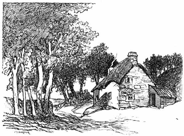
The way round by the cliffs direct to the headland of Trereen Dinas, where the famous Logan Rock is situated, is scarcely to be ventured. The best way is up the delightful valley of Penberth, past the mill-house, and so round to the left by the "Logan Rock Inn," in the hamlet of Trereen.
It is half a mile from the stony hamlet of Trereen to the Logan Rock, which stands up against the skyline towards the seaward extremity of that magnificently rugged headland, Trereen Dinas. The narrow neck of this peninsula is deeply scored across with a ditch and heaped with a parallel wall of stones and earth, the defensive works of a long-forgotten people, but it is not so much to see these vestiges of insecure prehistoric times, nor even to view the fine scenery, that a continual stream of visitors comes hither all the summer. It is the Logan Rock that attracts them. This rock, one of the many "logans" in Cornwall which are so balanced or pivoted by the natural weathering of ages that they "log," or oscillate slightly, to a vigorous push, is the most famous of its kind, both for its own self and for the circumstances of its later history. It is an irregular cube of granite weighing sixty tons, some say ninety, poised upon a great mass of fantastic rocks, curiously jointed, and overlooking the sea from a height of about two hundred feet. Borlase, writing in his "Antiquities of Cornwall," 1754, declared it to be "morally impossible that any lever, or indeed force, however employed in a mechanical way, can remove it from its present situation." The same view was held by the country people, and so worked upon Lieutenant Goldsmith of H.M.S. cutter Nimble, cruising off-shore on the look-out for smugglers, that he determined to overthrow the stone and thus prove himself a fellow clever beyond all expectation. So, on April 8th, 1824 (it would have been more appropriately done on the 1st), he landed with a boat's crew of nine men, and with handspikes and much personal exertion did succeed in performing that which Borlase and the united voice of the countryside had declared to be impossible. He overthrew the Logan Rock, and had it not become lodged in a cleft, it must have descended into the sea and been lost for ever. He did, incidentally, a great deal more. The wanton act of folly rightly aroused Cornwall to furious indignation, and he went in great personal danger for awhile. If such an ass as he had been lynched it would have been a salutary warning to others. The Admiralty could not ignore the anger that had been aroused, and speedily intimated to Lieutenant Goldsmith that he must either replace the rock or lose his commission. The tackle for the purpose was lent to him from the dockyard at Devonport, and after much preparation and the construction of elaborate staging, the rock was returned to its place on November 2nd, in the presence of a vast crowd assembled to witness it. The work was costly beyond the means of a lieutenant, and was carried through by subscription. Goldsmith's career was ruined by this act of folly, and he died in 1841, without promotion. The "logging" of the rock was quite destroyed and, although it appears still to be delicately poised, it requires great exertion to induce even the suspicion of a tremor.
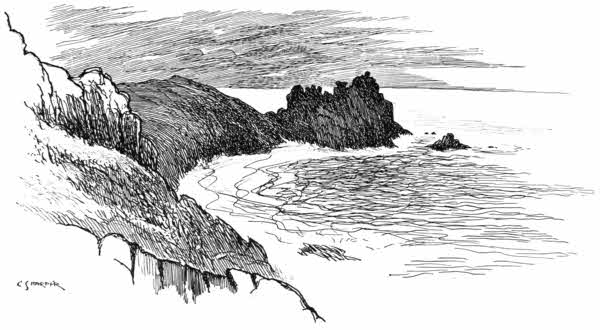
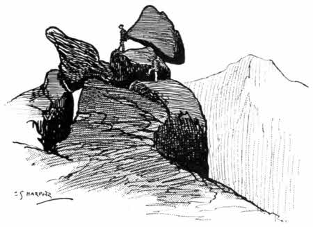
There[236] is an excellent good climb for the young and active and the reckless down from this grim granite promontory of Trereen Dinas to an exquisitely secluded sandy cove, and thence up again, and over more tumbled hummocks of the all-pervading granite, to the sandy and shelly shore of Porthcurno, properly Porth Kernow, the "Port of Cornwall."
But halt awhile! secluded, did I say that sandy cove to be? So it may seem at certain hours of the day, when the young barbarians of the Eastern Telegraph Company are in office, at work; but even then, when this yellow strand under Trereen Dinas is indeed solitary, the observant explorer, who thinks himself one of the very few who ever scale these rocks and pace these selvedges of the sea, will be startled, even as was Robinson Crusoe on a memorable occasion, by the imprint of a human foot. A human foot? Nay, dozens of them, for this is, in short, one of the favourite bathing-coves of the ninety or so telegraphist probationers of the Eastern Telegraph Company at Porthcurno. For at Porthcurno the cable lands from Gibraltar and all the wide world, including the Cocos Islands and places of unpronounceable name in tropic climes, where white men sweat and fume far from their kind and dwell lovingly on the good time coming, when they shall be home and in London again, living instead of existing.
At Banjoewangi (which is a real place on the Telegraph Company's system, somewhere back even of Back of Beyond, and not what it looks like, a nigger-minstrels' kingdom-come), London, you know, seems a very desirable place.
Well, here is the E. T. C. telegraph station, up inland a quarter of a mile from the cove; a square white building with a flat, bomb-proof roof, and here in various quarters are the officials, and here too are some ninety probationers of[238] sixteen to eighteen years of age, or thereabouts, all learning telegraphese, the punching of dots and dashes on endless tapelike strips of paper and the reading of the same: a sufficiently beastly business, so what wonder if these ninety in their off-hours be somewhat untamable!
All these things are late developments. A few years ago Porthcurno was a wild little place, and quite behind the age. Now it is perhaps even a little in advance of it. An almost typically suburban street runs up inland, and on the elegantly thin iron telegraph-poles that carry the land-lines of the E. T. C. are incandescent electric globes with white shades, which light the road at night. And on the cliffs the Telegraph Company is trying a wireless installation of its own, of which the visible evidence is a very tall and very groggy-looking pole, stayed and tied elaborately. Such is Porthcurno, the "PK" of telegraphists.
From Porthcurno, to reach the church of St. Levan, you take the church path, avoiding the hideous houses on the headland, plastered and of a dismal neutral tint, that have recently been built there. Through three fields runs the church-path, and then the sea, with distant horizon, opens out between the flanks of a combe, the four pinnacles of St. Levan church-tower suddenly rising before you, scarce above your line of vision. The church, in fact, is built in a hollow—once a solitary hollow—giving upon the sea, a place where few strangers ever came in those distant fifth-century days when St. Levan lived the hermit[239] life. We know very little of that saint, except the tale of the disastrous entertainment he offered his sister when she came to visit him here. It seems that he subsisted entirely upon the fish he caught, and thinking he would spread a dainty meal before his visitors, he went out and caught a chad. The fish that came to his line he did not consider good enough, so he threw it back. Not before the identical fish had been caught three times did he accept the inevitable, and he cooked it accordingly; but at the first bite the child was choked. St. Levan was illogical enough—and I think blasphemous enough—to consider this a judgment of Providence upon himself for refusing what had been sent him. The chad was long called locally "chack-cheeld." "St. Levan's Path" to the rocks where he used to fish is still pointed out.
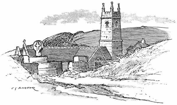
The place teems with legends. Thus, the great granite rock in the churchyard, called "St. Levan's Stone," with a grass-grown gap in it, is the subject of a local rhyme, which tells us that when this slowly widening fissure has grown large enough for the passage of a packhorse, the Day of Judgment will be at hand. Personal observation and judicious enquiries justify me in assuring trembling sinners that, if this be indeed a guide, that day is yet far off.
I have said St. Levan was solitary. The immediate neighbourhood of the church is even now not very densely populated, for the visible buildings are only the rectory and a cottage; and it can, I conceive, scarcely be called cheerful; for the bell-buoy on that submerged rock, the Rundlestone, out to sea, is for ever heard tolling, sometimes like a funeral knell and at others like some harsh gong, calling lost mariners to dinner down there in weedy caves with the mermaids.
The little church of St. Levan is rich in old bench-ends, displaying his fishes, a palmer with cockle-shells in his hat, knights, ladies, and jesters; while the chancel-screen is enriched with the eagle of St. John, the lily of the Virgin, the sacred monogram, and the spear, nails, and hammer of the Crucifixion. The Virgin herself is rendered, with round silly face and coif and fifteenth-century ruff. There has been a great deal of restoration effected here of late years.
A sundial in the churchyard displays a solemn motto: Sicut umbra transeunt dies, and a memorial[241] to one of the Telegraph Company's probationers, drowned while bathing at Porthcurno, stands near by the grave of Captain Henry Rothery and the twenty-two others lost in the wreck of the Khyber at Porthloe in the storm of March 15th, 1905.
The narrow cliff-path from St. Levan presently leads to the small and rocky fishing-cove of Porth Gwarra, the foreshore roughly paved with granite blocks in between the projecting rocks, which are here hollowed into caverns, where the few boats and lobster-pots are stored. A yellow snapdragon grows profusely in the cliffs here, and ivy richly mantles some of the crags along the coast towards Land's End; while a curious plant with fleshy leaves, curved like giant talons, and red and yellow flowers, called the "ice-plant," thickly drapes many of the rough walls enclosing fields.
The cliffs here rise to their grandest in the magnificent piles of granite blocks towering up at the crested promontory of Tol-Pedn-Penwith, the "Holed Headland in Penwith." The cliff-top walk has here broadened out to an expanse of short moss-like grass interspersed with rabbit-burrows, knobs of lichened rock and tufts of thrift or sea-pink. It is good going for the pedestrian, but the grass is apt to be slippery. A stranger wandering here alone suddenly finds the chasm that gives Tol Pedn its name, directly in his path.
There are few places on the coasts of Cornwall[242] really dangerous, unless you go out of your way to court danger, but this abrupt hole in the cliff-top is really a deadly place. That no one appears ever to have fallen down it and broken his neck seems to be because strangers who walk these cliffs generally do so with a very proper sense of the perils which lie in the way of those who do not exercise due caution. Any one who walked here in one of the frequent sea-fogs would stand an excellent chance of walking right over the edge of this hole in the headland, and so falling an inevitable one hundred feet to his death. This great circular gap, the "Funnel," as some call it, is about thirty feet across, and is a real startler. It was formed just in the same manner as the "Lion's Den," near the Lizard, and the "Devil's Frying Pan," near Cadgwith, by the falling-in of the roof of a cave; and the beach down below communicates with the sea. Adjoining it, from the cliffs' edge, rises the impressive pile of granite rock called "Chair Ladder," tinted all hues by weathering and by lichens, from black and grey to green, red, and a vivid orange. It is not difficult to climb down into the black depths below Chair Ladder, or to the beach, but it requires rather more energy to return. To style Chair Ladder and the other rocky spires neighbouring it piles of rock is by no means straining language, for they have exactly the appearance of having been heaped one upon another by some superhuman energy, the granite cubes being jointed like so many blocks of rude cyclopean masonry. The coast here indeed displays some of the most curious imitative forms in natural architecture, and every point and every little porth has its old Cornish name.
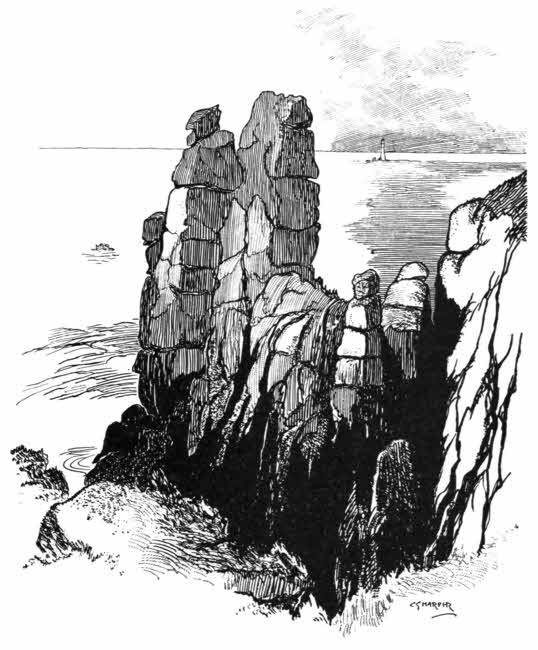
The[245] point of Carn Guethensbras, the "Great Carn," juts out beyond Chair Ladder, and encloses Porthloe, the "Lake Port." It was here that the homeward-bound sailing ship Khyber, from Australia, was cast away in March 1905, and twenty-three of the twenty-six aboard were drowned. An Admiralty signalling station has since been established on the cliffs.
I was walking here in August 1909, and two men came hurrying out of the signal-station.
"Are you a doctor, sir," they asked.
I felt unreasonably ashamed that I was not.
"What's the matter?"
"Why, 'zno, a man, one of a party camping tu Porth Gwarra, runnen along th' cliffs, has fell'd down a hunner 'an twenty feet, an' scat's head all to bits, an' we'm most at our wits' end what to du."
It seemed, hearing a report like this, that there was really nothing to do but hold an inquest; but doctors had been telegraphed for to Penzance, and when at last they arrived, the man was not dead. It was a marvellous escape. Falling down the jagged rocks, into a place difficult of access, from which the coastguard only brought him up on a stretcher after great exertion, he was not killed outright; and indeed, according to later advices, eventually recovered.
A lovely nook opens out beyond Pendower Cove, at Nanjizel, or Mill Bay, where there is a natural archway and a tall rifted cavern in the headland of Carn-les-Boel, known as the "Song of the Sea," perhaps the most entirely beautiful and romantic cave in Cornwall.
Past this, the point of Carn Voel is reached, with the "Lion's Den" cavern. Ahead, the heights of Pardenick Point rise in columnar majesty, the point whence Turner painted his view of the Land's End, that extraordinarily fantastic and darkling composition, in which the rocks on the hillsides look more like sheep than rocks.
There stretch the stacked rocks of Bolerium, the Land's End, in Cornish "Pedn-an-Laaz," and in Welsh, "Pen-Gwaed," the Headland of Blood; in effect not remotely resembling bundles of cigars set on end.
Most strangers obtain their first sight of Land's End at the conclusion of a direct walk or drive from Penzance. It is generally the first place the stranger desires to see, and he makes directly for it along the high road that runs inland.
The Land's End district, stretching westward from Penzance, forms the hundred of Penwith, a Celtic word meaning the "great, or chief, headland"; and Land's End itself was formerly "Penwithstart," a curious word produced by the association of the Celtic "Penwith," which had in very early times come to mean the district in general, with the purely Saxon "steort," or "start," a word which indicates a projecting point: an object that in fact juts, or starts, out. Hence, for example, the name of the Start, that prominent headland in South Devon, one of the most salient promontories along our coasts.
The aspect of the country, as you proceed from Penzance into the Land's End district, is quite in keeping with the name. Everything appears to resign itself to an ending. The town of Penzance looks like a last great urban effort,[248] and the railway itself seems to come, tired out, to the shores of Mount's Bay, and to expire, rather than come to a terminus. It cannot make an effort even to get up into the town, but stops on the doorstep, so to say. And the large white granite station, with iron and glass roof, more resembles an aviary than a railway terminus, the sparrows assembling there in multitudes on the tie-rods, and chattering in almost deafening fashion. In those very considerable intervals between the coming and going of trains one may stand on the platform and not be able to hold a conversation, owing to the sparrows.
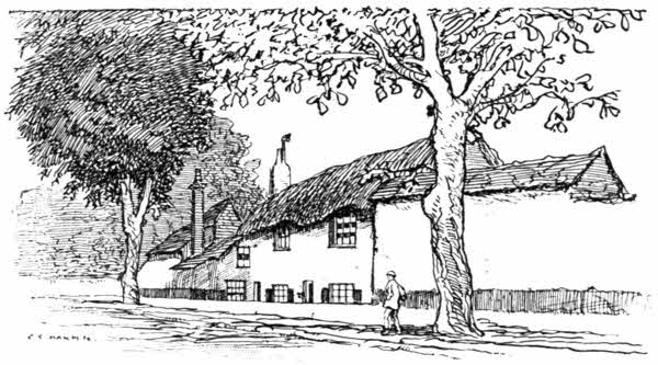
The western suburb of Alverton, with its beautiful gardens, and the birthplace, or early home, of Edward Pellew, afterwards Viscount Exmouth, left behind, and the elm-avenues of Trereife and the stream at Buryas Bridge once passed, on the main road to Buryan and Land's[249] End, you come to an elevated tract of country where trees are few. Cultivation gradually grows the exception, instead of the rule, and there is a look as though Nature herself had grown weary and presently could do no more.
Three miles out from Penzance the road forks. You may go equally well either to right or left. Let us take the left-hand road, through the half-way village of St. Buryan, which itself adds no hospitable note to the scene, but seems to stand on the windy upland as an example of how ashen-hued and weatherbeaten a village may be. The tall, dark church-tower rising from its midst and serving as a landmark for miles, is the most striking feature of the place. St. Buriana, the patron saint, was originally Bruinech, daughter of an Irish chieftain, who adopted the religious life. The existing church, successor of a collegiate establishment founded by Athelstan, the Saxon conqueror of Cornwall, in A.D. 936, stands on the site of her oratory. It was last rebuilt in the Late Perpendicular style prevailing so largely in Cornwall, and is a fine large building. Two ancient granite crosses on steps stand outside; one in the churchyard, the other in the village street.
From St. Buryan the road descends presently to the valley of Penberth a wooded interlude, and thence rises to other bare and bleak heights, passing at one mile from Land's End the turning that leads to Sennen, on the alternative road.
Sennen takes its name from Senan, one of the[250] numerous Irish missionary saints. He returned to Ireland, and died there. It was perhaps the friendship he cultivated with the Welsh St. David that led to Llansannan church in Denbighshire being dedicated to him.
Sennen is the very negation of life. Conceive a village that is no village, but only a small, grey, solemn church, a plainly built inn with creaking sign, swaying in the wind, a few whitewashed granite cottages, and a gaunt granite chapel. Through the place runs the road to the Land's End, and all around are fields enclosed within stone hedges. Never a tree in sight. That is Sennen. If you be a painter, you will not need to set your palette with many or brilliant colours to represent it as it is. It does not seem attractive; but in spite of all this gaunt, weatherbeaten character Sennen is not unlovely. The pearly, often opalescent, qualities of the Cornish skies are capable of transcending even four-square grey granite houses with slate roofs, and ugly chapels of the like, and of glorifying even stone hedges and unfertile fields; and so long as Sennen remains true to itself and innocent of red brick and ornament, which would be alien here, and therefore vulgar, even its weatherbeaten self is not without charm.
But if Sennen be indeed in the restricted key of grey and white, there is plentiful colour on the moorland around it, where the gorse spreads like lavishly flung gold, mingled with abundant purple heather. Not the scent of the sea, but the honey-like[251] fragrance of those blossoms, pervades the place. The sea, indeed, although only a mile distant, whether at Land's End or at Sennen Cove, is not in view, nor is there any hint of it. Only the treeless land, the sudden gusts of wind that come booming along in a clear sky, and the sign of the inn give any idea of its neighbourhood. The sign reads, as you go west, "The Last House in England," and as you return it is "The First." But effluxion of time and the insistence of enterprise have qualified these legends, and there are two others, at Land's End itself: "The Land's End Hotel," and a little shanty where refreshments are to be had.
And from the turning to Sennen one comes thus along an unromantic final stretch of road to Land's End.
The name, "Land's End," has an eloquent appeal understood, or if not really and truly understood, certainly felt, by all. When one first heard of Land's End, it was in those early years, when it indicated an actual ending, in which the lesson presently to be learnt—that the earth is round—had no part. The image then figured in the mind was that of a place truly ultimate, unqualified by the statement that it is so many thousands of miles across the seas to America, where the land commences again. To know that it does commence again is perhaps disappointing: just as a sequel to a story is an ill thing alike for the dramatic ending of that story and for the sequel itself.
And now we all know that, as the world is round, there cannot be any land's end, anywhere, here or at Finisterre, or in any other country; and that in the quest of it we should be like so many futile Wandering Jews. One almost envies those heretics—that small but constant band—who persist in their faith that the earth is flat; for that view surely connotes a Land's End, somewhere. Meanwhile, we must put up with the chastened feeling of romance with which a journey to the Land's End of Cornwall is first undertaken.
I cannot, at any rate, find fault with the circumstances of my own first journey to this spot, from London, many years ago. It was before photographic and other illustrations had multiplied so vastly, a time before even the untravelled were very well acquainted with the general appearance of the most distant and obscure places; and one could still cherish some feeling of curiosity. In those days the Great Western Railway, while issuing excursion tickets to Penzance and elsewhere, did so as though it were a weakness, of which it were well to say as little as possible. The hoardings did not in those times flame with pictures of places which were apparently created for the benefit of enterprising railway companies.
I made that excursion journey alone from Paddington to Penzance; and when the long day was drawing to its close and the train, having left Truro, and most of the other passengers, behind, began to wind through the mining-fields of[253] Chacewater and Scorrier, where the deserted mines and their ruined chimney-stacks and 'count-houses looked in the gathering twilight like so many weird beasts of the world's youth, then, as I gazed pale-faced, from a corner of the unlighted carriage, I felt I was indeed coming to the Land's End. Perhaps, also a little sorry for having come. But that was the dramatic, and therefore the right, way. Penzance formed a cheerful interlude for the night, and then on the morrow came the ten miles' walk to Land's End itself.
One has plenty of company here. Brake-loads of people, cyclists, motor-cars, all day long: contemplative people, reverent people, disappointed and irreverent people, a little contemptuous. You can see the thought, "Is this all?" visibly expressed upon their faces. I don't know what they expected: perhaps something in the nature of that childish vision of an abysmal ending, with a horned and hoofed personal devil over the edge; or, at the very least, whales spouting and sharks swimming. And really the cliffs are but some sixty feet high, and it is not a difficult matter to scramble down to the shore, such a tiny exigent bit of shore as there is, at low-water.
The very worst thing to do, to get an adequate idea of Land's End, is to stand upon Land's End itself. It is not impressive, and you want that which you will hardly get here, except on a winter's day or late in the evening: solitude. It is, in fact, not so much the comparative tameness[254] of the spot as the too much company that is really at the bottom of the not very reasoned dissatisfaction most people feel here; and the guides who wish to point out "Dr. Johnson's Head," the "Armed Knight," and other rock-resemblances, are a nuisance. No: go rather a little to the north of Land's End, and then look back upon it, and thence you will see the little crowds of people clustered about it, giving a much-needed idea of scale; and the natural arch beneath it then is visible, and Enys Dodnan and other rocky islets come properly into perspective, with the Longships lighthouse yonder; and, if it be sunset, you may see the round red face of the sun setting on the distant horizon, with some scattered black specks in front. Those are the Isles of Scilly, twenty-seven miles away. The sea in between is "Lethosow," traditionally the site of that lost land of Lyonesse which, with its one hundred and forty churches, was suddenly overwhelmed by the sea in a great storm, vaguely about a thousand years ago. Carew indeed gravely tells us that fishermen at the Seven Stones (a lonely reef thirteen miles north of St. Mary's Island, marked by a lightship) have drawn up with their nets pieces of doors and windows! The Fishermen even to this day call the spot "The City."
The Longships lighthouse is about a mile and a half out at sea, but such is the deceptive purity of the atmosphere that, to a Londoner, it looks less than half that distance. Carn Brâs, the reef on which it stands, rises forty-five feet above the sea[255] at low water, and all around it are numerous rocks, marked on Ordnance maps "Kettles Bottom." The original lighthouse, built in 1793, was a very stumpy affair, and was rebuilt in 1872. It has a singularly tragic record. Four of the lighthouse men have at different times been washed off the rock and drowned, the last in 1877; another died in the lighthouse, one went raving mad, and another committed suicide. He lacerated himself severely and his two mates staunched his wounds by stuffing them with tow. They hoisted signals for assistance, but stormy weather severed all communication for some days, and he was at last landed only to die. It is a melancholy history, and that and the weird noises made by the sea in caverns under the reef make the Longships one of the least desirable of berths at the disposal of the Trinity House.
Here in November 1898 the steamship Bluejacket ran at full speed upon the rocks.
The Wolf lighthouse, eight miles from shore, is a picture of utter loneliness. It was built between 1862 and 1869 on the reef of that name, awash with the tide at high-water, and cost £62,726.
The Isles of Scilly lie twenty-seven miles off the mainland and forty miles from Penzance, the nearest harbour from which you can voyage to that fortunate archipelago. It is possible in these days to reach St. Mary's, the capital of Scilly, in a little over sixteen hours from London, doing it luxuriously, as far as the railway portion of the journey is concerned, by taking the 9.50 p.m. train from Paddington, which arrives at Penzance terminus at 7.30 the next morning, leaving two and a half hours' rest before the steamer Lyonesse leaves for the islands, a voyage of about four hours. But this is suspiciously like toiling to get your pleasure, for night travel, however well-appointed, is tiring, and then you miss the scenery on the way. Upon this writer at least, the delights of the country, as seen framed in the carriage-windows of the flying express, never pall, and he who forgoes the daylight journey by[257] the Great Western Railway misses much. The best method of reaching Scilly is therefore by taking the 10.30 a.m. restaurant car train ex Paddington, which delivers you upon Penzance platform at 5.5 p.m.; a railway journey of 305-1/4 miles, performed at the rate of nearly fifty miles an hour throughout.
The Lyonesse leaves Penzance at 10 a.m. Over that voyage of forty miserable miles—miserable or magnificent according to whether you are what is called a "good sailor" or not—I would like to draw a veil. Once the steamer has passed the Rundlestone and left the lee of the land (with some even before) the woes of the "bad sailor" begin. Do I not know it, all too well? Alas! yes. But the potent charm of Scilly may well be deduced from the fact of such a voyager revisiting the islands, knowing full well that even a "good passage," which phrase in these rolling leagues seems like the ill-timed saturnine humour of a misanthrope—will prostrate him in the scuppers, or fling him athwart the bulwarks, yearning for peace and rest in the creaming billows that go dizzily seething past. Here let me not fail to add, for the comfort of those who would dare the deed, that "once pays for all," as the old proverb says. Your miseries, generally speaking, are confined to the outward voyage, and, although you may be thoughtful and perhaps apprehensive of the like disturbance in returning, Neptune generally refrains from exacting other tribute. You have paid your footing, if staggering along the heaving deck (ugh!)[258] may so be called; and having paid your fare in money and in kind, are free of the ocean blue.
The Scillies rise slowly out of the waters as you approach. There is St. Mary's Island ahead, with St. Martin's on the extreme right, rising behind the numerous rocky islets known as the Eastern Islands, comprising Menewethan, Great and Little Inishvouls, Great and Little Arthur, Ragged Island, Hanjague, Nornor, Great and Little Ganilly, and Great and Little Ganinick. There are two means of approach to the pier at St. Mary's, to which the steamer comes: if it be high tide, by Crow Sound; if at ebb by the circuitous route of St. Mary's Sound. It is the last despairing misery of the sea-sick, who know nothing of the local conditions of navigation, to notice that the captain, apparently out of sheer wanton cruelty, is making a prolonged circuit of the island before coming to an anchor.
But these miseries are speedily forgotten when once you have set foot upon the quay at Hugh Town, St. Mary's; for you realise at once that you have come to a new and strange, and interesting, land.
The Isles of Scilly are the land of the narcissus and the daffodil, but not of those alone. Arum lilies, stocks, wallflowers, and crimson anemones are grown abundantly. There are in all 3,600 acres in the islands, and of these 2,000 are cultivated, chiefly nowadays in the flower-farming interest. It was in 1878, or thereabouts, that the first ideas of flower-farming took root in Scilly.[259] There had always been, time beyond the memory of man, more or less wild narcissi growing on the isles. It was thought, without any evidence being available, that the old Benedictine monks of Tresco had introduced them. There were eight varieties known to botanists. Some time subsequently to 1834, Mr. Augustus Smith, the then Lord Proprietor of the islands, uncle of the present Mr. Dorrien-Smith, introduced many others to Tresco, and it is claimed for him that he was the first to see the possibilities of a London market for these delightful flowers, blossoming here so early, when London is still shivering in midwinter. According to this article of faith, he advised some of his tenants to grow them and send them up to Covent Garden for sale, himself sending the first lot, and realising £1 profit from the transaction. According to other versions, it was Mr. Trevellick, of Rocky Hill, St. Mary's, who made the first consignment; and there is a circumstantial story which tells us that he and a few pioneers, who despatched a few bunches in those early years, when fresh spring blossoms first took London with delight, realised thirty shillings a dozen bunches. A bunch in Scilly is a dozen blooms; and therefore those fortunate few took twopence-halfpenny apiece for narcissi. It seems almost too good to be true, and still the Scillonians (there are no "Scilly people," as Sir Walter Besant makes Armorel say, in his delightful "Armorel of Lyonesse") talk in reverential tones of those wonderful days.
At that time the islanders were making a moderate livelihood out of growing early potatoes; I have seen the quays of St. Mary's heaped high with boxes of them. But nowadays let those grow "new potatoes" who will. Scilly knows a more excellent way, and specialises in flowers so completely, that no one would be in the least surprised to hear of potatoes being imported, just as Scilly imports its cabbages and other vegetables, its butter, and most other things, from "England."
The growth of flower-farming in Scilly has been continuous, and is by no means restricted to St. Mary's: the "out-islands" take an active part. But it is not the easy business it was, for the increased output has naturally by degrees brought prices down, and a steady shilling a dozen bunches would now be considered good. The business increases so surely that this year's figures are out of date the next season. It was considered remarkable in 1893, when the shipments amounted to something over four hundred tons, but those of 1910 exceeded one thousand tons, valued at £40,000. Of this total, the sum of £25,000 is reckoned to be clear profit. So, although the flower-farmers have now to work for their increase, the results are not discouraging, and the Scillies still remain, and increasingly become, the Fortunate Isles. The climate is mild and equable, there are no poor; "penal" Budgets raise no alarms, for the isles are free from income-tax; and the wan, ragged, famished spectre of unemployment, or of the unemployable,[261] is unknown. Scillonians read of it in the newspapers that occasionally come their way, and ask visitors what it is!
Every one works in Scilly. I have seen it stated that Scillonians never hurry. The person who made that statement can never have witnessed the desperate efforts often made to pack the flowers, and get them on to the quay at St. Mary's in time for the steamer, which, in winter, when the flower-harvest is at its height, sails only thrice a week. If the steamer is missed, that consignment is worth just nothing at all, for it has to be on sale in London the next morning.
Visitors to Scilly, who commonly travel in summer and autumn, see nothing of these activities. Then, if ever, the islanders who are flower-farmers take things easily, and the little fields where the daffodils and the narcissi grow are of comparatively small interest, being bare of leaves or blossoms.
The fields are all carefully hedged round with shrubs calculated to ward off the winds, which are the farmer's greatest enemy. They are hedges of tamarisk, of laurel, and of escallonia; but chiefly of escallonia, a small-leaved evergreen shrub with a close-growing habit. Strangers at the first sight of its small delicate pink, waxlike blossoms are taken with delight, but it is to the islanders a mere commonplace. Some fields are large, but most very small, giving less chance for the winds to come and play havoc, and the hedges grow to great heights. Picking the blossoms[262] begins as early as Christmas and generally ends in March, when the season "in England" begins, and Scilly rests from its labours, happy in the knowledge that it has skimmed the cream of the trade.
Photographs of fields rich in daffodil and narcissus blossom are familiar, but not readily to be understood, unless on the assumption that they represent a glut in the market, rendering it not worth while to pick them; for the practice is so to arrange the crop that there is a succession of blossoms in the two months and a half, and always to pick them before they are actually opened in full. They are then taken to long glass sheds, and having been tied in bunches of a dozen, are placed in water. Packing then follows. In the height of the season the school-children have a month's holiday from school, especially to help in the work of picking and packing. There are about four dozen bunches to a box, and 240 boxes to a ton. Often the packing is continued all night and into the early hours of the morning. Steam-launches bring laden boats in from the out-islands by nine o'clock in the morning, and an hour later there are perhaps fifty tons of flowers aboard the steamer.
Such are now the chief activities of the Scilly Isles, and they, with fishing and piloting, make up the entire life of the archipelago. Formerly it was new potatoes, and before that a little kelp-burning, and before that a good deal of smuggling kept the islanders alive.
Whence the isles derive their name no man[263] knows. They are first mentioned by Ausonius, who styles them Sillinæ Insulæ. Some declare them to be named from a branch of the ancient Silures; others consider "silya," a name for the conger, to be the origin; and yet others think "sulleh," the sun-rocks, to be the true derivation. There are now five inhabited islands. The largest of these, St. Mary's, contains 1,620 acres and a population of 1,200; Tresco has 700 acres; St. Martin's, 550 acres, St. Agnes, 350 acres, and Bryher, 300 acres. Samson, last inhabited in 1855, has 80 acres. The smaller and uninhabited islets are Annet, 40 acres, St. Helens, 40 acres: Teän and Great Ganniley, each 35 acres, Arthur, 30 acres, Great and Little Ganniornic, 10 acres, Northwithiel and Gweal, each 8 acres, and Little Ganniley, 5 acres. Besides these, there are some hundreds of rocky islets and rocks.
The Isles of Scilly have never been too remote for conquerors to descend upon and subdue them. Thus Athelstan not only subjugated Cornwall in the tenth century, but subdued Scilly as well; and they were fortified in the time of Queen Elizabeth, when the still-existing Star Castle, overlooking St. Mary's, was built, as the initials, E. R. and the date 1593, remain to prove. Scilly was not a safe place of refuge for Prince Charles in 1645. He landed at St. Mary's from Falmouth on March 4th, but the fleets of the Parliament rendered it advisable for him to depart for Guernsey on April 17th. But the isles became, only four years later, the headquarters of a determined[264] band of Royalists under Sir John Grenville, whose privateering exploits so dealt with the shipping trade that it was found necessary to fit out an expedition against him. He was reduced and forced to capitulate in June 1651.
From early times the greater part of the Islands belonged to Tavistock Abbey. In 1539, when the Abbey was suppressed, they reverted to the Crown. From the time of Queen Elizabeth, the Godolphin family and Dukes of Leeds held them on lease, and so continued, except during the Commonwealth period, until 1831. A lease from the Duchy of Cornwall was then taken up by Augustus Smith, a landowner from Hertfordshire, who thus became the first of the Smith and Smith-Dorrien "Lords Proprietors," whose rule, from their residence on Tresco, has been absolute.
Augustus Smith was an autocrat, but a benevolent one. He found the islanders a half-starved race of smugglers and kelp-burners, and by the time of his death, in 1872, left them a prosperous community.
St. Mary's Island is of irregular shape, and is nine miles in circumference. The one town of Scilly, "Hugh Town," stands on the low sandy isthmus of a rocky, almost islanded, peninsula, nearly awash at very high tides, and with two sea-fronts. Over it towers the hill called "The Garrison," crested by Star Castle, so called from its ground-plan of a seven-pointed star; or, some say from "Stella Maris," Star of the Sea; a somewhat unlikely Roman Catholic dedication,[265] considering the Protestant times in which it was built. There has been no garrison here since 1863. A tall wind-gauge stands near by, on the hill-top.
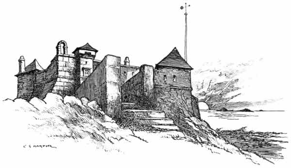
From hence one best sees the island of Samson, two miles and a half distant, lying directly in front of the setting sun. Samson is an island of singular appearance, consisting of two hills joined by a low belt of land. Its name probably derives from that sainted sixth-century Bishop of Dôl, who has given his name to St. Sampson's (or Samson), Golant. There are some ruined houses on Samson, sole relics of the fifty people who once lived on it, and were deported to other islands by the autocratic Augustus Smith. And on Samson's northern hill are no fewer than eleven large sepulchral barrows. But if one wants to learn much about Samson and about the Isles of Scilly,[266] glorified by romance, it is to the pleasant pages of Sir Walter Besant's novel, "Armorel of Lyonesse," one must go. There is no better book to read at Scilly. But Armorel's wonderful old home at Holy Hill is not in being, although photographs show the ruined walls of a house more or less identified with it. Besant no doubt took as his model the flower-farm at Holy Vale, in the centre of St. Mary's Island.
Standing on the Garrison at night, the lights of many lighthouses and lightships are visible. There, on the almost exactly hemispherical outline of Round Island, is the lighthouse that shows a red flash; the Seven Stones lightship is out far beyond; St. Agnes light flashes on its island, south-east; and behind it, four and a half miles away, is the lonely Bishop lighthouse, completed in 1858, and said by some to be exposed to worse weather and more terrific seas than any lighthouse in the world. The lighthouse on St. Agnes is one of the oldest, if not actually the oldest, in the service. It was built in 1680.
The wrecks upon Scilly have been innumerable, and the crowded churchyard overlooking Old Town Bay bears witness to the great loss of life incurred, even in modern times. Here rest one hundred and twenty of the three hundred lost in the wreck of the German mail steamship Schiller, which was on her way from New York to Plymouth. She struck on the Retarrier reef, close by the Bishop lighthouse, in a fog on the night of May 8th, 1875, and almost immediately sank.[267] Only forty-five of the three hundred and fifty-four persons on board were saved.
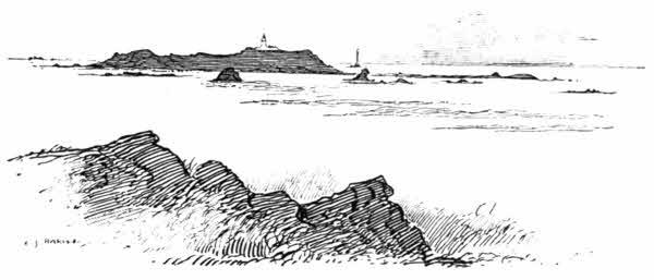
The Scilly Islands are not less remarkable for rock-scenery than the mainland, and weirdly imitative piles of granite abound. There is a rock, or rather a heap of rocks, on Peninis Head, called the "Pulpit Rock," which at evening looks less like a pulpit than a naval gun; and elsewhere are the "Punch Bowl," on St. Mary's, the "Nag's Head," on St. Agnes, and many others. Not least among these is the Logan Rock, on Peninis Head, which weighs over three hundred tons, and "logs" in a most satisfactory manner, when once started. But it is a brace-breaking business, this starting of it, and you had better have a guide, for this particular rock is not easily to be distinguished from its fellows; and it is exhausting to attempt the moving of other, and immovable, rocks of three or four hundred tons, before you happen to hit upon the right one.
Round past Old Town is the rocky head of Giant's Castle, and then Porthellick.
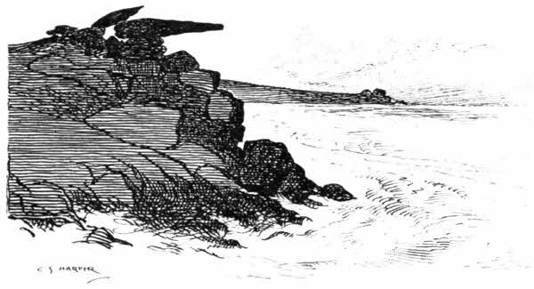
Porthellick, the "Bay of Willows," is a flat, shallow strand, where the scant herbage at the foot of Sallakey Down dies gradually away upon the beach. At one extremity of the Bay is the curious pile of granite rocks resembling a loaded camel, kneeling, and at the other a rude fragment of granite has been set upon another, on the sand, to form a rough and ready monument, marking the spot where the body of Admiral Sir Cloudesley Shovel was buried.
The story of the naval disaster in which the Admiral and nearly eighteen hundred men were lost is one of the most tragic associated with Scilly. A squadron consisting of the flagship Association, the Eagle, Phoenix, Lenox, Royal Anne, St. George, Romney, and Firebrand, returning from an expedition against Toulon, in October 1707, lost its course in foggy weather. On[269] the 22nd the Association struck on the Bishop and Clerks rocks and immediately went down, with all on board; the Eagle and Romney were also lost, together with the Firebrand, but a few on board the last were saved. The other vessels miraculously escaped. A great deal of mystery was made respecting the disaster and the fate of the Admiral, and a legend, long implicitly believed, gained currency that the shipwrecks were entirely due to the savage obstinacy of the Admiral, who, it was stated, not only refused to listen to a sailor, a native of Scilly, on board, who warned him that he was steering too far northward, but actually had the man hanged from the yardarm for presuming to know better than his superiors. That such a story should ever have gained belief in itself shows us how undesirable service in the Royal Navy must then have been. The sailor, the story goes on to say, asked one favour before he was turned off—that he should be allowed to read a portion out of the Bible. It was granted, and he read the 109th Psalm, one of the cursing Psalms, with this salient passage: "Let his days be few; and let another take his office. Let his children be fatherless and his wife a widow.... Let his posterity be destroyed, and in the next generation let his name be clean put out. Because his mind was not to do good, but persecuted the poor, helpless man, that he might slay him that was vexed at the heart."
The whole story is a fabrication, simply elaborated out of the narrative told by George[270] Lawrence, quartermaster of the Romney, to Edmund Herbert, Deputy Paymaster-General of Marines, and detailed in his report of 1709. Lawrence was the one man saved from the Romney, and he said that about one or two o'clock on the afternoon of October 22nd, the Admiral called a council of officers, to discover in what latitude they were. All agreed they were off Ushant, except the master of the Lenox, who said they were off Scilly. Then a lad also declared a light they presently made was Scilly light, whereupon all the ship's crew swore at him.
Among the many contradictory stories told of the finding of Sir Cloudesley Shovel's body on the sands of Porthellick, the most tragic version is probably the most truthful. It was at first given out that he was dead when found, and he certainly was buried here, where the rude stone monument now stands—a spot where, superstition says, grass will never grow. Four days later, the body was dug up, identified, and eventually given a State funeral in Westminster Abbey.
No one could tell what had become of a very valuable emerald ring the Admiral wore, and his widow offered rewards for it, in vain. But many years later, about 1734, a woman of St. Mary's, then lying at the point of death, made the terrible confession that the Admiral had been washed ashore, exhausted, but still living, and that she had choked him, to secure his clothes and jewellery. She produced the ring, which was[271] sent to Lord Dursley, afterwards Earl of Berkeley. It has been set with diamonds in a locket, and in that form is still possessed by the Berkeley family.
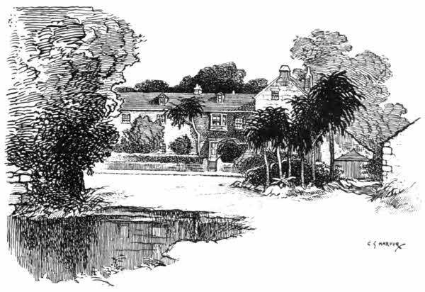
Holy Vale, inland, is one of the few places on St. Mary's where trees grow. Whence arose the name is quite unknown, and there is nothing in the nature of any religious house here; but there is, if you like to look at it in that way, a holy calm in this sheltered spot, where the winds abate and groups of dracæna palms grow freely.
But Tresco is the show-place in Scilly for gardens. It is something under two miles to the island of Tresco, where the residence of the Lord Proprietor is situated. There is little left of the Abbey buildings, and the residence so called is quite modern. Beneath it is a rush-bordered[272] freshwater lake, and all around are subtropical gardens, in which visitors are free to wander. Here is a large shed partly built from the timbers of wrecked vessels, whose figureheads form a melancholy row in front. The old iron cresset in which the coal-fires of St. Agnes lighthouse were burnt until 1790, stands close by.
Tresco is two miles long. Visitors rarely go beyond the Abbey gardens, but the walk along to the northern extremity of the island is interesting, commanding views on one side across the narrow channel of New Grimsby to the island of Bryher, and on the other across Old Grimsby to St. Helen's, Menavawr, Round Island, Teän, and St. Martin's. Here, in New Grimsby Harbour, are the ruins of "Cromwell's Castle," and out in the channel is Hangman's Island, where vague legends say he hanged his prisoners. Not far off are the ruins of Charles Castle. The shores are thickly grown to the water's edge with vivid-coloured mesembryanthemum, an alien plant, which looks better than its name. And in the cliffs on the headland is the dark cavern of "Piper's Hole," running a long way in, with a stygian lake in its midst and a boat to take you across to further exploration, which is weirdly done by the aid of torches.
The names of the Scilly rocks and islets are themselves a pure delight, compact of romantic suggestion. There, off Bryher, exposed to the full fury of the Atlantic, are the two grim rocks called Scilly, that confer a name upon the entire group;[273] there is Maiden Bower, there are Mincarlo, Illiswilgie, Great and Little Minalto, Carntop, Nundeeps, the ominous Grim Rocks, Tearing Ledge, Crebawethan and his little brother, Rosevean, Rosevear, Daisy, Gorregan, Meledgan, Hellweathers, and I know not how many others. And weather permitting—a much more insistent condition here than elsewhere—you may, with the aid of experienced boatmen, come near them all, and experience wonderful fishing and see strange assemblages of solemn sea-birds grouped, fishing also, but with unerring beak, from lonely ledges.
Great families of cormorants, shags, and puffins inhabit these rocky places, subsisting upon fish. The fishing methods of these birds differ entirely from those of the gull, for they are clumsy in flight and are expert rather in diving from cliffs than soaring. It is not easy to frighten a cormorant, and it is quite impossible to satisfy his ravenous hunger, which has rendered the very name of "cormorant" a synonym for greed and rapacity. I have seen excursionists engage in the hopeless task of trying to "shoo" a solemn conclave of cormorants away by shouting, gesticulating, and throwing stones, but those wise birds, better able to judge distances in their native air than any holiday-making townsfolk, do not so much as deign to take notice of the disturbers, and witness stones falling a quarter of a mile or so short with all the contempt such marksmen deserve.
The shag is no doubt equally wise, but his is an even more contemplative and much less active[274] wisdom than that of the cormorant. To see a row of still and solemn shags, all black and white, gazing into immensity from a shelf of rock is extraordinarily parsonic in effect: just as though one had come upon the Upper and Lower Houses of Convocation in full session. But there is humour among the clergy; no one has ever yet observed it in a shag. The shags, indeed, are extra-parsonic; more like fakirs in surplices. They take life seriously, and look with a calm but severe disapproval upon the laughter of strangers.
And strangers tend to increase in Scilly and its surrounding seas, in spite of the voyage from Penzance. The isles, truly the Fortunate Isles, where there is no income-tax and there are no motor-cars, and the post comes but once a day—and sometimes not even then—and the only police-force necessary is one officer, who combines all ranks, and even then has little to do, are further blest with a delightfully equable climate, and good hotel and other accommodation. They look with some pity upon the turmoils of the adjacent island of Great Britain.
Printed and bound by Hazell, Watson & Viney, Ld., London and Aylesbury.
Footnotes have been moved to the end of the text just before the index and relabeled consecutively through the document.
Illustrations have been moved to paragraph breaks near where they are discussed.
Punctuation has been made consistent.
The Contents entry and chapter header for Chapter IX list "St. Anthony-in-Roseland," but the presentation in the chapter is for "St. Anthony-in-Meneage."
Variations in spelling and hyphenation were retained as they appear in the original publication, except as noted below.
Changes have been made as follows:
Page 3: Inserted "a" (beautiful as a Thames-side)
Page 10: "circuituous" changed to "circuitous" (most circuitous loops)
Page 106: "Alafs" changed to "Alass" (Alass Frend Joseph)
Page 176: "obession" changed to "obsession" (an obsession, not)
Page 220: "as" changed to "a" (Penzance as a great)
Page 272: "thee ntire" changed to "the entire" (upon the entire group)